CASTLEWOOD STATE PARK
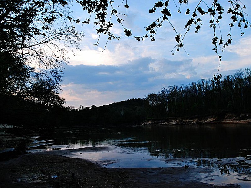
A trip to Castlewood State Park gives visitors a first-hand look at the area's glorious past. At the same time, the natural beauty of the Meramec River and the surrounding open spaces offer a serene escape from urban life.
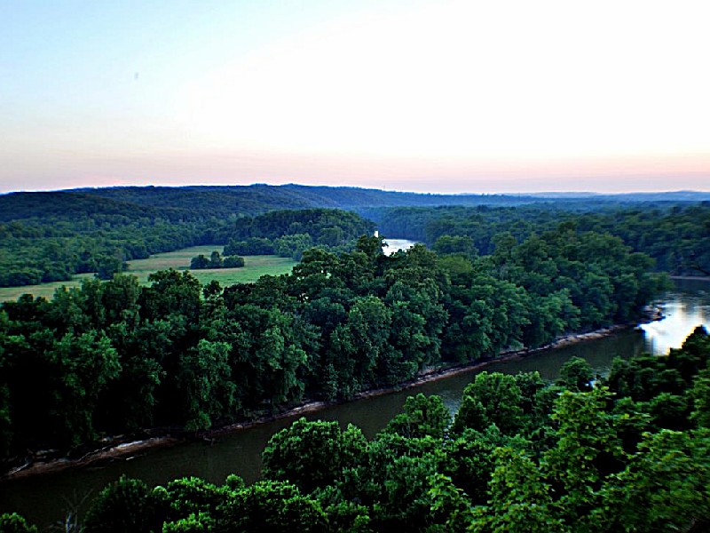
Between 1915 and 1940, thousands of St. Louis residents traveled by train each weekend to the Castlewood area for water fun, dancing and clubhouse partying. Today, the 1,779-acre Castlewood State Park preserves the history of the former resort. The park stretches for nearly five miles, straddling both sides of the Meramec River. It incorporates much of the old resort area, including the grand staircase that once led revelers up to the large hotels and clubs. Although the hotels and clubs are gone, the staircase and the lure of the region remain.
Hike the River Scene Trail that ascends to the top of the majestic limestone bluffs towering above the river. Stand 250 feet below on the riverbank among the trees of the native floodplain forest. Angle for bluegill, largemouth bass and catfish in the cool waters of the Meramec River. Eat a relaxing lunch before strolling through meadows and along the spring-fed Kiefer Creek. The possibilities are endless and the choice is all yours.
There is a concrete boat launch located at the end of Kiefer Creek Road. There are no launch fees. Due to the presence of a large sand bar at the base of the ramp, it is recommended that you only attempt to launch watercraft (kayaks, canoes and small boats) that can be carried. During times of low water levels, it is approximately 90 feet across loose sand from the end of the ramp to the edge of the river. During times of higher water levels when the river actually is up to the ramp, boats can be launched normally. When the river reaches or exceeds flood stage (16 feet at the Valley Park gauge), the ramp is closed. For current river conditions, call the park office at (636) 227-4433.
Fishing
There are several miles of river frontage throughout the park. The river can be accessed via the launch ramp area or along the River Scene Trail. There are a number of deep holes, shallow ripples, under cut banks, logjams, root wads and rocky areas that provide cover for the fish.
Fish common to the lower Meramec River include channel catfish, flathead catfish, carp, drum, gar, walleye, crappie, bluegill, longear sunfish and bass. All statewide regulations and license requirements apply. Special limits have been set for spotted bass in the lower Meramec; please check Missouri Wildlife Code for all applicable rules.
Castlewood State Park is located near Arnold, Ballwin and Bridgeton
There are two picnic shelters available at the park for use. Shelter 1 can comfortably seat 100 people; Shelter 2 seats 70 people. Each shelter has a 4 foot by 4 foot barbecue grill, water fountain, restroom and play space for volleyball, soccer, softball or other group activities. A volleyball net is provided but you will need to bring your own recreational equipment. The shelters can be reserved for the day for a fee of $50 or half-day for $30. If not reserved, the shelters are available at no charge on a first-come, first-served basis. If you need a place for a family or company picnic, please call the park office at (636) 227-4433 to make a reservation. A corporate rate of $75 is available.
There are 50 picnic sites available on a first-come, first-served basis scattered throughout the park. Each site consists of a picnic table and grill. Sites are available at the main picnic area near the Meramec River, along Kiefer Creek, near the playground and at all trail heads.
Equestrian picnic sites are available at the horse trailer parking area. Equestrian sites have a picnic table, grill and hitching post.
There is a playground located in the middle of the field between the two picnic shelters.
The park offers diverse birding opportunities with over 170 species spotted, including warblers and woodpeckers. It features several trails for optimal viewing of both resident and migratory birds. The river corridor attracts waterfowl while the forested areas are home to woodland species. Birdwatchers can also participate in annual Christmas Bird Counts or join organized bird walks led by experienced guides.
Park staff are available to do programs by request for civic, scout, church or school groups. Programs include guided hikes, nature programs, history programs, informational talks and service projects. We will try to tailor the program to your needs. Contact the park office at (636) 227-4433 for details.
Park staff also accept requests and proposals for special events. In the past, the park has hosted a number of bicycle races, cross country races, company gatherings, fishing derbies, hayrides and day camps. Please submit all special event ideas in writing and include who, what, when, where, why and how. Insurance covering your group and the Department of Natural Resources (minimum liability coverage of $300,000 per person and $2,000,000 per occurrence) may be required. Special permission is also required to sell merchandise at special events.
The World Bird Sanctuary, located in the park, is open to the public on Saturdays and Sundays. It houses live birds and features interpretive displays on birds of prey and their activities.
From the south on I-44 or I-55 : Take the Hwy. 141 exit and travel north on Hwy. 141 to Big Bend Road. Turn left onto Big Bend Road and travel west to Ries Road. Turn left onto Ries Road and continue until reaching the park entrance at the intersection of Kiefer Creek and Ries roads.
From I-270 : Take the Dougherty Ferry Road exit and travel west on Dougherty Ferry to Big Bend Road. Turn right onto Big Bend Road and travel west to Ries Road. Turn left onto Ries Road and continue until reaching the park entrance at the intersection of Kiefer Creek and Ries roads.
From the north on U.S. Hwy. 40/61 : Take the Clarkson exit (near Chesterfield Mall) and travel south. Clarkson crosses Manchester Road and becomes Kiefer Creek Road which leads into the state park.
From Hwy. 100/Manchester Road (three options) : Take Kiefer Creek Road off of Manchester/Hwy. 100. Kiefer Creek Road will lead into the state park OR Take Ries Road off of Manchester/Hwy. 100. Follow Ries Road to the intersection with Kiefer Creek Road at the park entrance. OR Take New Ballwin Road off of Manchester/Hwy. 100. When New Ballwin Road intersects with Kiefer Creek Road, turn left and continue into the state park.


 Share Your Castlewood State Park Photos (click here)
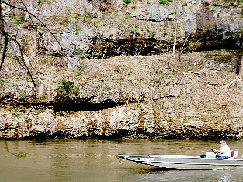