State Parks .com
USA Washington Fort Ward State Park


State Park Location Maps:
Local area map for Fort Ward State Park location
(click here to zoom and navigate local map)

State of Washington map showing Fort Ward State Park location
(click here to zoom and navigate regional map)


View TOPO Maps!


State Park Photo Gallery:
   volunteer positions open


State Park Event Calendar:
   volunteer positions open


Nearby Parks:
 Manchester State Park
 Illahee State Park
 Fay Bainbridge State Park
 Fay-Bainbridge State Park
 Old Man House State Park
 Klondike Gold Rush National Historic Park
 Kitsap Memorial State Park
 Scenic Beach State Park
 Saltwater State Park
 Saint Edwards State Park


State Park Contact Information:
Fort Ward State Park
Adopt-A-Park Contacts:
Yogi's Helper: volunteer positions open
Nature Programs: volunteer positions open
Photography: volunteer positions open

State Park Overview:
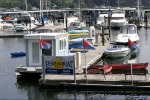
Fort Ward State Park is a 137-acre marine park with 4,300 feet of saltwater shoreline on Rich Passage. Many of the structures in the park reflect the historic military significance of the area, but the park is well developed for day use. There is an underwater park for scuba divers, a two-lane boat ramp and a long, beautiful beach along Rich Passage.

Summer: 8 a.m. to dusk.

Winter: 8 a.m. to dusk; upper day-use area closed Oct 18, reopens April 8.
Reviews By Park Visitors:
visitor rating: (1 vote)   |Post Your Own Review

Great for people and dogs

Lovely, shady, wooded trails. Cool on the hottest days, peaceful and quiet. Nice picnic spots with grills and tables at some. Beach access and views over the Olympic Mountains. Deficits? A map of the trails and where they interconnect with Metro parks such as Blakely Harbor with approximate distances would be handy.

Written by Chrissy  29-Jun-2008

Camping:
The park has one water trails campsite available only to those arriving by human-powered watercraft. The campsite is first-come, first-served.
Picnicking:
There are 16 unsheltered picnic tables, available first-come, first-served. The upper picnic area is accessible by automobile. The lower picnic area (along Rich Passage) is accessible by foot only.
Boating:
There is one boat ramp. Be advised Rich Passage has swift currents during tidal exchanges.

A daily permit is available for watercraft launching, vehicle parking and trailer dumping at the park for $5. Annual permits also may be purchased at State Parks Headquarters in Olympia, at region offices, online, and at parks when staff is available.
History of the Area:
After World War II, the U.S. Navy used a radio tower (once located adjacent to the park and east of the upper picnic area) to send messages to Navy Command in Seattle at Pier 91.

In 1903, Fort Ward was offically commissioned as a seacoast fort with the primary objective of protecting the Bremerton Naval Shipyard. Two gun batteries are located in the park. During World War II, the navy used the fort as a radio station and training school for communication personnel and installed a submarine net across Rich Passage. In 1958, the navy decommissioned the fort, and State Parks purchased Fort Ward in 1960.

Note to Park related businesses:
List your vacation cabin, weekend getaway, log cabin rental, romantic cottage, vacation home, resort, hotel, motel, bed and breakfast, country inn, campground, RV park, horseback riding stable, canoe livery, river rafting, outfitting, sporting goods store, guide service, RV rental or any other park related activity, park related attraction or park related service on Google or StateParks.com. (more)....
Related Links:
Fort Ward State Park - Fort Ward State Park Alex & Olga's Dive Sites Copyright ? 2000-2002 Cyber-Strategy, Inc. All Rights Reserved. For any use of the picture please send e-mail to photo at cyber-strategy.org.
Links to all Washington State Parks pages - Links to all Washington State Parks pages ... Beach State Park Fort Simcoe State Park Schafer State Park Fort Ward State Park Seaquest State Park Fort Worden State Park Sequim Bay State Park Ginkgo ...
Bainbridge Island Parks - Locations and information for Regional, County and City Parks on Bainbridge Island, Washington ... Bainbridge State Park 11 Olson Park 5 Fort Ward State Park 12 Rotary Park 6 Grand Forest 13 Strawberry ...
Bainbridge Island Trails - Locations and information for Regional, County and City Trails on Bainbridge Island, Washington ... at the back of the playground. 9 Fort Ward State Park Trail Lovely views of the Port Orchard Narrows ...
Bainbridge Island Photos :: Mahalie M. Pech - Photographs of Bainbridge Island ferry and Fort Ward State Park, Washington. ... there are many). We stumbled upon Fort Ward State Park in about ten minutes. The beach was really quiet, suprising ...
Bainbridge Island Photos :: Mahalie M. Pech - 25 year old seeks full time employ, professional personal assistant. ... Mahalie Dot Com! > Home Page <. 04.28.02 Trip to Bainbridge Island Pebble strewn beach in Fort Ward State Park. Back to Photos
Kitsap Transit - Bus Route 98 Bus Stops- Fort Ward - ... Country Club Rd. Right onto Fort Ward Hill Rd Fort Ward & State Park Entrance Left onto Park View Dr Right onto Evergreen Ave ... Ward Hill Rd Fort Ward & State Park Entrance Left onto Park ...
Directions:
Located on the southwest side of Bainbridge Island, along Rich Passage.

From Hwy. 305: Turn west on High School Rd. Travel to T-intersection (approximately three miles), and turn left onto Fletcher Bay Rd. Continue on Fletcher Bay Rd. to T-intersection, then turn right. This takes you past Linnwood Center. Continue to Y-intersection. Veer right to go to the Fort Ward boat ramp, or veer left to find park entrance and upper picnic area. To get to park entrance, continue on left fork to Country Club Rd., and turn right. Turn right again on Fort Ward Rd. Park entrance is on right. (NOTE: The route is well signed from High School Rd.)
USA Washington Fort Ward State Park

Visit Rainier

Advertise on StateParks.com
    American Dreams Inc. - Logan, Ohio    www.stateparks.com