MISSION TEJAS STATE PARK
Mission Tejas State Park is a 363.5-acre park in Houston County, 22 miles northeast of Crockett. The park was constructed in 1935 and acquired in 1957 by Legislative Act from the Texas Forest Service, at which time it was open to the public.
The park was built in 1934 by Co. 888 of Civilian Conservation Corps (CCC) as a commemorative representation of Mission San Francisco de los Tejas, the first Spanish mission in the province of Texas, which was established in 1690. Also in the park is the restored Rice Family Log Home, built in 1828 and restored in 1974. The home, which Joseph Redmund Rice, Sr. constructed between 1828 and 1838, is one of the oldest structures in the area. The home served as a stopover for immigrants, adventurers, and local residents traveling the Old San Antonio Road across pioneer Texas.
Mission Tejas State Park is located near Rusk
1. Mission Tejas State Park offers numerous picnic spots with tables and grills.
2. Enjoy a meal by the park's tranquil pond or under towering pines.
3. Some areas provide covered shelters for picnicking, ideal during hot summer days.
4. Bring your own food as there are no concession stands in the park.
5. Picnic near historical sites like Rice Family Log Home or San Francisco de los Tejas mission replica.
Birdwatchers can spot various species like the Red-cockaded Woodpecker, Pine Warbler and Brown-headed Nuthatch. The park is part of the Big Thicket Birding Trail. It's also home to migratory birds in spring and fall seasons.
Nearby attractions include Caddoan Mounds State Historic Site, Jim Hogg Historic Site; Rusk and Palestine State Parks, and Texas State Railroad State Park; Davy Crockett National Forest, Texas Forestry Museum, in Lufkin; and Ratcliff Lake Recreation Area (a U.S. Forest Service park, 12 miles away, that has a nice swimming beach).
The park is located 21 miles northeast of Crockett and 12 miles west of Alto on State Highway 21. The entrance to the park is in Weches, where Park Road 44 intersects with State Highway 21.


 Share Your Mission Tejas State Park Photos (click here)
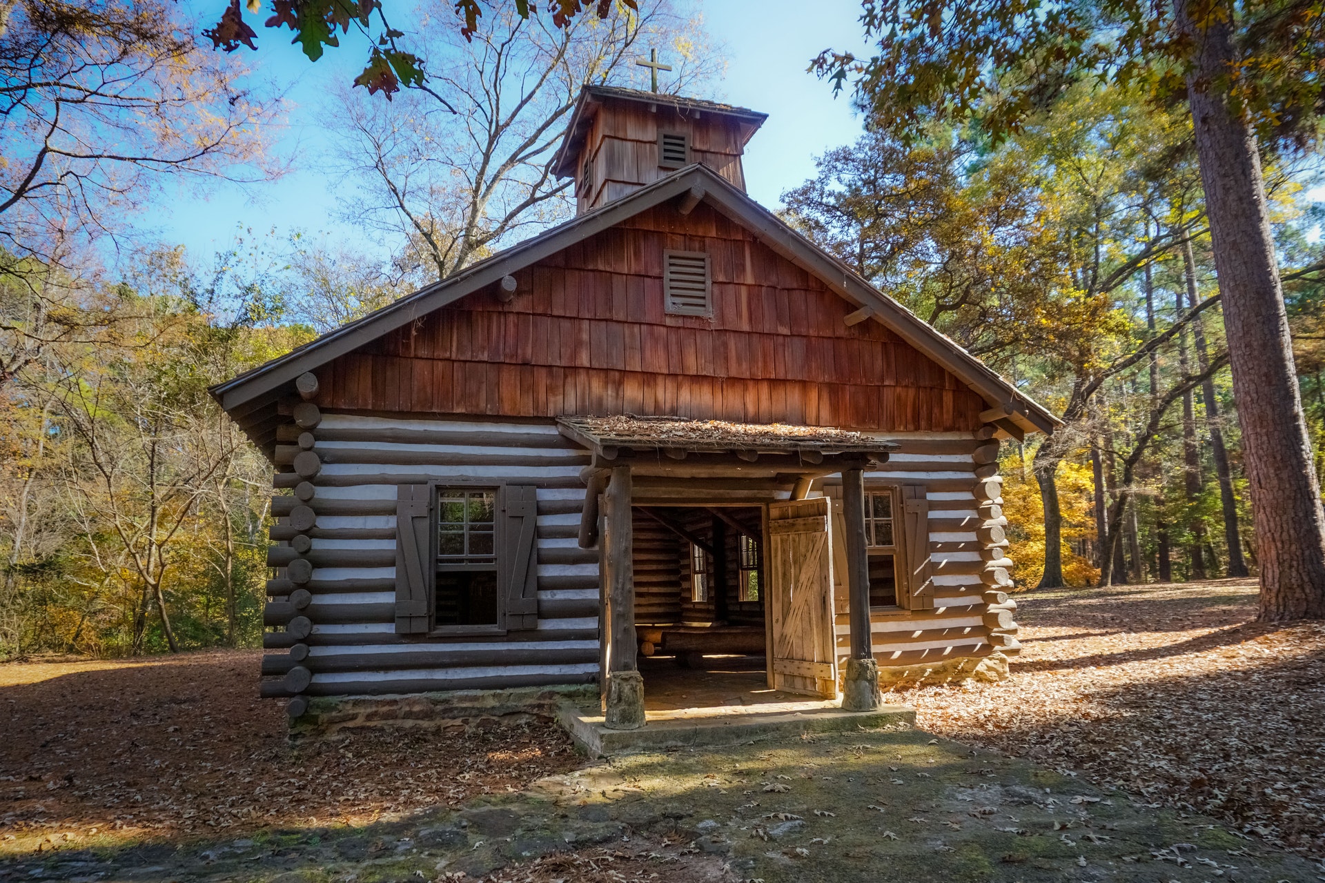