PALOUSE FALLS STATE PARK
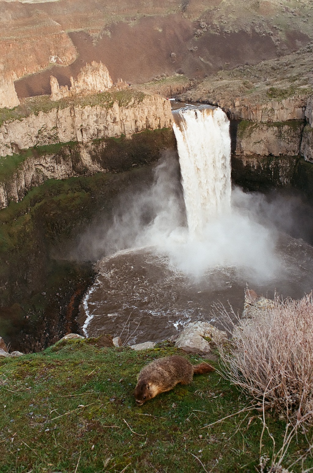
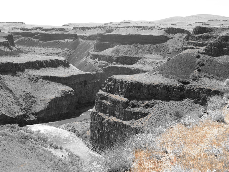
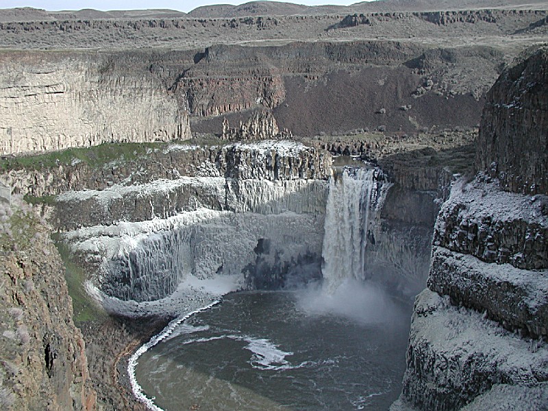
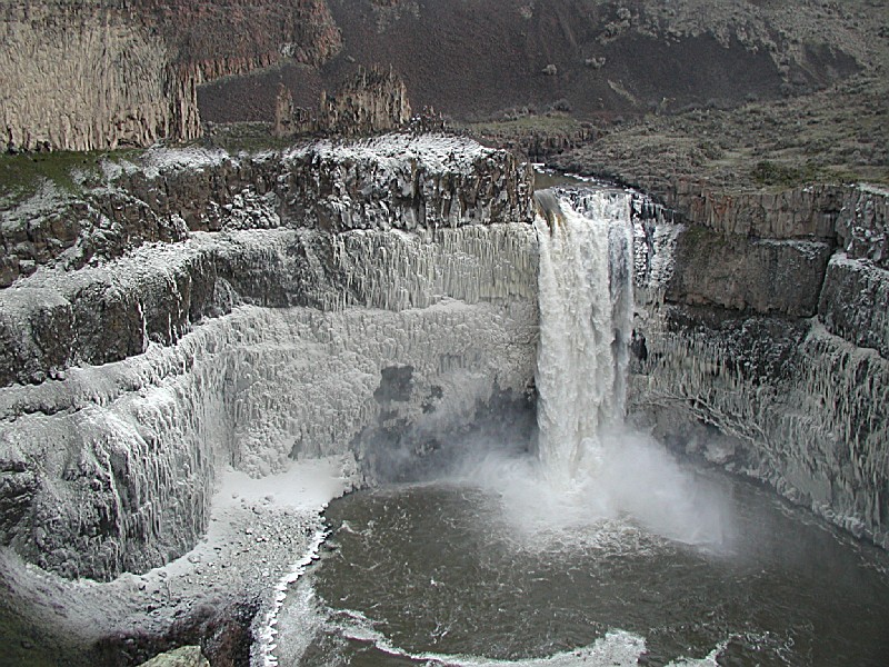
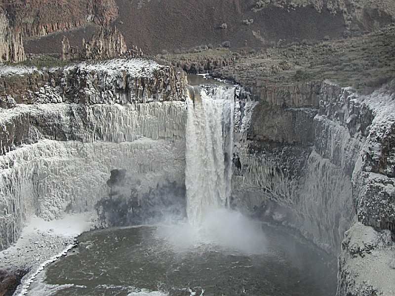
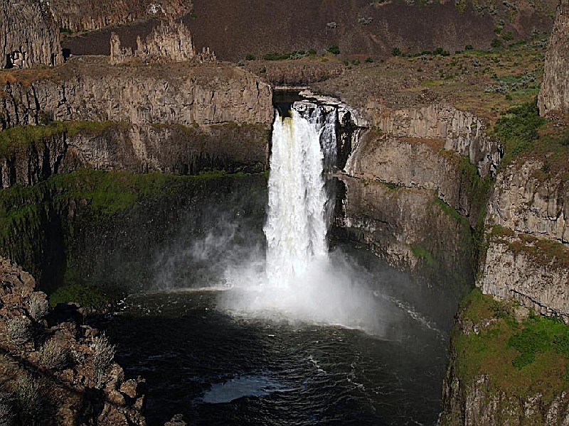
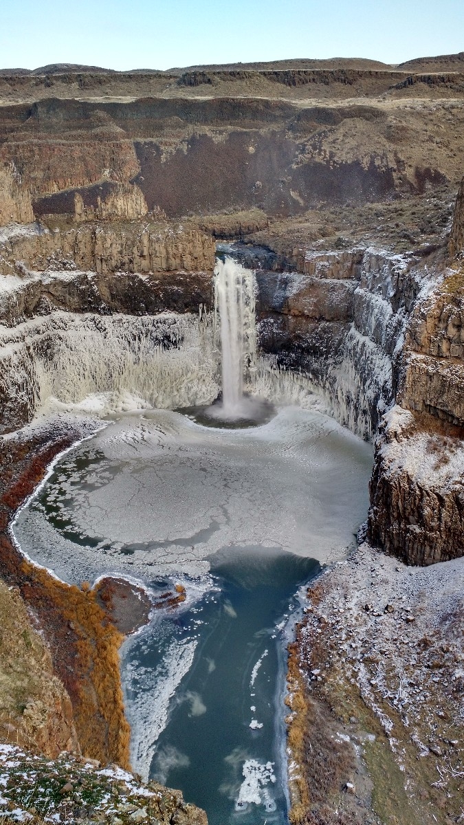
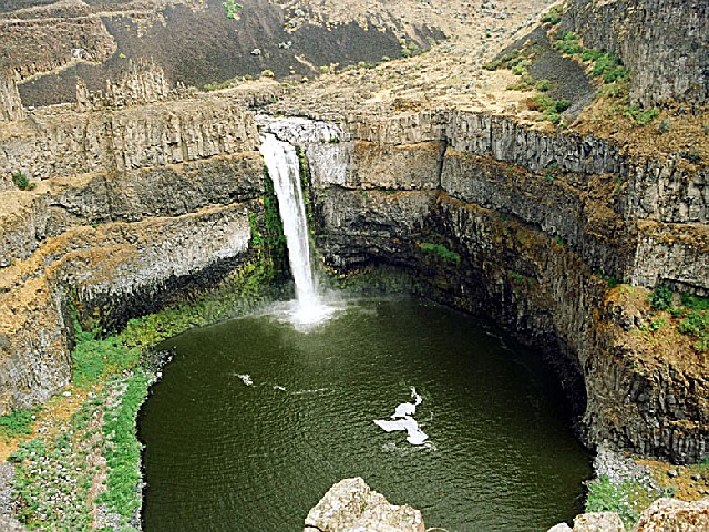
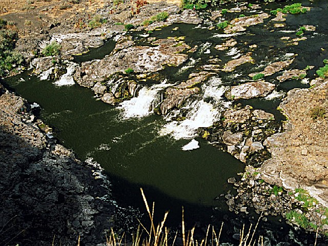
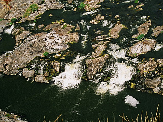
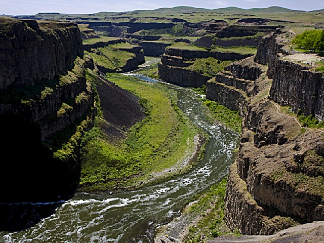
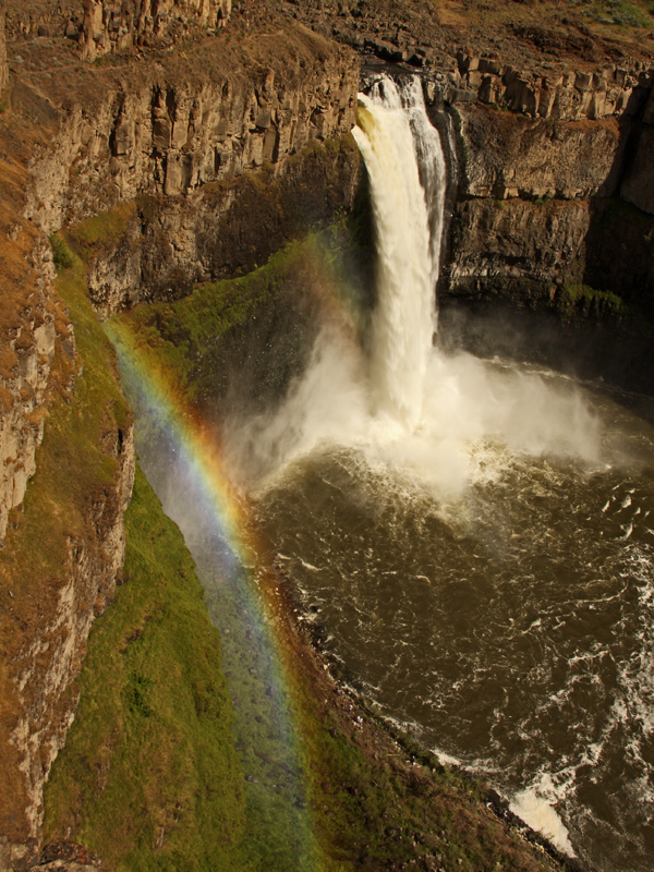
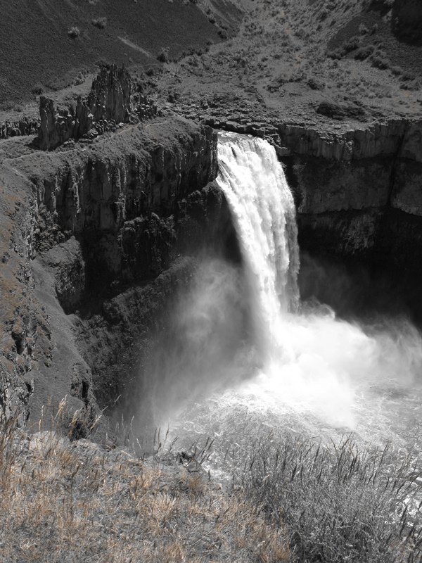
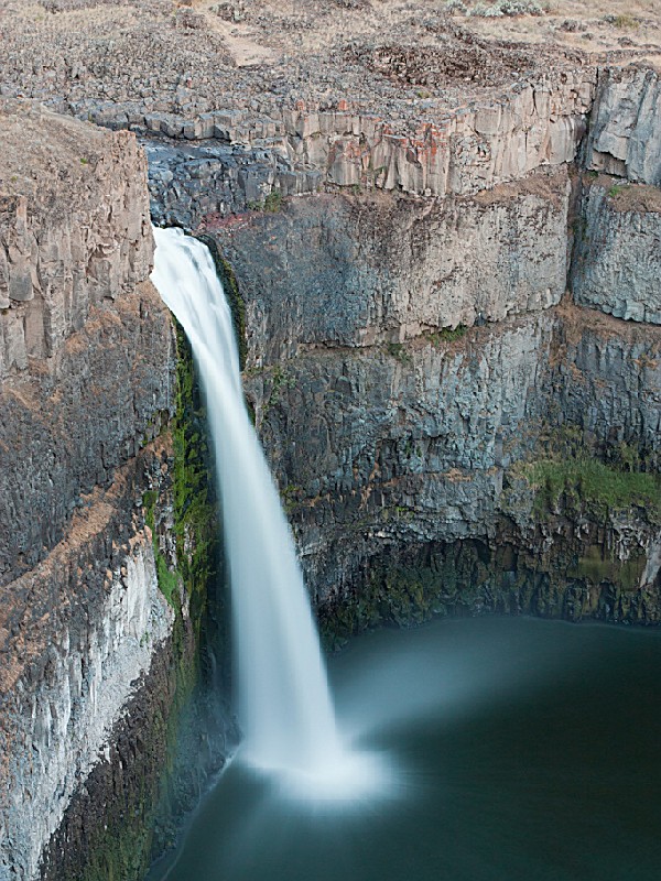
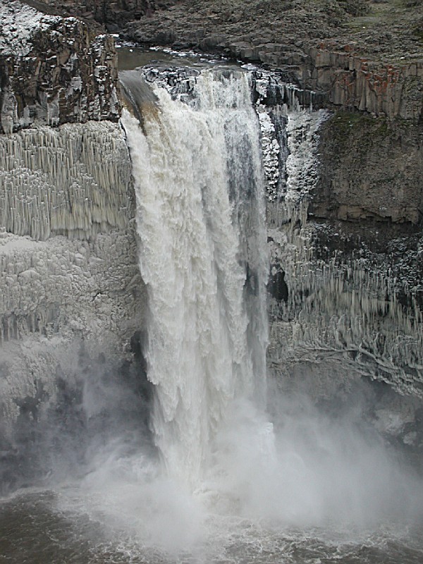
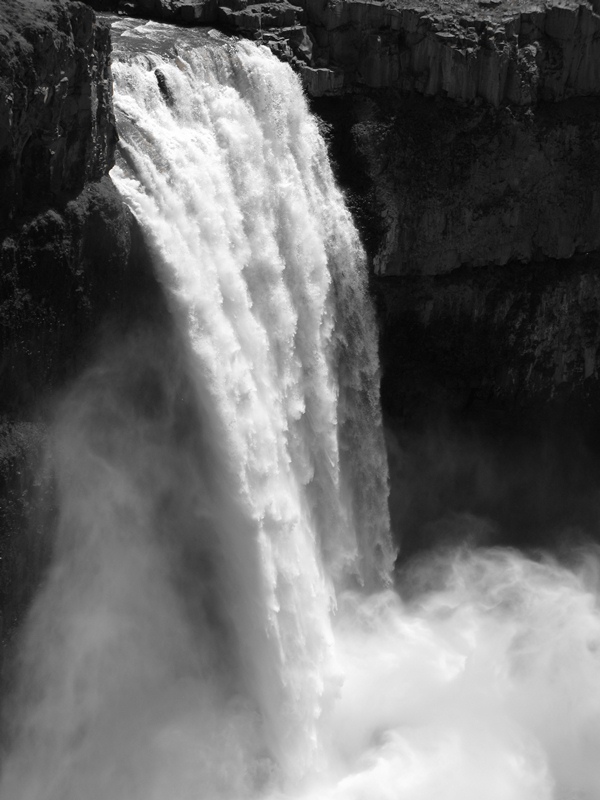
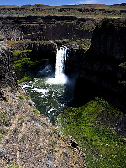
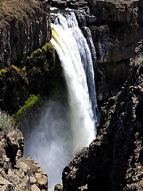
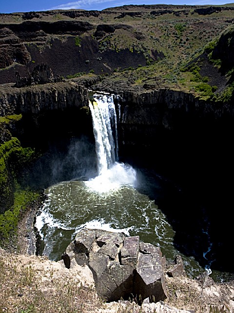
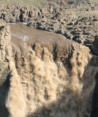
Palouse Falls State Park is a 105-acre camping park with a unique geology and history. The park offers a dramatic view of one of the state's most beautiful waterfalls. Palouse Falls drops from a height of 200 feet.
The park was dedicated June 3, 1951. For many years the falls were called "Aputapat." Later, the name was changed to commemorate the Palouse Indian culture.
According to a story of the Palouse tribe, the Palouse River once flowed smoothly into the Snake. But four giant brothers, in pursuit of a mythic creature called "Big Beaver," speared the great creature five times. Each time Big Beaver was wounded, he gouged the canyon walls, causing the river to bend and change. The fifth time he was speared, he fought the brothers valiantly and tore out a huge canyon. The river tumbled over a cliff at this point to become Palouse Falls. The jagged canyon walls show the deep marks of Big Beaver's claws.
A Discover Pass is required for vehicle access to Washington state parks for day use. For more information about the Discover Pass and exemptions, please visit the
Discover Pass web page.
Camping Fees : Please note that the following general fee information is not customized for each individual park, so not all fees will apply to all parks (for example, primitive campsite and dump station fees listed apply only to parks that have primitive campsites and dump stations).
Standard campsite, $15.
Utility campsite, $21.
Primitive campsite (accessible by motorized/non-motorized vehicles) and for water trail camping, $10
An additional $3 fee (standard) or $5 fee (utility) may be charged for select premium campsites at some parks.
Maximum eight people per campsite.
Second vehicle: $10 per night is charged for a second vehicle unless it is towed by a recreational vehicle. Extra vehicles must be parked in designated campsite or extra vehicle parking spaces.
Dump stations (if available): Year-round dump station fees are $5 per use. If you are camping, this fee is included in your campsite fee.
More about park hours : Check-in time is 2:30 p.m., and check-out time is 1 p.m.Quiet hours are from 10 p.m. to 6:30 a.m. Length of stay: you may stay up to ten consecutive days in any one park during the summer; the stay limit is extended to 20 days between Oct. 1 and March 31.
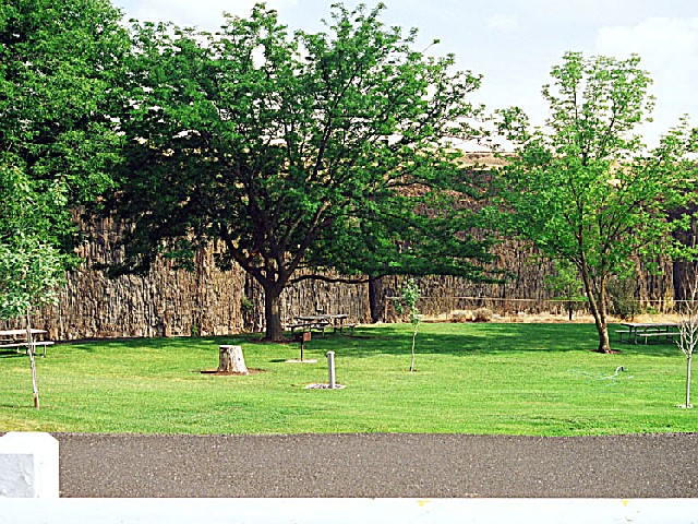
Campsite Information : The park has 10 tent spaces (one ADA), one dump station and two restrooms (both ADA). One tent site is ADA-compliant. Sites have no hook-ups. Maximum site length is 40 feet (may have limited availability). Braziers are available. All campsites are first-come, first-served.


 Share Your Palouse Falls State Park Photos (click here)
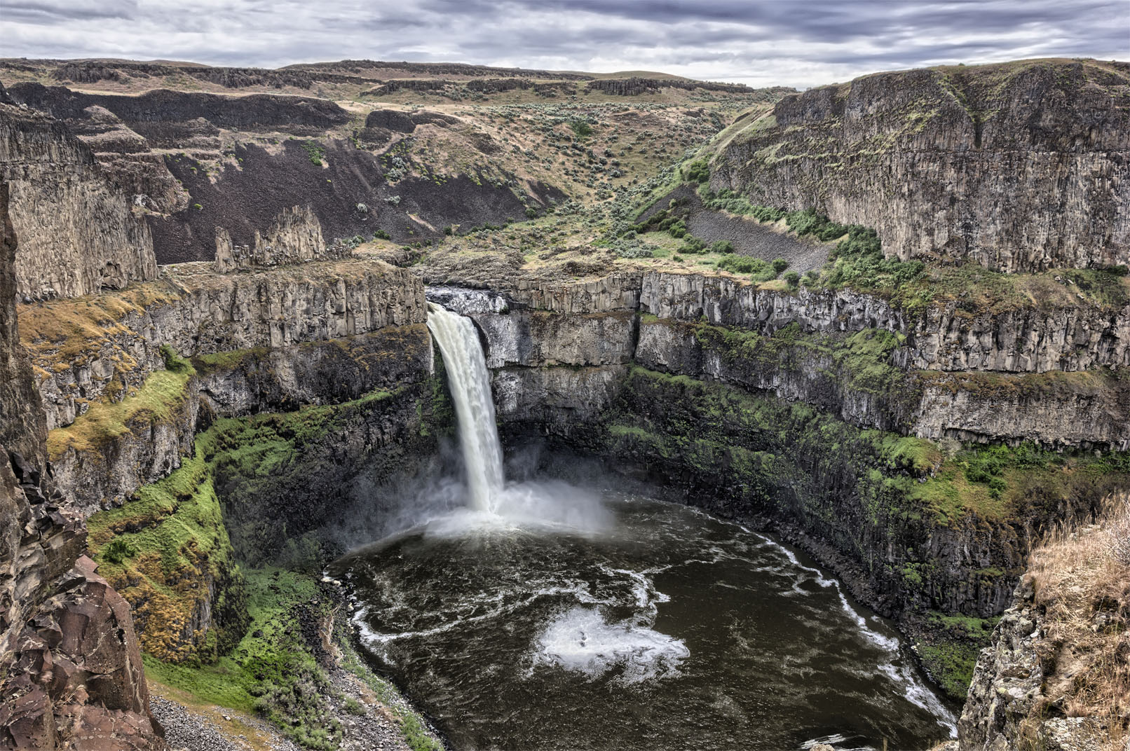