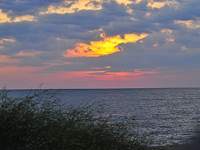
POINT LOOKOUT STATE PARK
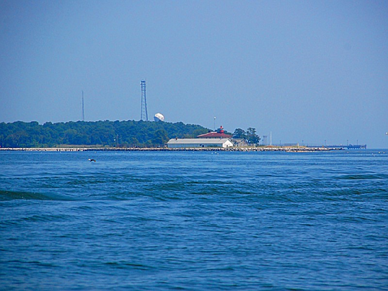
Recreational opportunities abound on this picturesque peninsula formed by the Chesapeake Bay and the Potomac River. Swimming, fishing, boating and camping are just a few of the activities to be enjoyed in this beautiful bay setting. The park's peaceful surroundings belie its history as the location of a prison camp which imprisoned as many as 52,264 Confederate soldiers during the Civil War. This is a Maryland State Park. For full information go to the official webpage. (Link on the right side)
Day-UseFishingyes
Huntingyes
Hiking Trailyes
Picnickingyes
Swimming Beachyes
Bike Trailsyes
BoatingLaunch Rampsyes
WinterActivitiesyes
6 people maximum) The cottage is located directly on the shore of the Potomac River overlooking scenic Cornfield Harbor near the confluence with the Chesapeake Bay. It is also located near historic Fort Lincoln. The cottage contains a refrigerator, stove, dishes and utensils, bathroom and coffee pot. Guests must provide their own food, linens, pillows, towels and personal items. A two night minimum stay is required April and October. Weekly rental only May through September. The cottage is closed November through March. The 2004 service charge is $80 per night. Reservations can be made by calling 1-888-432-CAMP Monday through Friday, 8 a.m. to 8 p.m.
Swimming is available from Memorial Day to Labor Day. No lifeguards are on duty. The beach area has grills, picnic tables, and a playground. Facilities include showers and restrooms. Jelly fish can be found in our swim area. The number of jelly fish changes daily depending on the time of year and rainfall.
The boat launch will operate under reduced services from 5 p.m. to 8 a.m. from December 16, 2005 to March 31, 2006. The lights will not be turned on at night during this time period. Please come prepared to launch in the dark. A boat launch facility and fish-cleaning station are available for boaters. Boat rentals and supplies are also available at the camp store. Boat launch service charge is $10 per launch, valid 24 hours a day from April-October. Boat launch service charge is $10 per launch when the facility operates sunrise to sunset November - March. Between December 16, 2005 and March 31, 2006 limited services will be available from 4 p.m. to 10 a.m. Bring a flashlight if you plan to launch and recover after dark. There will be no routine service available from staff during these hours. For emergencies call 1-800-825-7275.
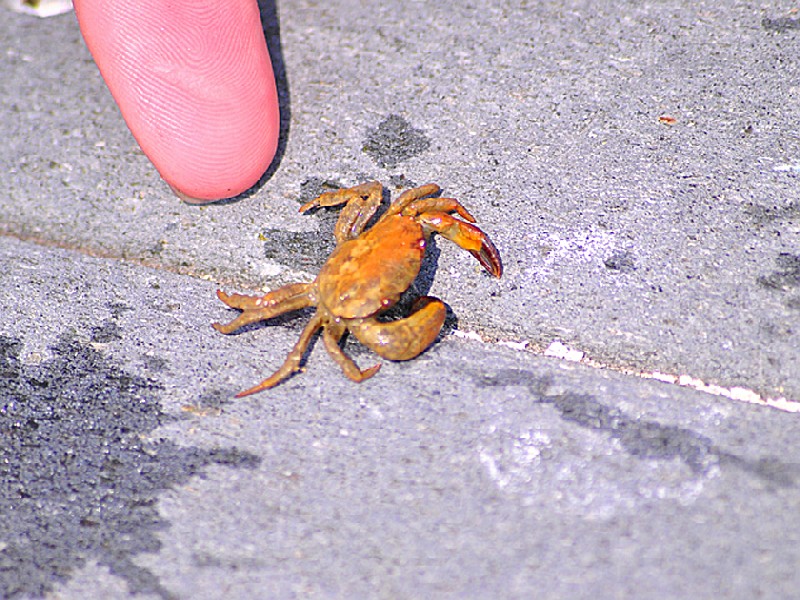
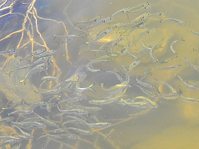
Located in Maryland, this park offers a variety of fishing options. Anglers can fish from the pier or shoreline for species such as striped bass, flounder and bluefish. Additionally, crabbing is also popular here due to an abundance of blue crabs. Fishing licenses are required for those aged 16 and above while no license is needed for crabbing.
Point Lookout State Park is located near California, Leonardtown and Lexington Park
Pedestrian access only is available between November 1, 2005 and March 31, 2006. Vehicles will not be permitted to access this area, the gates will be closed, and restrooms will not be available. Pedestrian access only is available on weekdays between April 1, 2006 and May 26, 2006. Vehicles will not be permitted to access this area on weekdays, the gates will be closed, and restrooms will not be available.
Biking enthusiasts can explore miles of scenic trails. However, caution is advised due to varying terrain and wildlife encounters.
The park offers a flat 5-mile loop trail for cyclists which provides stunning views but requires careful navigation.
Cyclists should be aware that some areas may have limited access during certain times of the year due to nesting birds or other environmental concerns.
While biking at night is permitted, it's important to use proper lighting equipment as paths are not lit after dark.
For safety reasons, all bikers under age 16 must wear helmets while riding in accordance with Maryland law.
Remember: always stay on designated bike routes and respect both nature and fellow visitors when cycling through this beautiful area.
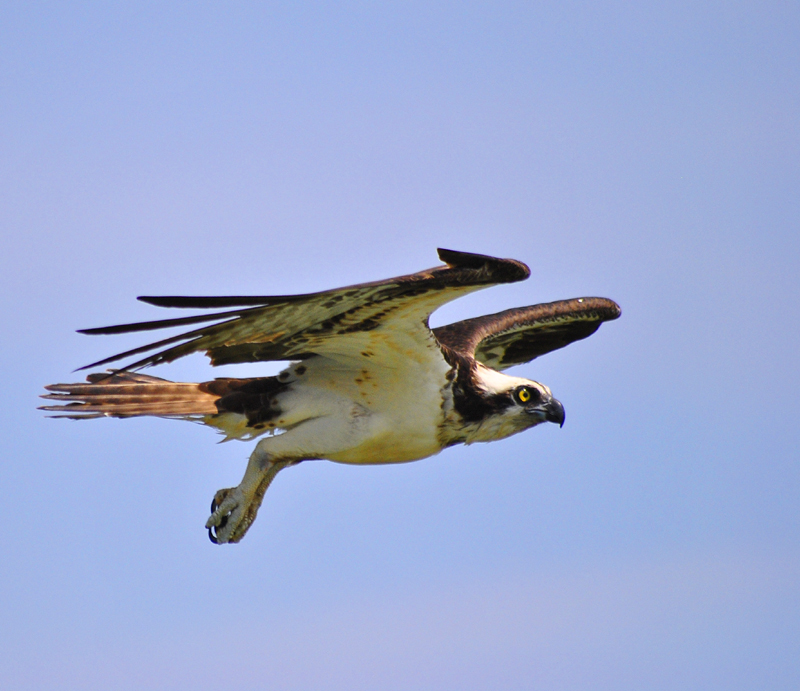
The park offers diverse birding opportunities with over 300 species recorded. It's a hotspot for migratory birds, particularly in fall and spring. Birdwatchers can explore various habitats including marshes, forests and beaches. The area is known for sightings of rare waterfowl during winter months.
Directions from Baltimore:From Rt. 695Follow to Rt. 97 south to Rt. 3 south (Rt. 3 will turn into Rt. 301. Follow Rt. 301 south. From Rt. 301 south continue to Rt. 4 south in Upper Marlboro. Follow Rt. 4 south all the way across the Solomons Island Bridge. After the Solomons Island Bridge the first traffic light you come to will be Rt. 235. Turn left onto Rt. 235 south. Follow Rt. 235 south into a town called Ridge (there will be a blinking red light). Turn left onto Rt. 5 south. Follow Rt. 5 south as far as it will go (approximately 7 miles) and you will be in Point Lookout. After the entrance sign, the second road on the right will be the campground. When you arrive in the campground, park at the left and register at the Ranger Station.
Directions from Washington, D.C.:From Rt. 495Follow to Rt. 4/Pennsylvania Avenue south to Upper Marlboro. Continue on Rt. 4 south until you cross the Solomons Island Bridge. After the Solomons Island Bridge the first traffic light you come to will be Rt. 235. Turn left onto Rt. 235 south. Follow Rt. 235 south into a town called Ridge (there will be a blinking red light). Turn left onto Rt. 5 south. Follow Rt. 5 south as far as it will go (approximately 7 miles) and you will be in Point Lookout. After the entrance sign, the second road on the right will be the campground. When you arrive in the campground park at the left and register at the Ranger Station.
Directions from the Rt. 301 Bridge:Follow Rt. 301 north to Rt. 234 towards Leonardtown. When you reach the end of Rt. 234 at Rt. 5 turn right. Follow Rt 5 south all the way into Point Lookout. After the entrance sign, the second road on the right will be the campground. When you arrive in the campground park at the left and register at the Ranger Station.
Volunteer opportunities are plentiful at Point Lookout. Volunteers can help with special events, site maintenance, visitor center activities, and general site operations. For volunteer information call 301-872-5688 and ask for the Volunteer Coordinator.


 Share Your Point Lookout State Park Photos (click here)
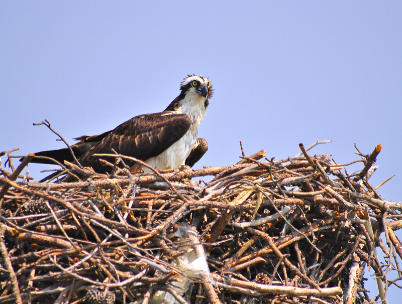