PRESCOTT NATIONAL FOREST
The Forest is located about 70 air miles northwest of Phoenix, Arizona, contains approximately 1,237,000 acres, and is composed of two distinct divisions. The eastern portion of the Forest, which forms the headwaters of the Verde River (sections of this river have been designated as a component of the Wild and Scenic River System), is bordered on the north by the Kaibab National Forest, on the east by the Coconino National Forest, and on the south by the Tonto National Forest. The western portion of the Forest, which includes the Bradshaw and Santa Maria mountain ranges, is separated from the eastern portion by a broad patchwork of state, private, and other Federal lands. It forms the southern and western boundaries of the town of Prescott, the first capital of the territory of Arizona.
 Alto Pit OHV
Alto Pit OHV Campground is located at the foot of Granite Mountain Wilderness Area, at an elevation of 6,200 feet. The off-highway trail system within the recreation area draws enthusiasts of all ages with degrees of skills that prove challenging and enjoyable for everyone alike. To make reservations call 1 877 444-6777. For general campground questions
....moreGroom Creek Horse Camp Equestrian campers will find Groom Creek Horse Camp seven miles south of Prescott, Arizona at an elevation of 6,398 feet. The ponderosa pine setting, nearby trails and limited equestrian camping opportunities make this a popular destination. Each campsite has a steel corral enclosure and an overhead tether line that accommodates two to four horses. Two
....more Hilltop Campground Hilltop Campground is located in the Prescott Basin at 5,712 feet in elevation and just over three miles south of Hwy 69 and east of Walker Road. Campers will appreciate the mild weather and the cool ponderosa pine forest. The facility's attractive and convenient location allows opportunities for pursuing a variety of recreation activities that will
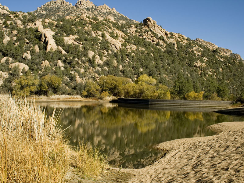
....more Yavapai Campground Yavapai Campground is within the Granite Basin Recreation Area, at an elevation of 5,600 feet. The campground is located seven miles northwest of downtown Prescott. Main attractions are mild weather, cool ponderosa pine forest, and Granite Basin Lake. Activities include fishing for largemouth bass, channel catfish, and sunfish, canoeing, hiking, mountain
....more Day-UseFishingyes
Huntingyes
Hiking Trailyes
Picnickingyes
The forest contains 10 campgrounds, 4 group reservation campgrounds, 7 picnic areas, and 2 group reservation picnic areas. Most of the developed recreation sites are located in the pines with 5 of the campgrounds and two of the picnic areas situated near manmade lakes. Several developed sites offer barrier-free access for users experiencing disabilities.


 Share Your Prescott National Forest Photos (click here)