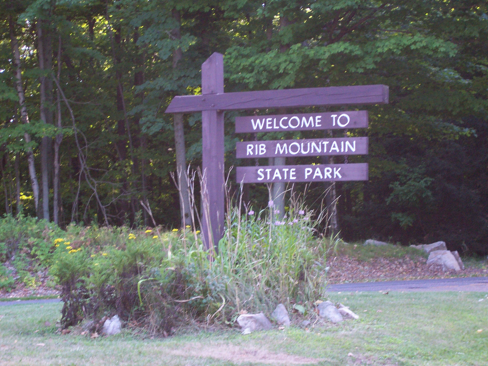
RIB MOUNTAIN STATE PARK
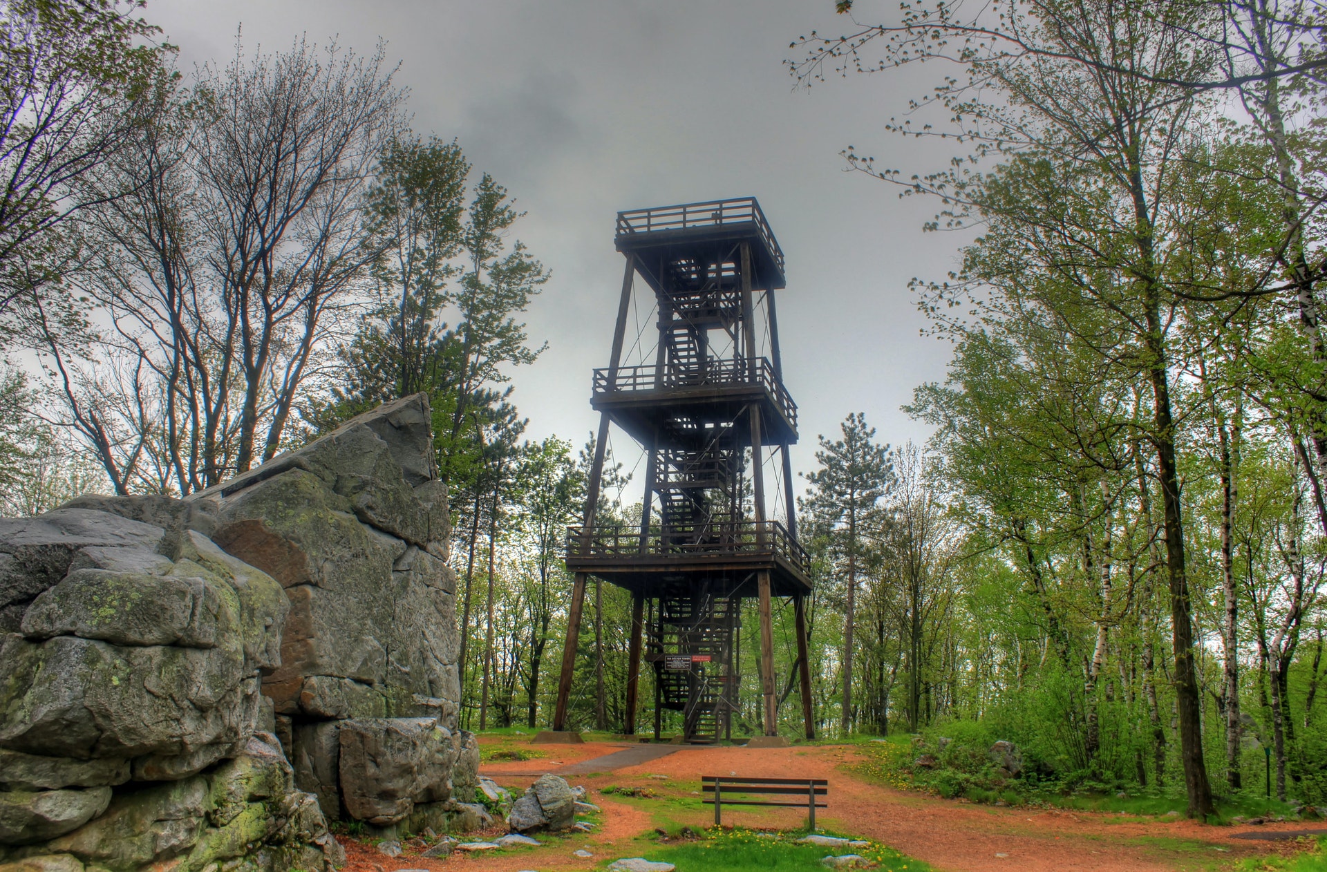
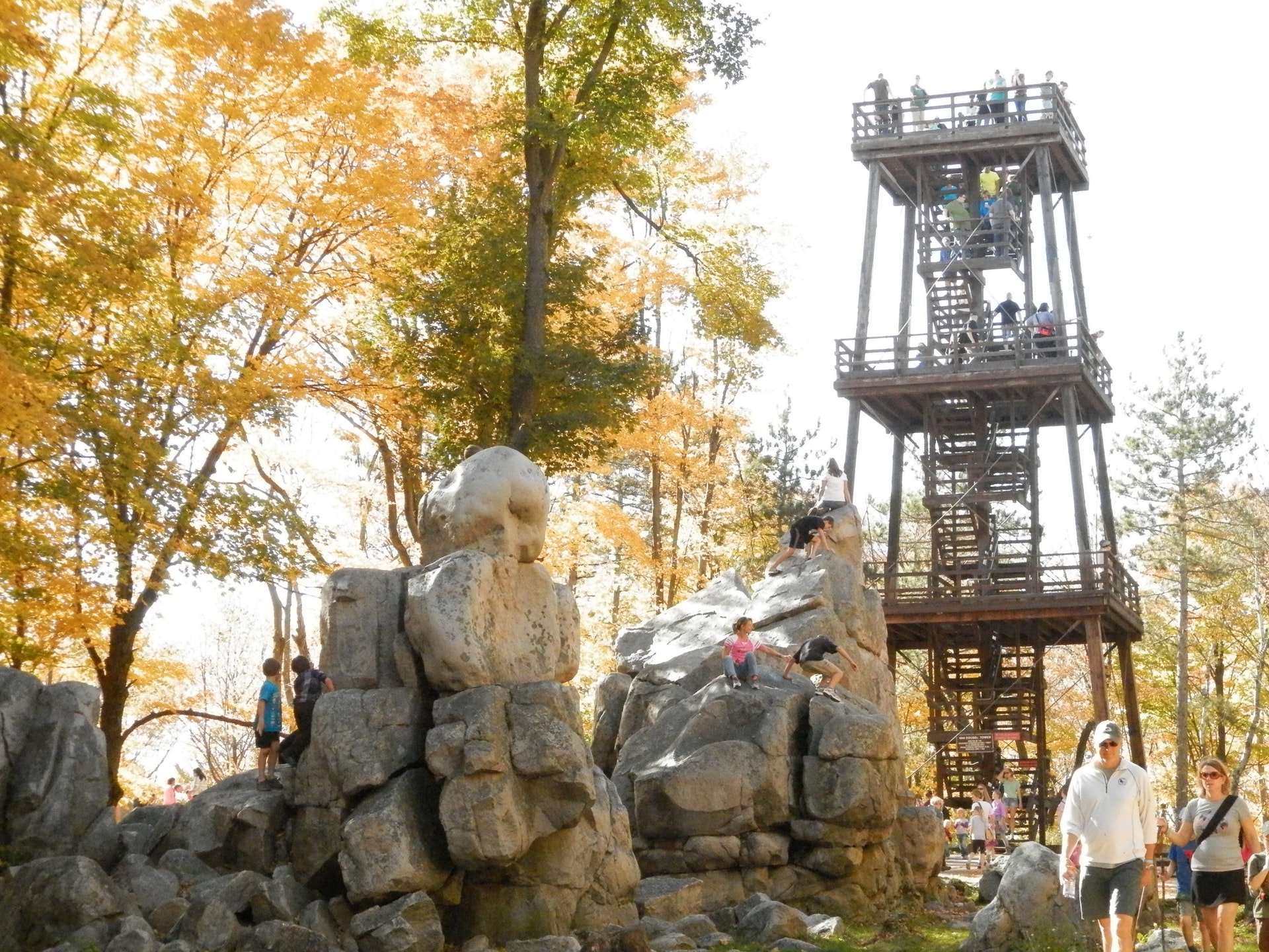
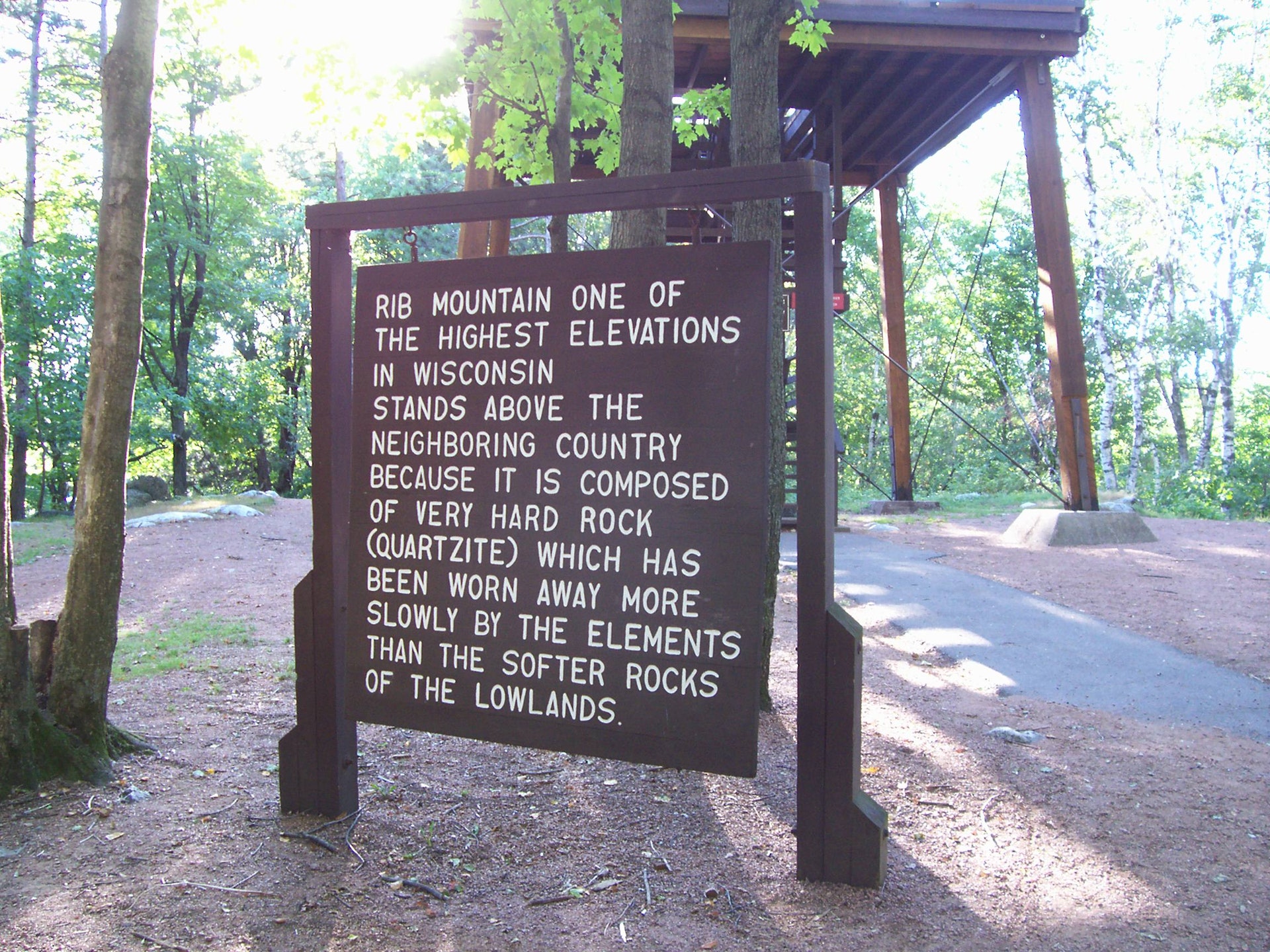
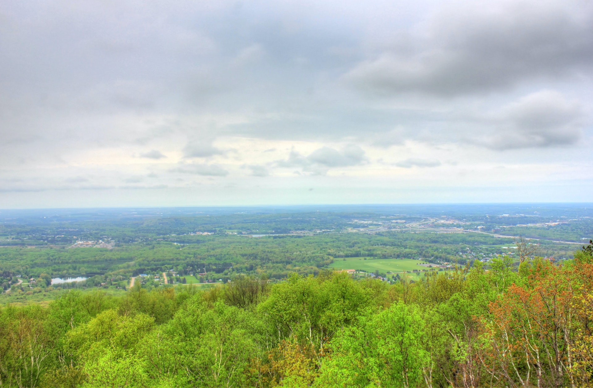
This billion-year-old hill is one of the oldest geological formations on earth. The top of the 60-foot tower and two observation decks offer spectacular views.
The 1,480-acre park also has 13.6 miles of hiking trails, 9.7 miles of snowmobile trails, 8.2 miles of trails accessible to people with disabilities, 8.2 miles of snowshoeing trails, 69 picnic tables, a reservable enclosed picnic shelter, a concession stand, two playgrounds, a reservable amphitheater, summer naturalist program, wild turkeys, deer, fox, raccoons, woodchucks, rabbits, and squirrels.
A Wisconsin State Park System vehicle admission sticker is required on all motor vehicles stopping in state parks, forests and recreation areas, please visit the
VEHICLE ADMISSION STICKERS web page.
Rib Mountain State Park is located near Mosinee, Schofield and Wausau
Rib Mountain State Park offers scenic picnic areas with tables and grills, overlooking the Wisconsin landscape. Shelters are available for rent.
The Mountain-Bay State Trail, for hiking, bicycling, and snowmobiling, links the Wausau area and Green Bay.
The City of Wausau offers a variety of lodging, restaurants, and stores, galleries, theaters, and a symphony orchestra. A channel of the Wisconsin River is used for whitewater kayaking and canoeing (exit DNR).
Marathon County has space and facilities for activities ranging from hunting and fishing to golf, curling and bowling. Nine Mile County Forest Recreation Area has trails for cross-country skiing, mountain biking, and other uses.
Embarrass River ATV Park, about 45 miles east in Tigerton, has extensive all-terrain vehicle trails.
Rib Mountain is west of Interstate Highway 39/U.S. Highway 51 southwest of Wausau.
Ski area facilities are at the north base of the mountain. Exit the freeway onto County Highway NN and go about .7 mile west to the entrance.
The camping and picnic areas, trails, and other facilities are at the top of the mountain. Exit the freeway onto County Highway N west. Turn right (west) at the first intersection onto Park Drive and go about 2.5 miles to the summit.
A valid Wisconsin State Park vehicle admission sticker is required and may be purchased at the park.


 Share Your Rib Mountain State Park Photos (click here)
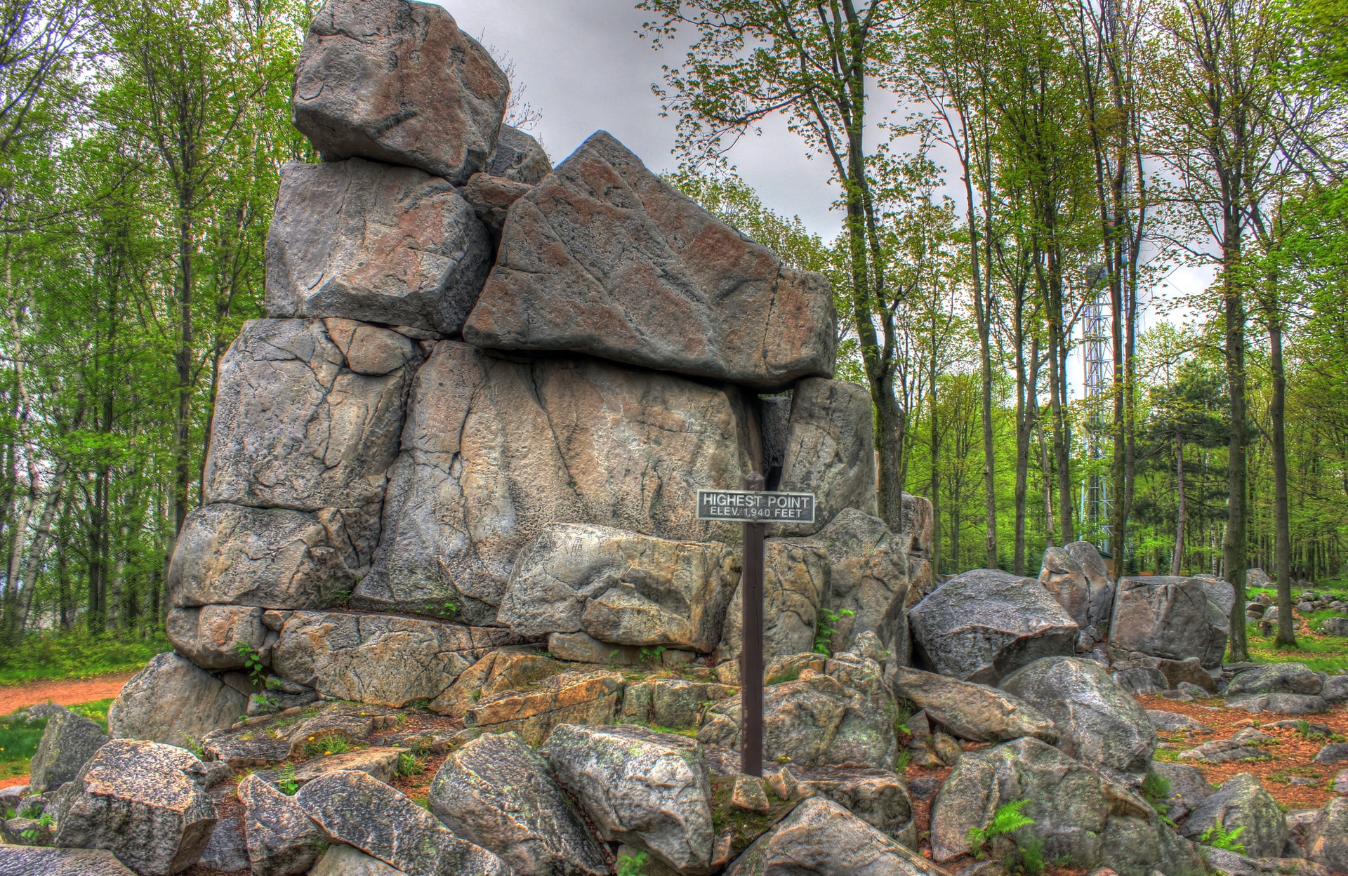