TAHQUAMENON FALLS STATE PARK
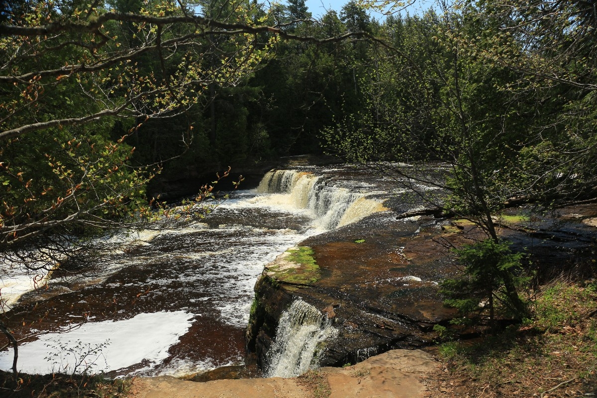
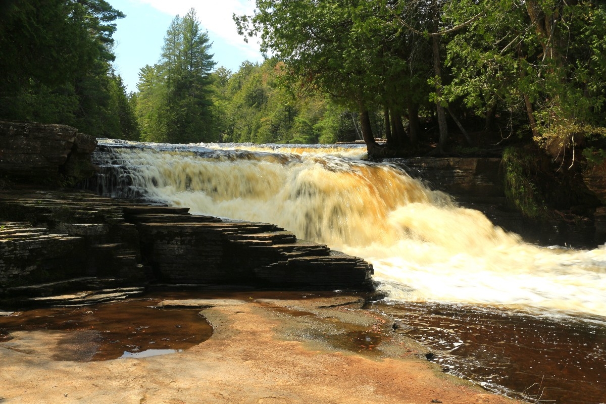
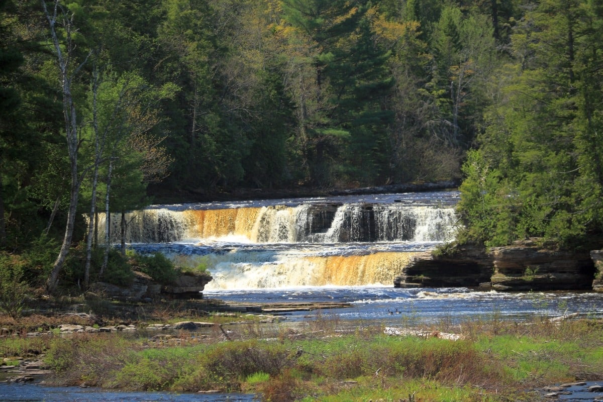
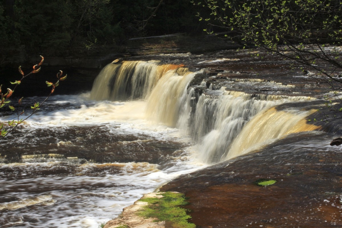
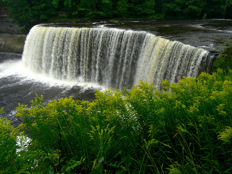
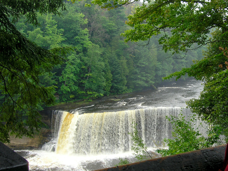
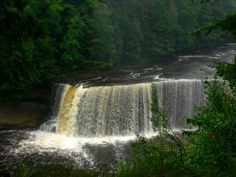
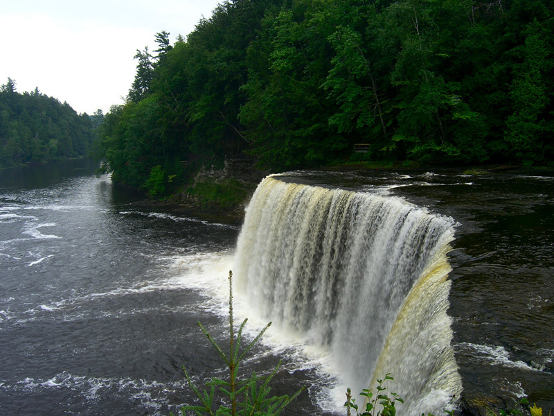
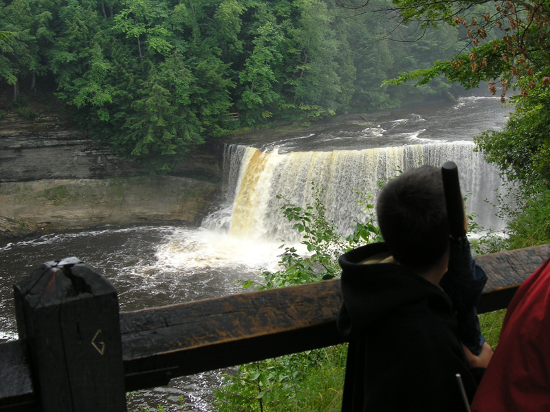
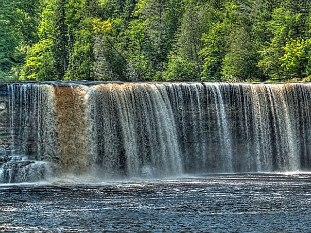
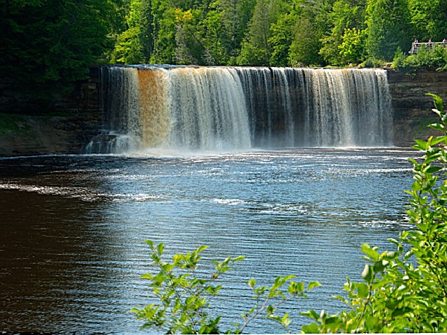
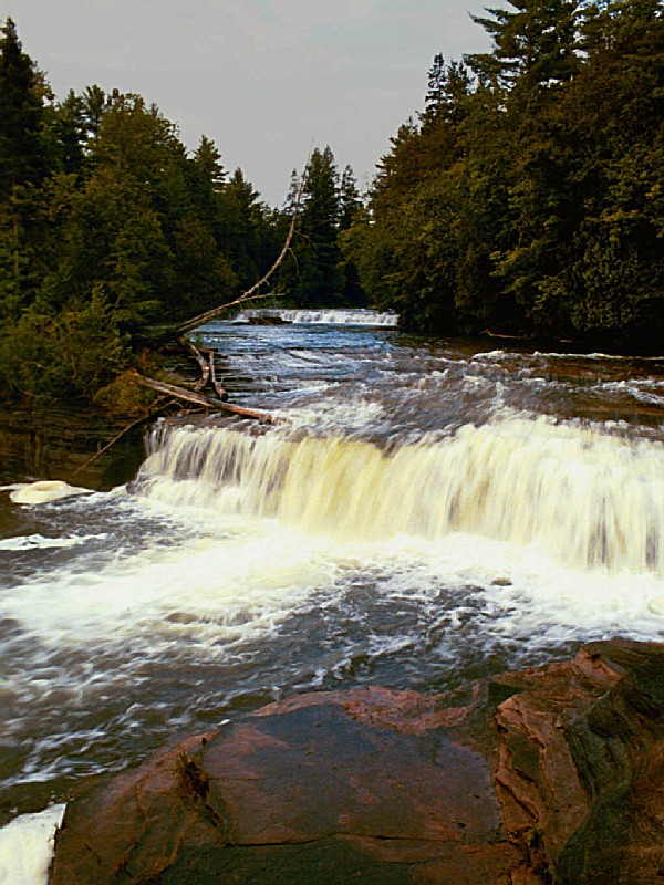
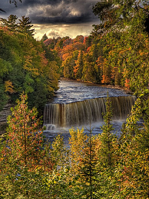
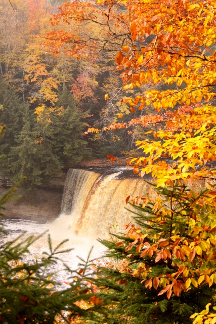
Tahquamenon Falls State Park encompasses close to 50,000 acres stretching over 13 miles. Most of this is undeveloped woodland without roads, buildings or power lines. The centerpiece of the park, and the very reason for its existence, is the Tahquamenon River with its waterfalls. The Upper Falls is one the largest waterfalls east of the Mississippi. It has a drop of nearly 50 feet and is more than 200 feet across. A maximum flow of more than 50,000 gallons of water per second has been recorded cascading over these falls. Four miles downstream is the Lower Falls, a series of five smaller falls cascading around an island. Although not as dramatic as the Upper Falls, they are equally magnificent. The falls can be viewed from the river bank or from the island, which can be reached by rowboat rented from a park concession. The island walk affords a view of the falls in the south channel.
This is the land of Longfellow's Hiawatha - "by the rushing Tahquamenaw" Hiawatha built his canoe. Long before the white man set eyes on the river, the abundance of fish in its waters and animals along its shores attracted the Ojibwa Indians, who camped, farmed, fished and trapped along its banks. In the late 1800's came the lumber barons and the river carried their logs by the millions to the mills. Lumberjacks, who harvested the tall timber, were among the first permanent white settlers in the area.
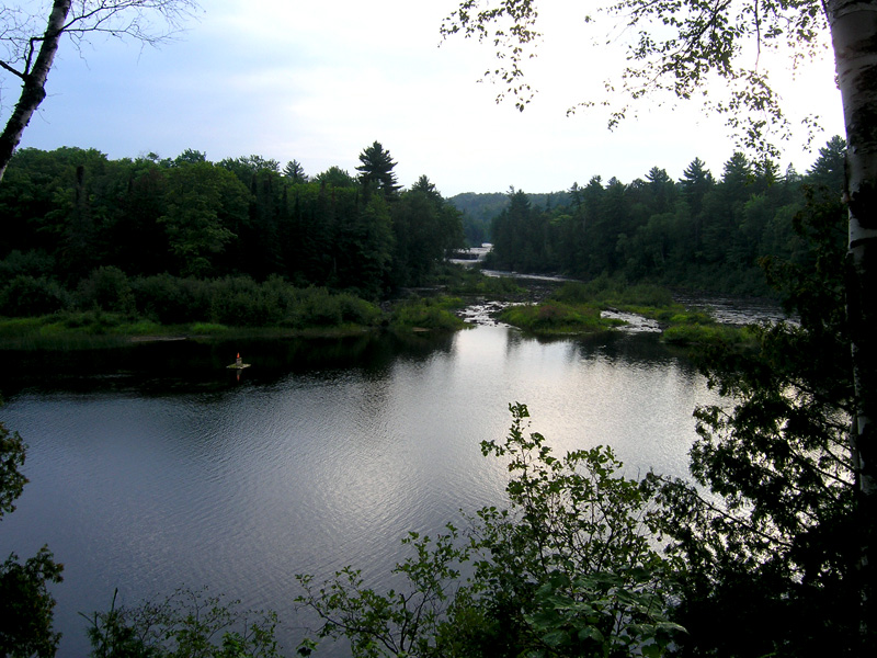
Rising from springs north of McMillan, the Tahquamenon River drains the watershed of an area of more than 790 square miles. From its source, it meanders 94 miles before emptying into Whitefish Bay. The amber color of the water is caused by tannins leached from the Cedar, Spruce and Hemlock in the swamps drained by the river. The extremely soft water churned by the action of the falls causes the large amounts of foam, which has been the trademark of the Tahquamenon since the days of the voyager.
Moose are occasionally seen feeding in the wet areas of the park, especially along M-123 between Paradise and the Lower Falls. Black bear, coyotes, otter, deer, fox, porcupines, beaver and mink are a few of the other wildlife which can be seen in the park. The abundant bird life includes spruce grouse, pileated woodpeckers, bald eagles and a variety of waterfowl and songbirds.
The Recreation Passport is required for vehicle entry into state parks and recreation areas, state boat launches, state forest campgrounds and state trail parking lots. Details and information on how to obtain your Michigan Recreation Passport can be found by visiting the
MICHIGAN RECREATION PASSPORT web page.
Day-UseFishingyes
Huntingyes
Hiking Trailyes
Tahquamenon Falls-Group Use Area(906) 492-3415 50 site(s)Rustic Site, Vault Toilet
Tahquamenon Lower Falls-Modern(800) 447-2757 188 site(s)Campsites with 50 amp Service, Electrical Service, Modern Restrooms
Tahquamenon Rivermouth Pines/Semi-Modern/Rustic(800) 447-2757 36 site(s)Rustic Site, Vault Toilet
Tahquamenon Rivermouth-Modern(800) 447-2757 72 site(s)Campsites with 50 amp Service, Electrical Service, Modern Restrooms
Park concession is available at the lower falls with souvenirs and limited menu items. The Upper Falls has a privately-owned restaurant and gift shop, which are adjacent to the park property.
Boat Rentals are available from Memorial Day to Labor Day for row boats and canoes. Reservations available for groups only. Call the concession at 906-492-3457 or the park at 906-492-3415.
The Tahquamenon River offers 17 miles of canoeing from the Lower Falls to the Rivermouth area. Put-ins are available both at the Lower Falls and at Rivermouth.
The park offers abundant fishing opportunities in its rivers and lakes. Species include brook trout, brown trout, and northern pike.
Fishing is allowed year-round with ice-fishing popular during winter months.
Boat rentals are available for those wishing to fish on the water bodies within the park.
Fly fishermen can enjoy casting their lines into swift-moving streams teeming with various species of gamefish.
For a more relaxed experience, try still-water angling from shorelines or docks where panfish like bluegill abound.


 Share Your Tahquamenon Falls State Park Photos (click here)
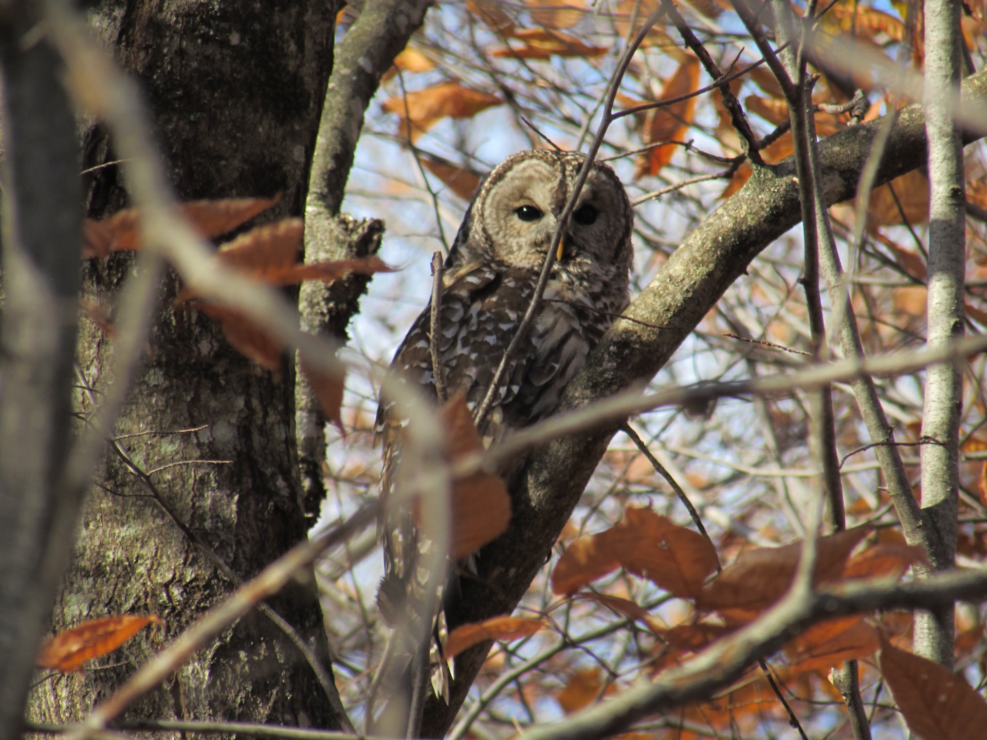