CANYONLANDS NATIONAL PARK
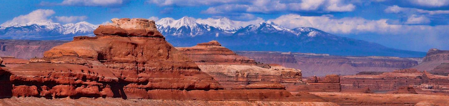
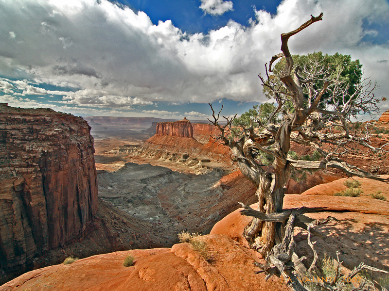
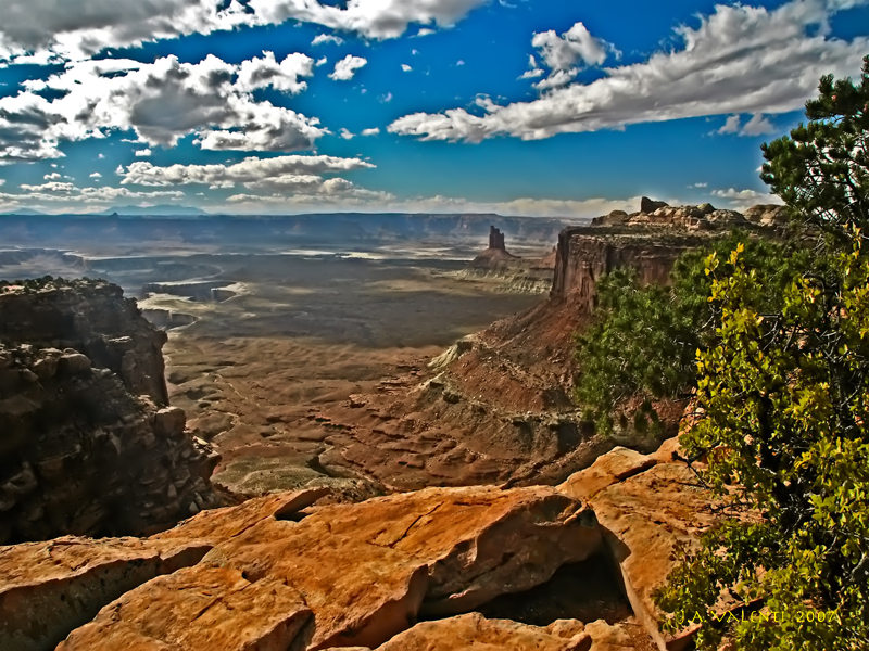
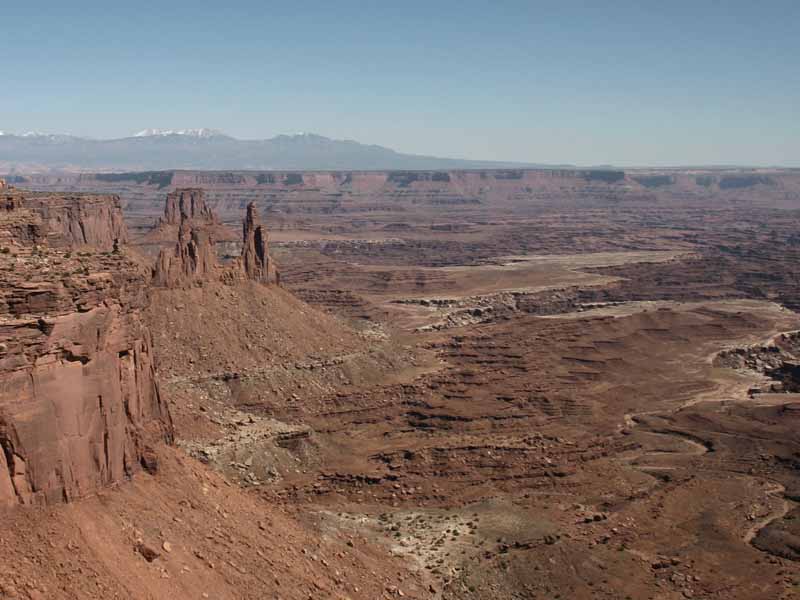
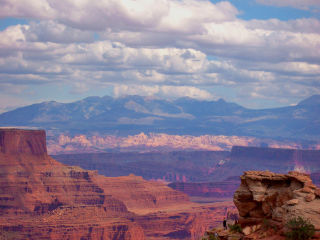
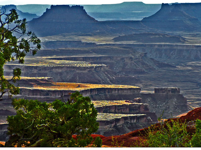
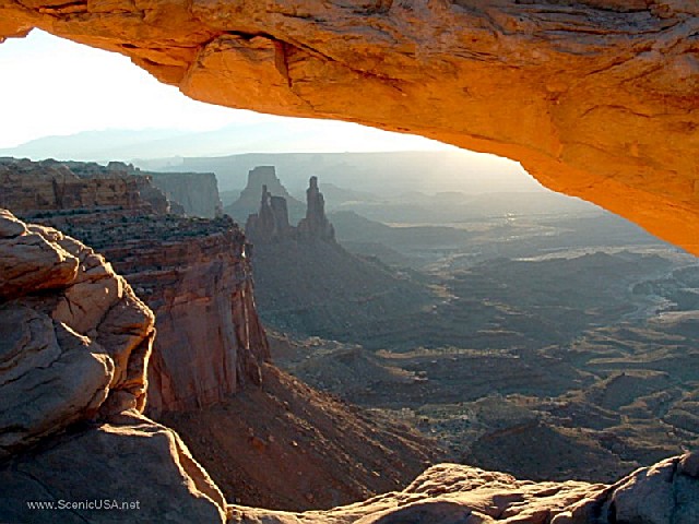
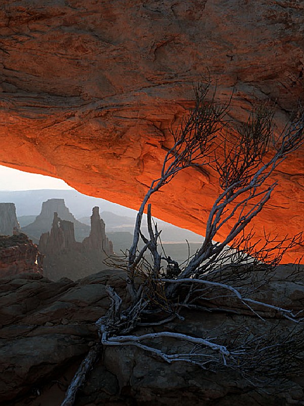
Canyonlands National Park preserves a colorful landscape of sedimentary sandstones eroded into countless canyons, mesas and buttes by the Colorado River and its tributaries. Located in southeast Utah, the park sits in the heart of a vast basin bordered by sheer cliffs of Wingate Sandstone.
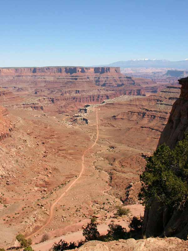
The Colorado and Green rivers divide the park into four districts: the Island in the Sky, the Needles, the Maze and the rivers themselves. While the districts share a primitive desert atmosphere, each retains its own character and offers different opportunities for exploration and the study of natural and cultural history.
Most visits to Canyonlands involve camping along the trails, roads and rivers found here. The four districts are not directly linked by any roads, so travel between them requires two to six hours by car. Generally, people find it impractical to visit more than one or two districts in a single trip.
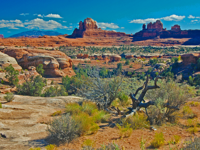
 Needles District Canyonlands
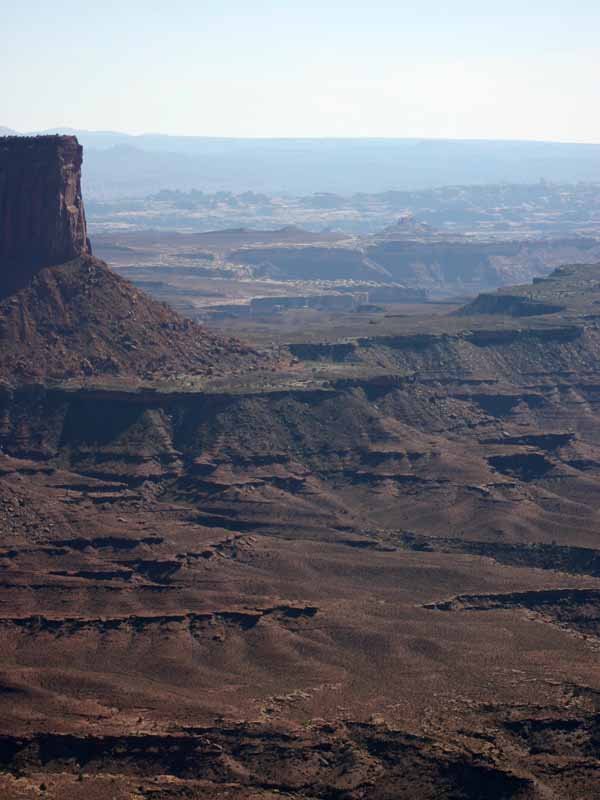
The Needles is a remote district located within the southern portion of Canyonlands National Park in southeastern Utah. The Needles District is 1.25 hours driving time from Monticello, Utah, and 1.5 hours from Moab, Utah, and sits at an elevation of approximately 4,900 feet 1494 m.
The Needles Campground offers limited services and is best suited to
....moreCanyonlands National Park preserves one of the last, relatively undisturbed areas of the Colorado Plateau, a geological province that encompasses much of the Colorado River and its tributaries. Carved out of vast sedimentary rock deposits, this landscape of canyons, mesas, and deep river gorges possesses remarkable natural features that are part of a unique desert ecosystem.
The foundation of Canyonlands' ecology is its remarkable geology, which is visible everywhere in cliff profiles that reveal millions of years of deposition and erosion. These rock layers continue to shape life in Canyonlands today, as their erosion influences elemental features like soil chemistry and where water flows when it rains.
Known as a "high desert," with elevations ranging from 3,700 to 7,200 feet above sea level, Canyonlands experiences very hot summers, cold winters and less than ten inches of rain each year. Even on a daily basis, temperatures may fluctuate as much as 50 degrees.
The plants and animals in Canyonlands have many adaptations that enable them to survive these conditions. Some species are found only in this area. The diversity of organisms reflects the variety of available habitat, which includes lush riparian areas, swift rivers, ephemeral pools, dry arroyos, mixed grasslands and large expanses of bare rock.
official exploration of the Colorado and Green rivers did not occur until 1869, when Major John Wesley Powell led a group from Green River, Wyoming all the way through the Grand Canyon in Arizona. During the three month expedition, Powell mapped the rivers and recorded information about the natural and cultural history of the area. One stop of his in what is now Canyonlands inspired the following passage in his journal:
?? The landscape everywhere, away from the river, is of rock ? cliffs of rock; plateaus of rock; terraces of rock; crags of rock ? ten thousand strangely carved forms.?
Powell repeated the trip a few years later.
European settlements in southeast Utah developed from the missionary efforts of the Mormon Church. In 1855, Mormons set up a mission in what is now Moab, but conflicts with the Utes caused them to abandon it. The Hole in the Rock expedition?a Mormon mission charged with settling southeast Utah?founded the town of Bluff in 1880. The towns of Blanding, Moab and Monticello were settled shortly thereafter. Most residents made their living as farmers, prospectors or ranchers.
From the 1880s to 1975, local ranches used much of Canyonlands for winter pasture. Cowboys searched the canyons for good feed and water. They constructed trails to move their stock across the rugged terrain. To guard their herds, cowboys lived in primitive camps for weeks at a time. The Cave Spring Trail in the Needles District features one such camp.
Places throughout the park bear the names of early cowboys. The Taylor, Holeman and Shafer families grazed cattle and sheep in what is now the Island in the Sky. Don Cooper, Mel Turner, D.L. Goudelock and Joe Titus ranched the Indian Creek area. Their holdings under the Indian Creek Cattle Company were bought by the Scorup and Sommerville families in 1914. Headquartered at the Dugout Ranch outside the Needles District, the Indian Creek Cattle Company operates today under ownership of the Nature Conservancy.
The Biddlecome, Ekker, Tidwell and Chaffin families wintered animals in the Maze. The Ekker Ranch grazed cows on lands adjacent to the Maze until 2000. In addition to cattle and sheep, the rugged country around the Maze harbored outlaws. Robbers Roost, a mesa top west of the Maze, provided refuge for Robert Leroy Parker (a.k.a. Butch Cassidy), Tom and Bill McCarty, Matt Warner and others.
Mining:
The growth of America?s nuclear arms program in the 1950s created a high demand for uranium. Geologists thought that Utah?s canyon country contained a significant amount of uranium, but the rugged terrain made access difficult. To encourage prospectors, the Atomic Energy Commission offered monetary incentives and built almost 1,000 miles of road in southeast Utah. In Canyon-lands, these roads include the popular White Rim Road at the Island in the Sky.
Though the region produced substantial amounts of uranium, miners discovered very little in what is now Canyonlands. However, the newly created roads led to other discoveries. For the first time, much of Canyonlands could be seen from a car. Tourism slowly increased as more people learned about the area?s geologic wonders. By opening canyon county to travel, the miners blazed the trail for the creation of a National Park.
SQUAW FLAT:
Located in the Needles District, Squaw Flat Campground is an ideal base camp for day hikes to popular destinations like Chesler Park, Druid Arch and the Joint Trail. There are 26 sites available on a first-come, first-served basis. Bathrooms, fire grates, picnic tables, tent pads and water available year-round. Group size limit is 10 people and 2 vehicles. Maximum RV length is 28 feet. Fee is $10 per night. Squaw Flat typically fills every day from late March through June and again from early September to mid-October.
WILLOW FLAT:
Located at the Island in the Sky, the Willow Flat Campground is a short walk from one of the finest sunset spots in the park: Green River Overlook. Twelve sites are available on a first-come, first-served basis. Sites include picnic tables, fire grates and vault toilets. No water. Maximum RV length is 28 feet. Group size limit is 10 people and 2 vehicles. Fee is $5 per night. Willow Flat typically fills every day from late March through June and again from early September to mid-October.
GROUP SITES:
The Needles District offers three campsites for groups of 11 or more people which may be reserved in advance. The Squaw Flat Group Site can hold up to 50 people and 10 vehicles. The Wooden Shoe Group Site can hold up to 25 people and 5 vehicles. The Split Top Group Site can hold up to 15 people and 3 vehicles. Nightly fees are $3 per person.


 Share Your Canyonlands National Park Photos (click here)
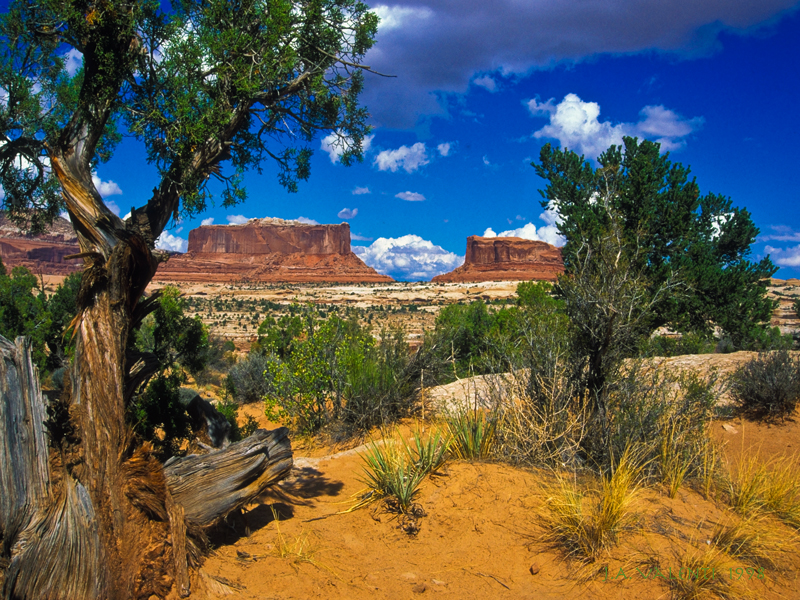