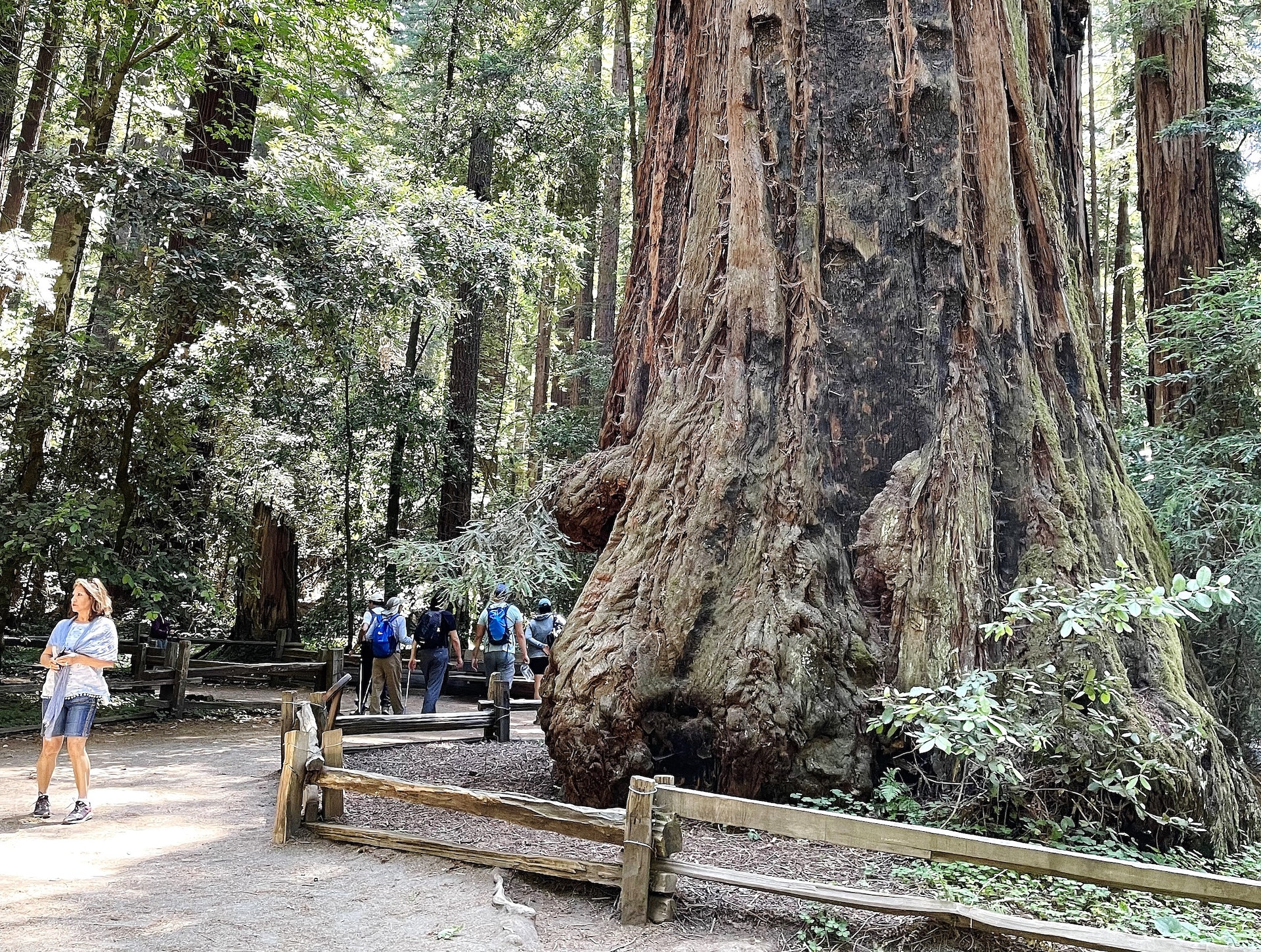
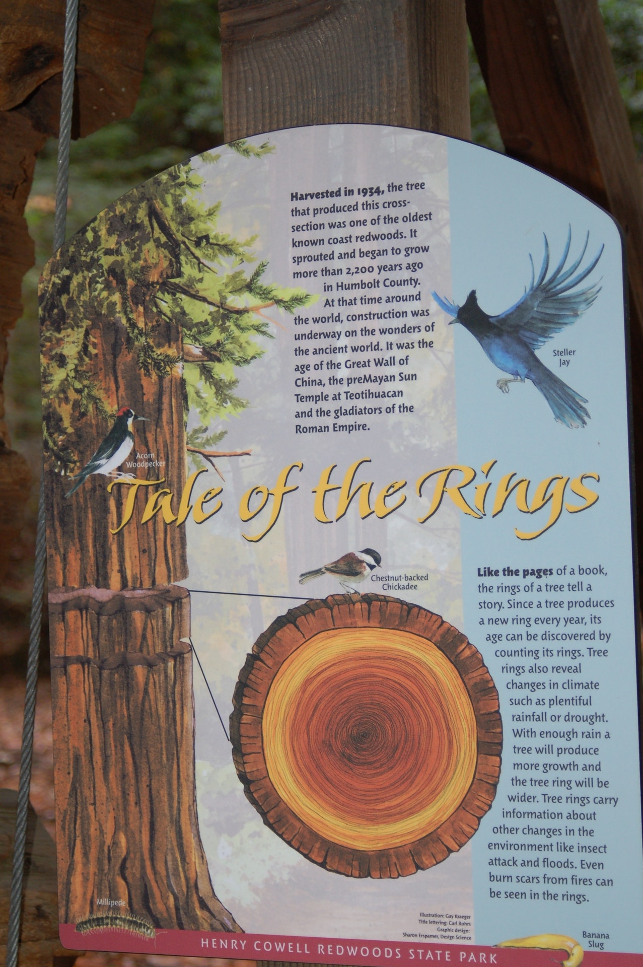
HENRY COWELL REDWOODS STATE PARK
Henry Cowell Redwoods State Park, located's Santa Cruz Mountains, is a natural sanctuary boasting 1,750 acres of old-growth redwood trees. The park features stunning landscapes with diverse ecosystems including lush forests and riparian areas along the San Lorenzo River. Visitors can explore over 20 miles of hiking trails or visit the nature center to learn about local wildlife and ecology. It also offers picnic spots, camping facilities as well as seasonal fishing opportunities for outdoor enthusiasts.
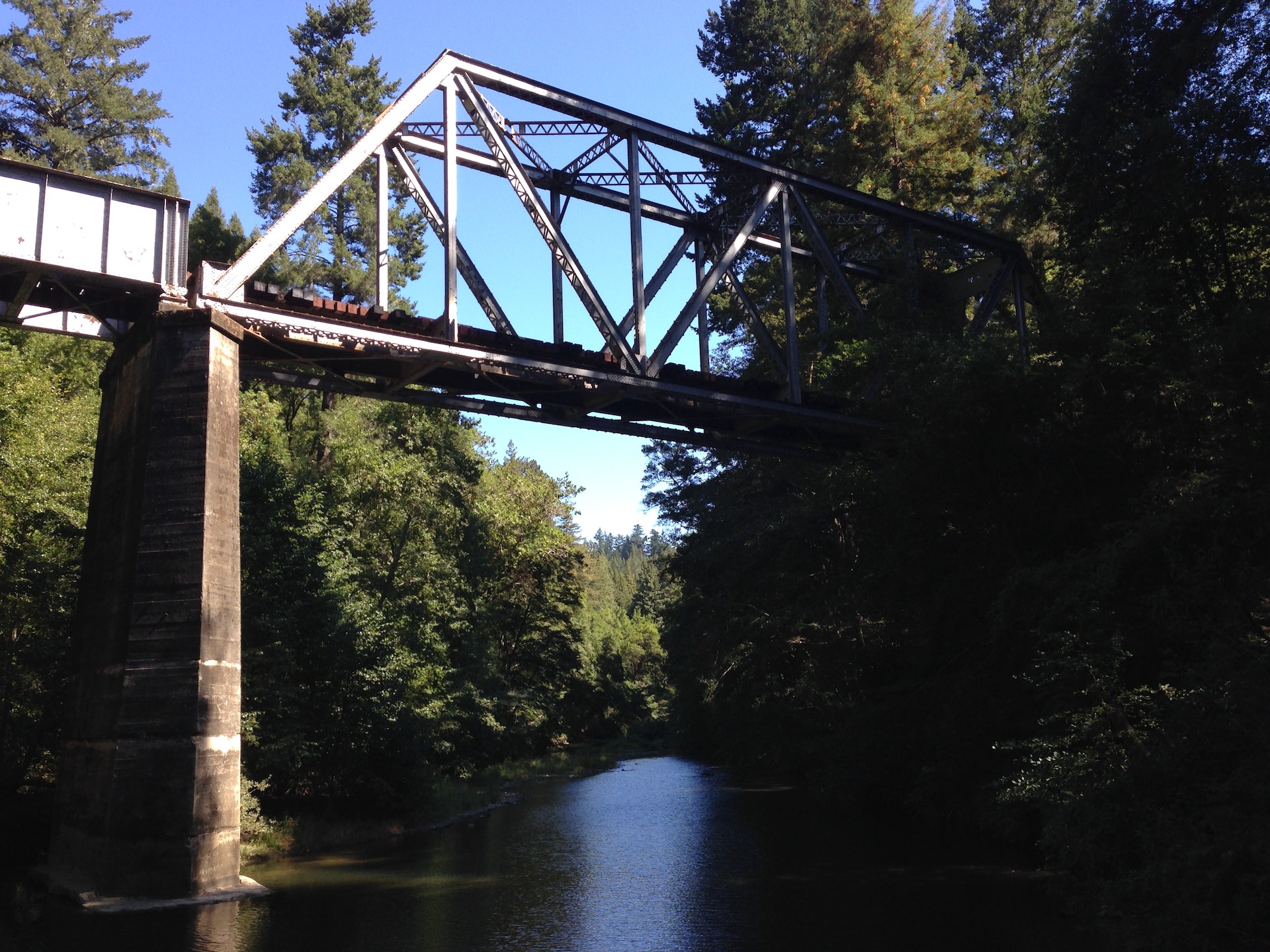
The park offers fishing in the San Lorenzo River, home to steelhead trout and coho salmon. A valid California fishing license is required for anglers aged 16 or older. The best time to fish is during winter months when these species migrate upstream from the ocean.
Henry Cowell Redwoods State Park is located near Aptos, Castroville and Los Gatos
Henry Cowell Redwoods State Park offers picnic areas with tables, BBQ grills and restrooms. Alcohol consumption is allowed in designated areas only.
The park offers a variety of birding opportunities with over 200 species, including owls and woodpeckers. Birdwatchers can explore different habitats such as redwood groves, riverfront areas, and sandhill environments. The Fall Creek Unit is particularly popular for spotting birds.
Roaring Camp Big Trees Railroad is next door to Henry Cowell Redwoods State Park. A brochure with general train information is available at the main entrance kiosk. You can call 831-335-4484 for more information. You can pay the day use fee, park in our parking lot, and walk a hundred yards to Roaring Camp.


 Share Your Henry Cowell Redwoods State Park Photos (click here)
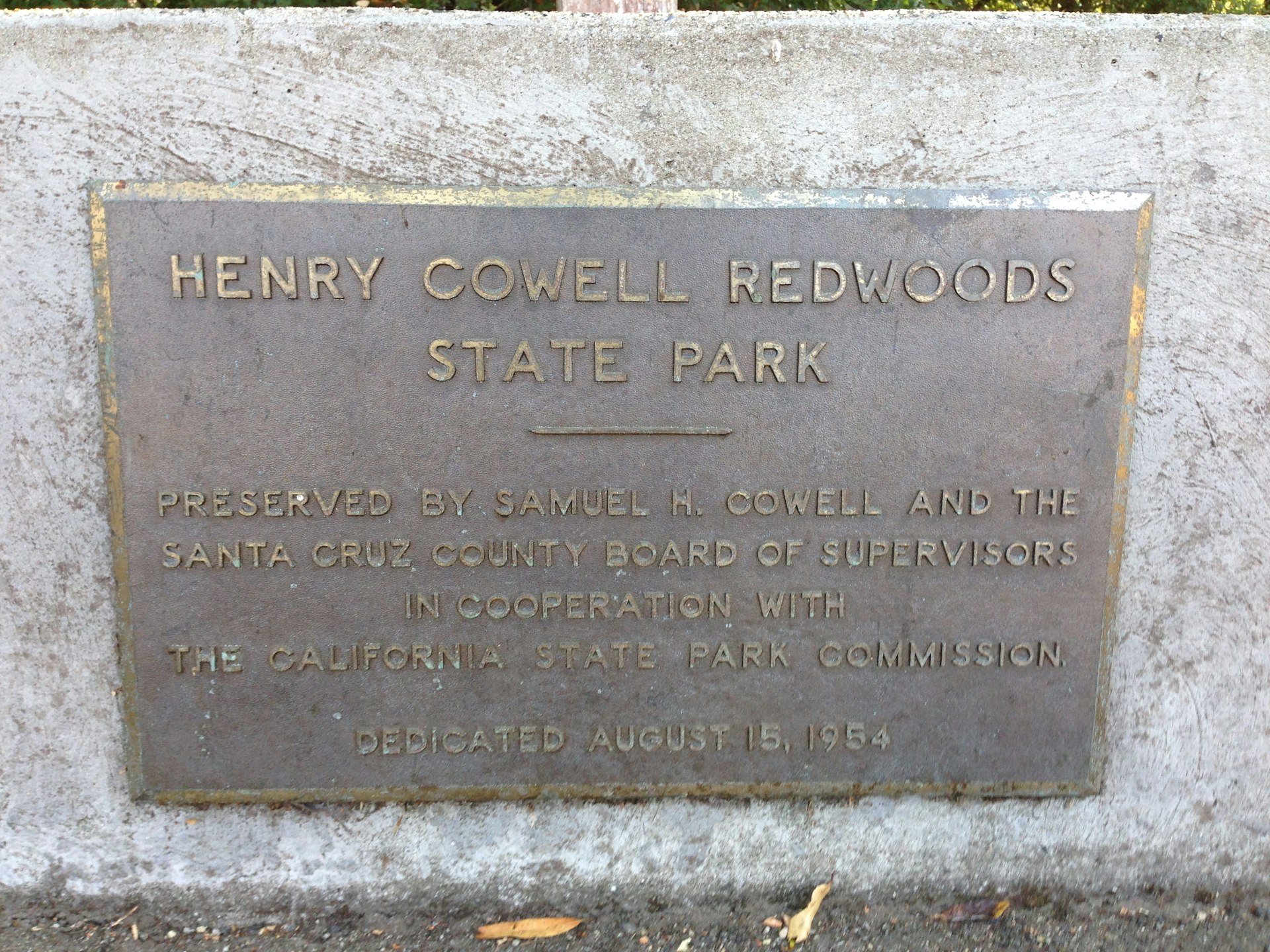