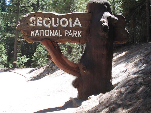
SEQUOIA AND KINGS CANYON NATIONAL PARKS
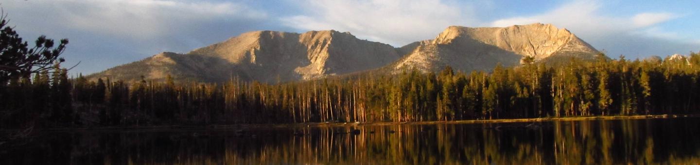
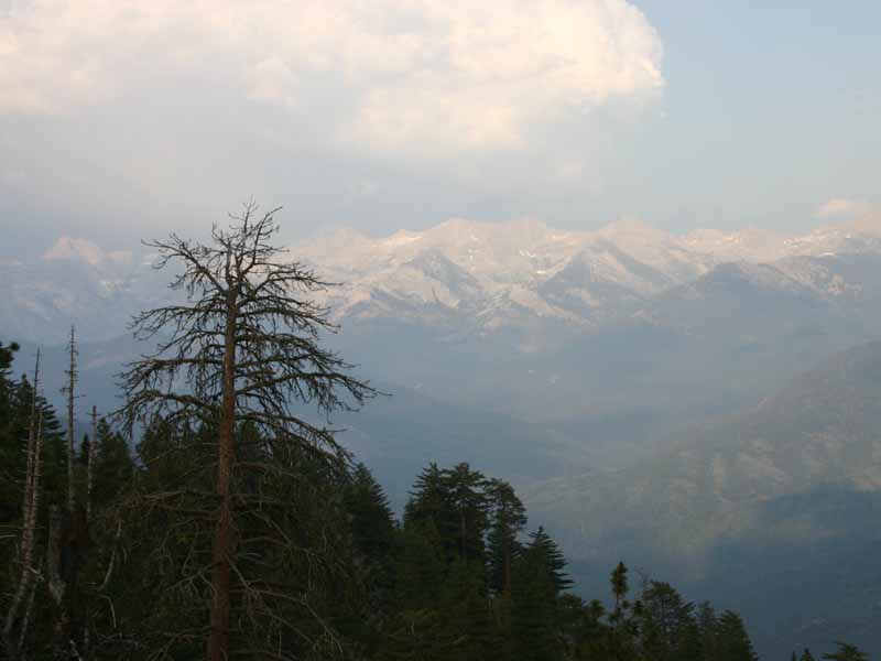
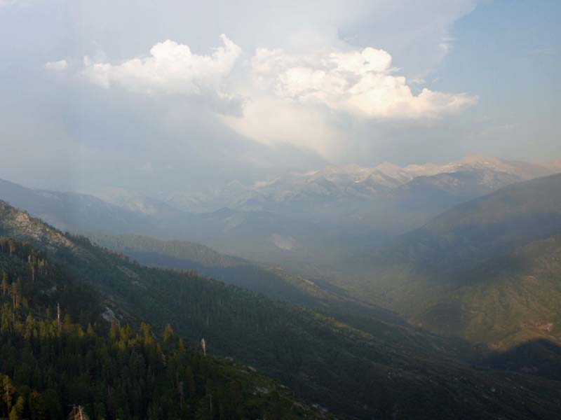
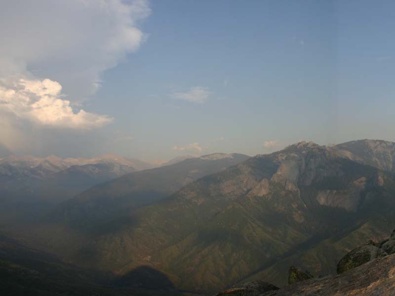
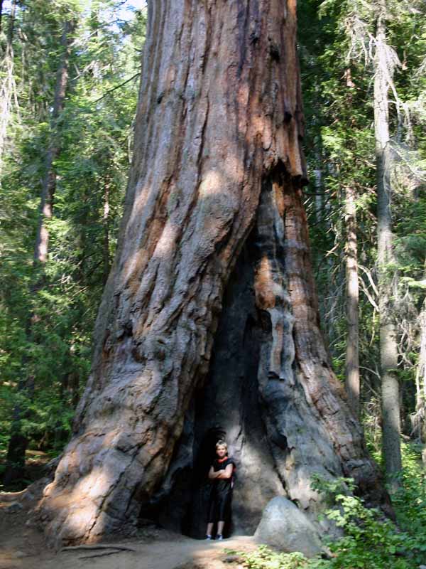
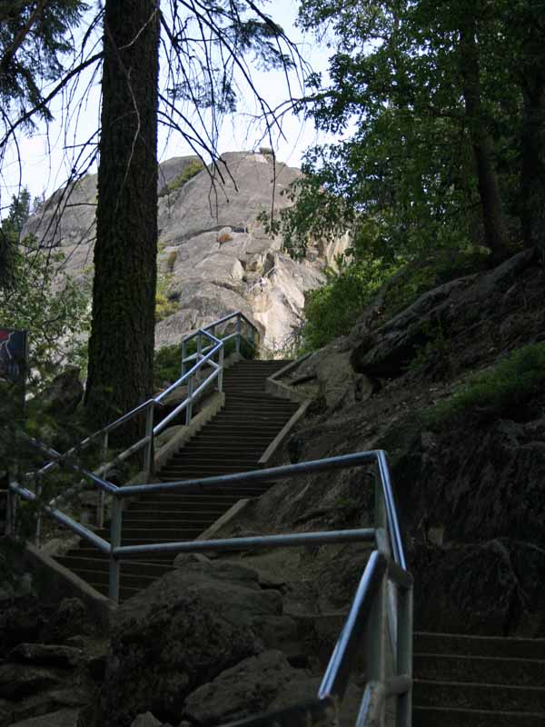
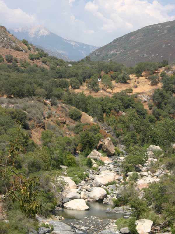
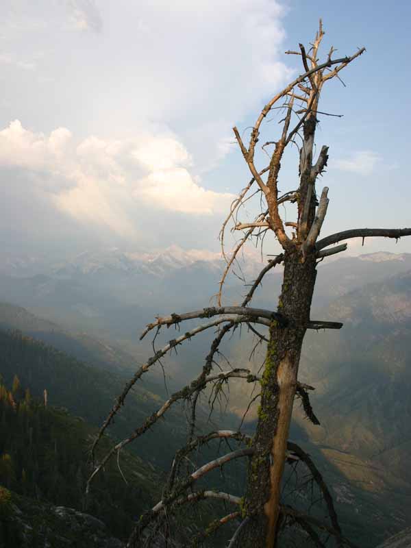
These parks are home to giants: immense mountains, deep canyons, and huge trees. Thanks to their huge elevational range, 1,500' to 14,491', these parks protect stunningly diverse habitats. The Generals Highway climbs over 5000 feet from chaparral and oak-studded foothills to the awe-inspiring sequoia groves. From there, trails lead to the high-alpine wilderness which makes up most of these parks. Beneath the surface lie over 200 fascinating caverns.
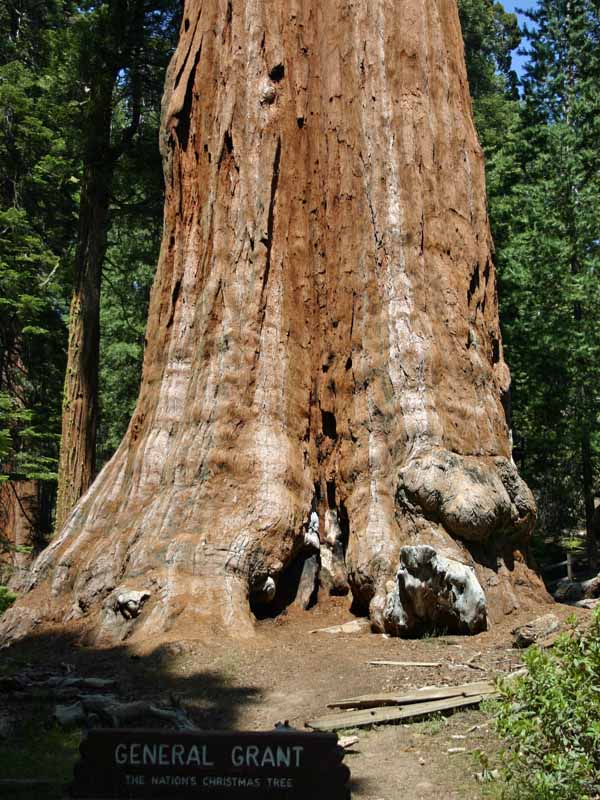
Although Congress created these two parks at different times, Sequoia and Kings Canyon share miles of boundary and are managed as one park. Sequoia was the second national park designated in this country. General Grant National Park, the forerunner of Kings Canyon, was third.
As you explore this landscape of giants, do so in step with nature. Be aware that human activity may conflict with natural events. One example: human - bear interactions can result in problems for both players. Store all food properly and learn other ways to keep your parks healthy and wild.
And stay safe! Rivers are especially dangerous now. Several people have drowned this year, and there have been frightening rescues. Please be careful, and supervise children near any water. Enjoy a safe visit to these wonderful parks.
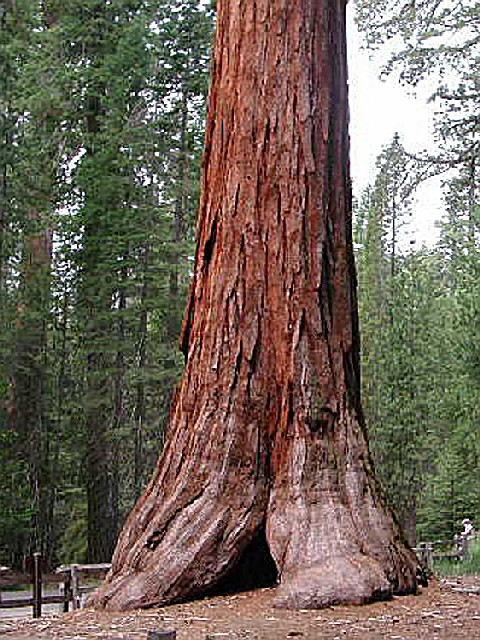
 Atwell Mill Campground
The Mineral King area features the highest elevation campground in the parks. At 7,500 feet 2280 m, it is only open during the summer months. A narrow, winding, largely unpaved road leads to the area and its two campgrounds. RVs and trailers are not recommended on Mineral King Road and are not permitted in campgrounds. Mineral King is not connected to the
....moreAzalea Campground Azalea campground is centrally located in Sequoia and Kings Canyon National Parks in central California's rugged Sierra Nevada range. This campground is at an elevation of 6,500 feet.
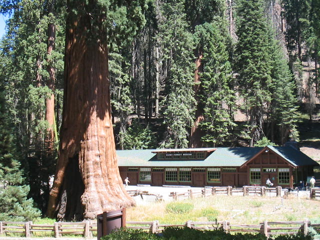
Azalea campground is within an hour's drive from the Giant Forest in Sequoia National Park, home of the biggest tree in the world, the General Sherman, and the Cedar
....more Buckeye Flat Campground Buckeye Flat Campground is located in Sequoia National Park, in the heart of the Sierra Foothills. The campground sits at an elevation of 2,800 feet, perched above the Middle Fork of the Kaweah River and shaded by a stand of large Live Oaks.
Buckeye Flat Campground offers 27 reservable campsites accommodating tents only. Picnic tables, fire rings and
....more Cold Springs Campground The Mineral King area features the highest elevation campground in the parks. At 7,500 feet 2280 m, it is only open during the summer months. A narrow, winding, largely unpaved road leads to the area and its two campgrounds. RVs and trailers are not recommended on Mineral King Road and are not permitted in campgrounds. Mineral King is not connected to the
....more Crystal Springs Campground Crystal Springs campground is centrally located in Sequoia and Kings Canyon National Parks in central California's rugged Sierra Nevada range. This campground is at an elevation of 6,500 feet.
In addition, Crystal Springs campground also has 14 mid-sized group sites available for reservation on recreation.gov. These sites are listed under Crystal
....more Sequoia and Kings Canyon National Parks contain big trees, high peaks, and deep canyons, but the diversity goes far beyond that. Located in the southern Sierra Nevada range, the parks? elevations extend from 1,300 feet (418m) in the foothills to 14,491 feet (4,417m) at the summit of Mount Whitney, the highest mountain in the contiguous 48 states. Plunging in the opposite direction far below the surface are over 200 marble caverns, many with endemic cave fauna. This huge variation in the landscape contributes to the collage of habitats that create a rich assemblage of terrestrial, aquatic and subterranean ecosystems. Here one can observe a vast diversity of plants and animals representing an array of adaptations.
Despite the protected status of resources within park boundaries, many threats to park resources exist. These include air pollutants, invasion by alien species, loss of natural fire regimes, habitat fragmentation, and rapid human-caused climatic change.
The Division of Natural Resources strives to:
Understand natural processes (such as fire) and human-induced effects on ecosystems (such as effects of air pollution).
Mitigate for the existing and potential human effects on ecosystems (for example, restoring previously developed areas using re-vegetation, re-introducing fire to areas where it has been suppressed for decades).
Monitor for ongoing or future trends in key ecosystem components.
Protect existing natural species, populations, communities, systems, and processes.
Interpret these organisms, systems, and processes to park visitors and to visitor center staffs so they may provide current information to the public.
Cedar Grove Lodge (Kings Canyon Park Services) : Open late April to mid-October.
Phone Reservations: 866-KCANYON.
Details: Front desk 1-559-565-0100. Rooms in a lodge in Cedar Grove Village, deep in the canyon of Kings Canyon National Park. Counter-service restaurant, market, gift shop in building. Elevation 4600 feet (1402m).
Grant Grove Cabins & John Muir Lodge (Kings Canyon Park Services): Open All Year
Phone Reservations: 866-KCANYON
Details: Front desk: 1-559-335-5500. Modern rooms in the John Muir Lodge as well as rustic and housekeeping cabins, all in the Grant Grove area of Kings Canyon National Park, 1/2-mile (.8km) to a sequoia grove. Visitor center, market, restaurant, gift shop, & post office nearby. Elevation 6500 feet (1980 m). In winter, you are least likely to encounter road closures enroute to Grant Grove if you enter the park on Highway 180.
Wuksachi Village (Delaware North Park Services): Open All Year
Phone Reservations: 1-888-252-5757
Details: In Sequoia National Park, 4 miles (6.5km) from Giant Forest; 23 miles (37km) from Sequoia Park entrance. Modern hotel rooms in several lodge buildings. Restaurant & gift shop nearby. Elevation 6500 feet (1980m). In winter, you are least likely to encounter road closures enroute to Wuksachi if you enter the park via Highway 198.
Lodging just outside the parks: on National Forest land between Sequoia & Kings Canyon Parks and outside the parks within 20 miles of the park entrances. Open All Year
Online Reservations Only
Sequoia and Kings Canyon National Parks is located near Tulare, Visalia
Caving:
Come explore the underground beauty of Sequoia National Park! Walk by scenic waterfalls on the half-mile trail to Crystal Cave. Beautiful stalactites and curtains, impressively large rooms, and ornate marble polished naturally by a subterranean stream make a tour of Crystal Cave an unforgettable experience.
Crystal Cave is located off the Generals Highway in Sequoia National Park, between the Ash Mountain entrance and Giant Forest. To reachthe cave, drive down the scenic, winding, paved road to the cave parking lot. Hike down the half-mile trail along beautiful Cascade Creek, where you will be met by a guide at the cave entrance. The cave is not wheelchair accessible.
No buses, trailers, or vehicles over 22 feet long are permitted on Crystal Cave road. Vans are acceptable.
Touring the Cave : Anyone wishing to visit Crystal Cave must be part of a guided tour. Tour tickets are not sold at the cave entrance. They must be purchased in person at Foothills or Lodgepole visitor centers in Sequoia National Park. After purchasing tickets allow at least 1? hours to arrive at the cave.
Regular Tour : Before passing through the Spider Web Gate, your guide will give a brief history of the cave and point out the unique formations and features. During the 45 minute tour, you will be led from room to room on paved lighted pathways, pausing to listen to the water and echoes in the cave in total darkness.
Tours are usually limited to 50 persons. Temperature in the cave is a constant 48 degrees F (9 degrees C). Sweaters or jackets are recommended. No strollers, tripods or baby backpacks are allowed in the cave.
Discovery Tour : This popular two-hour tour provides a deeper understanding of the geology and wildlife of the cave environment. Limited to 16 persons, ages 13 and up. Cost: $18.95/person, $16.95/SNHA member, and $17.95/Senior. Tours offered daily June 25 through September 2, 2005 at 4:15 p.m.
Wild Cave Tour - Four to six hours crawling and climbing off-trail tour in Crystal Cave. Limited to 6 persons, ages 16 and up. Cost: $109/person. SNHA members get $10 discount.
Backpacking:
Some 84% of Sequoia and Kings Canyon National Parks was designated as Wilderness under the 1984 California Wilderness Act. Currently, the parks are gathering information and public input in order to develop a Wilderness Management Plan for these areas.
For more details on planning a wilderness trip, see Backcountry Basics.
Food storage is required as black bears are at home in these parks. Their natural habitat is the forests and shrublands below 8000' (2438 meters), but they will frequently roam above these elevations in order to steal food from backpackers. Federal regulations require proper food storage and prohibit feeding of any park animal. Violations of these regulations will result in a fine of up to $5000. Even stronger than legal obligations is the moral responsibility to respect the wilderness you have come to enjoy. Careless food storage spells death for bears. When a bear repeatedly obtains human food and garbage, it becomes destructive and dangerous, and may have to be killed. You have entered the bears' territory; learn how to protect your food from bears, and don't let your carelessness destroy them in their own homes.
Wilderness permits are required for all overnight camping outside designated campgrounds. There is an overnight camping fee of $15 for permits issued by these parks. Permits are not required for day hikes, except in the Mt Whitney area. All hikers (even day hikers) to Mt. Whitney are required to obtain a permit.
Reservations: Quotas limit the number of people entering each trailhead on a single day. In the summer, the quotas on some popular trailheads are filled. To avoid this, you can reserve a permit in advance for trips between mid-May and September. We can accept backcountry reservations for the current year no earlier than March 1 and no later than 3 weeks before the start of your trip. All reservation requests must be faxed or mailed in. We regret that we are not set up to take backcountry reservations electronically at this time.
Groups are strongly recommended to use the reservation system. The maximum group size is 15 people per trailhead except for Redwood Canyon where the maximum size is 10.
Horseback Riding:
There is one pack station and one stable in Kings Canyon National Park, and one pack station in nearby Sequoia National Forest. All are closed from late fall to spring, but exact dates vary. Each offers specific services; check with them for details and prices.
In Kings Canyon National Park:
Cedar Grove Pack Station: 1-559-565-3464 (summer), 1-559-337-2314 (off season)
Grant Grove Stables: 1-559-335-9292 (summer), 1-559-337-2314 (off season)
In Sequoia National Forest:Horse Corral: (between Lodgepole in Sequoia National Park and Grant Grove in Kings Canyon National Park)
PO Box 546Woodlake, CA 932861-559-565-3404 (summer)559-564-6429 (off season)1-559-679-3573 (cell)
National Park Service Areas:
Death Valley National Park, Yosemite National Park, Manzanar National Historic Site, Golden Gate National Recreation Area, Channel Islands National Park, Devils Postpile National Monument, John Muir National Historic Site, and Joshua Tree National Park.
Other Attractions:
Giant Sequoia National Monument/Sequoia National Forest, (559)338-2251.
Sierra National Forest (559)855-5360.
Inyo National Forest, (760)873-2500.
Two highways enter the parks. Hwy 180 from Fresno leads east to Kings Canyon National Park, then continues 30 miles east to Cedar Grove. Hwy 198 from Visalia leads east to Sequoia National Park via Three Rivers. Inside the parks, Highway 198 becomes the Generals Highway, which connects 198 to 180.
Vehicles over 22-feet long should enter the parks via Highway 180.
In winter, the Generals Highway between the parks often closes. Chains may be required on park roads.
No roads cross these parks east to west.


 Share Your Sequoia and Kings Canyon National Parks Photos (click here)
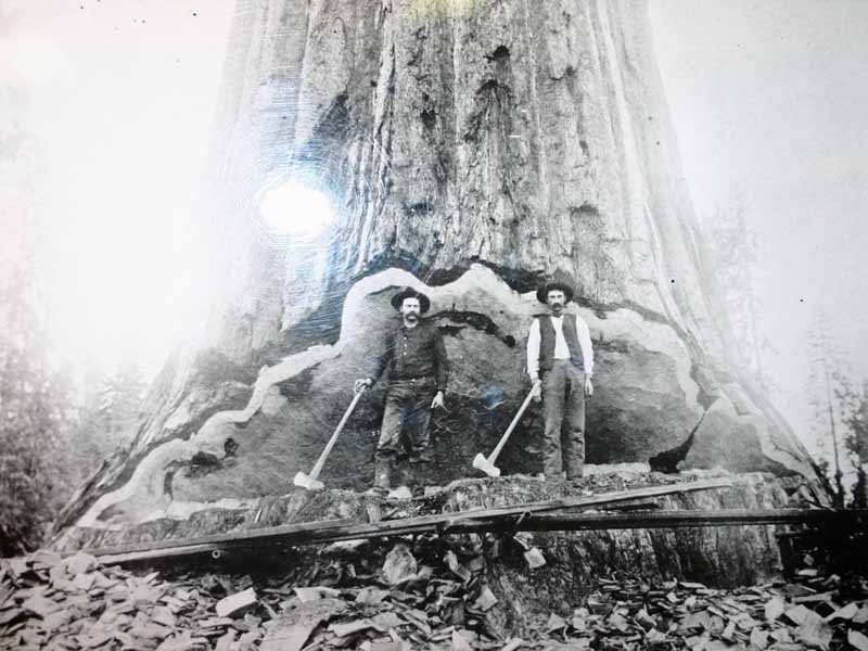