BRULE RIVER STATE FOREST
The Brule River State Forest was initiated in 1907. Mr. Frederick Weyerhauser deeded 4,320 acres to the state of Wisconsin for forestry purposes. The boundaries of the forest now includes about 50,000 acres, of which about 41,000 acres are under state ownership.
The Bois Brule is one of the best known rivers east of the Mississippi. For over a hundred years, it has been known as a an exceptional trout stream. The Brule River contains resident brook, brown and rainbow trout. Lake brown and rainbow (steelhead) trout along with coho and chinook salmon migrate up the Brule annually from Lake Superior.
The river itself has two distinct personalities. The upper river (the southern portion) flows through miles of coniferous bog and is fed by numerous springs. When the river crosses the Copper Range, it begins a fall of 328 feet in the eighteen miles to Lake Superior. Here, flashing cascades tumble over rocks and ledges; between steep river bluffs forested with aspen and balsam fir.
This state forest is used by more diverse species of birds and mammals than any other northern Wisconsin acreage of similar size. The forest has many distinct landscapes that allow for the wide range of species such as deer, ruffed grouse, geese, bald eagles, osprey and songbirds. A majority of the public lands within the forest boundaries are open to hunting and trapping in season.
A Wisconsin State Park System vehicle admission sticker is required on all motor vehicles stopping in state parks, forests and recreation areas, please visit the
VEHICLE ADMISSION STICKERS web page.


 Share Your Brule River State Forest Photos (click here)
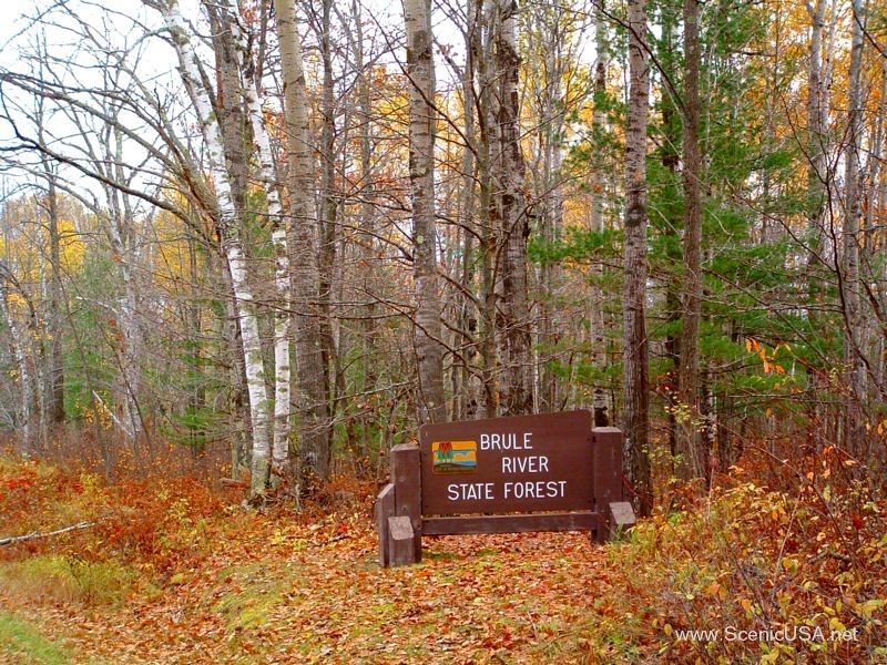