GRANDFATHER MOUNTAIN STATE PARK
Grandfather Mountain has been an icon in North Carolinas landscape for generations, offering stunning scenery and unmatched ecological diversity. This state park opens the mountains 2,456-acre backcountry to spectacular hiking and backpacking. The park is known for some of the Souths most severe weather and challenging terrain, with trails that have hikers scrambling along cliffs and up ladders. Access to 12 miles of trails and backpack camping sites is generally from the Profile Trailhead on NC 105 or trailheads along the adjacent Blue Ridge Parkway.
In 2008, agreement was reached for the state parks system to acquire 2,456 acres of Grandfather Mountain to become North Carolinas newest state park. The property is commonly known as the backcountry of the famous travel destination. The acquisition was arranged with the help of The Conservation Fund and The Nature Conservancy, which holds conservation easements on the mountain covering nearly 4,000 acres. The acquisition was financed by the Parks and Recreation and Natural Heritage trust funds.
In early 2009, the General Assembly formally authorized Grandfather Mountain State Park. This gives the state parks system the option of seeking additional acreage for traditional park facilities. Any additional tracts or facilities would be identified and prescribed through a public master planning process.
The park is known for some of the South's most severe weather and challenging hiking trails. Be preparedat times, hikers climb ladders up cliffs. Nature lovers and hikers alike find Grandfather Mountain to be a special, indeed globally significant place to encounter the outdoors.
Grandfather Mountain State Park is located near Boone, Lenoir and Spruce Pine
Grandfather Mountain State Park offers numerous picnic spots with stunning views, hiking trails nearby and wildlife sightings. Bring your own food and drinks.
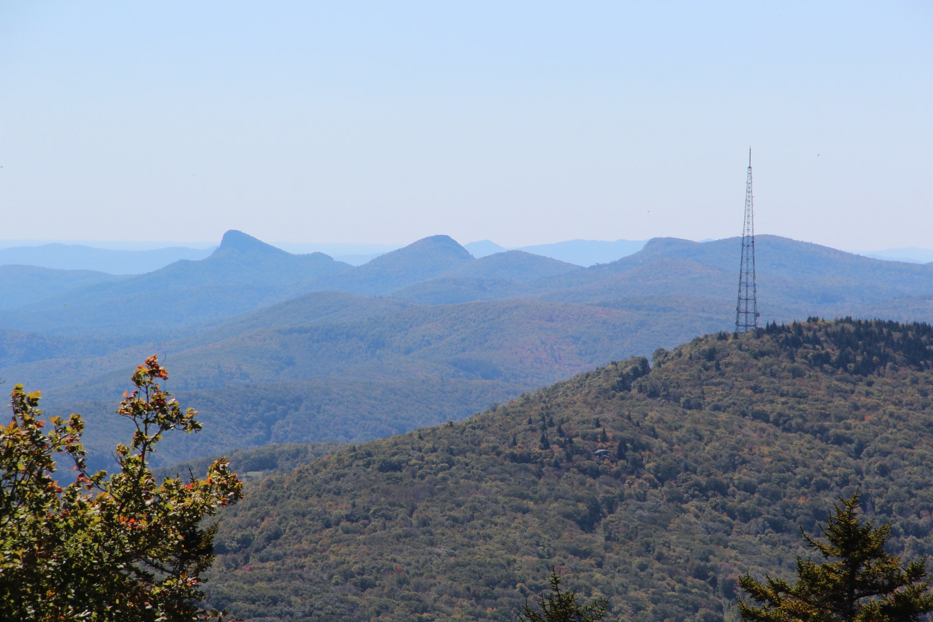
Grandfather Mountain State Park offers more than 12 miles of trails lacing 2,456 acres along the mountain's ridgeline and its highest point at Calloway Peak. The trails offer magnificent scenery from rock outcrops and quiet forested coves near the mountain's crest. Permits are required.
Most of these trails are challenging steep, rocky terrain can make progress slow at times. Hikers must use the trails' ladders and cables in some of the steeper sections. Be aware that hiking to the ridge area and back from the low-elevation trailheads may take a full day. Plan for enough time to get back to your vehicle before dark. And, wear proper clothing and carry adequate equipment.
Black Rock Trail - Hikers can access the Black Rock Trail from the Black Rock Parking Lot inside the private Grandfather Mountain attraction. From the attraction's Black Rock parking lot, the Black Rock Trail slopes out gradually to a wide-angle view of the swinging bridge, MacRae and Attic Window peaks as well as Beacon Heights and Grandmother Mountain to the southwest. To reach these view points at the end of the trail, hikers must climb a ladder and cable up the rock. This trail rambles through northern hardwood and spruce forests. Hikers return to the parking lot via the same trail.
Cragway Trail - The Cragway Trail is a connector trail between the Nuwati and Daniel Boone Scout Trails. A steep, strenuous hike with grand vistas. Boulders and crags offer elevated views of the Boone Fork area and Calloway Peak. This trail links Nuwati and Daniel Boone Scout trails, making a nice loop hike passing through rhododendron and blueberry thickets. Due to the narrow, steep terrain, this trail is not recommended for dogs.
Daniel Boone Scout Trail - Hikers can access the Daniel Boone Scout Trail from the Boone Fork Parking Area on the Blue Ridge Parkway. From the parking lot, follow the Tanawha Trail for 0.6 miles to the Daniel Boone Scout Trailhead. Ascending about 2,000 feet over three miles, this hike begins at the Blue Ridge Parkways Tanawha Trail and climbs to Calloway Peak, at 5,946 feet, the highest point in the Blue Ridge Range. About halfway up, at Flat Rock View, hikers reach the junction of Cragway Trail. The upper half of the Daniel Boone Scout Trail is rough going but spiced with exquisite views, including one of Price Park and one of the Linn Cove Viaduct. Near Calloway Peak, in-place ladders and cables help hikers through steep sections. The upper portion of this trail is not recommended for pets.
Grandfather Extension Trail - This trail begins in the Black Rock Parking lot and ends at the Grandfather Trail, below a grand view of MacRae Peak. Connecting this trail with the Grandfather and Bridge trails creates a loop. Not recommended for pets.
Grandfather Trail - Ridgeline - running between Calloway Peak and the private Grandfather Mountain Swinging Bridge parking lot. The Grandfather Trail runs the length of the summit ridge from the Grandfather Mountain attraction to Calloway Peak. It offers astonishing variety, running in and out of wind-dwarfed spruce and fir, across or around rock walls and pinnacles and into open spaces with mountain views in every direction.
Nuwati Trail - Off Blue Ridge Parkway - Boone Fork Parking Area. This trail follows the track of an old logging road. Its an easy but rocky hike, including a spectacular view of the Boone Bowl and Calloway Peak from Storyteller's Rock. There are stream crossings, a solitary stand of big-tooth aspens and reminders of logging days gone by.
Profile Trail - 4198 NC Highway 105 N, Banner Elk. Ascending about 1,775 feet over 3.6 miles, this trail begins at the Profile Trail parking area at 4198 NC Hwy 105 N and ends at the Grandfather Trail at Calloway Gap. Beginning as a scenic, rolling pathway through seasonal wildflowers, this trail crosses the Watauga River and travels under a hardwood canopy for much of its length.
Birdwatchers can enjoy spotting over 200 species, including rare ones like the Peregrine Falcon and Blackburnian Warbler. The park's varied habitats attract a diverse range of birds throughout the year. Birding trails are available for all skill levels with opportunities to see migratory songbirds in spring and fall.
Faye Hughes Store
63 Coffey Rd
Linville, NC
(828) 733-5145
Beech Mountain Slopeside Chalet Rentals
503 Beech Mountain Pkwy
Beech Mountain, NC
(828) 387-4251
Highland Hills Motel & Cabins
2748 Highway 105
Boone, NC
(828) 264-2277
Beech Mountain Club
105 Lakeledge Rd
Beech Mountain, NC
(828) 387-4717
Irmolot Lodge
579 Beech Mountain Pkwy
Beech Mountain, NC
(828) 898-4256


 Share Your Grandfather Mountain State Park Photos (click here)
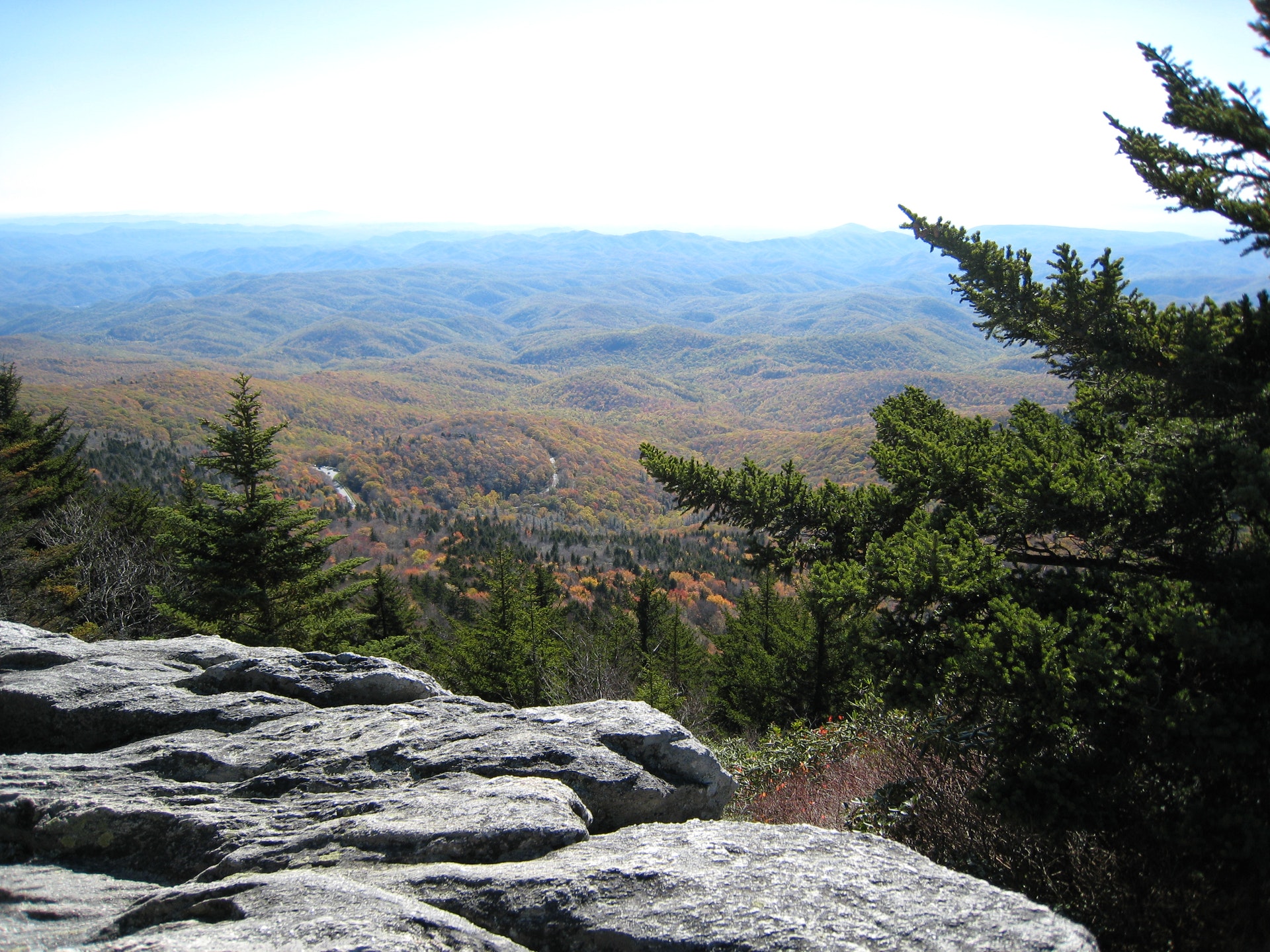