STAUNTON RIVER BATTLEFIELD STATE PARK
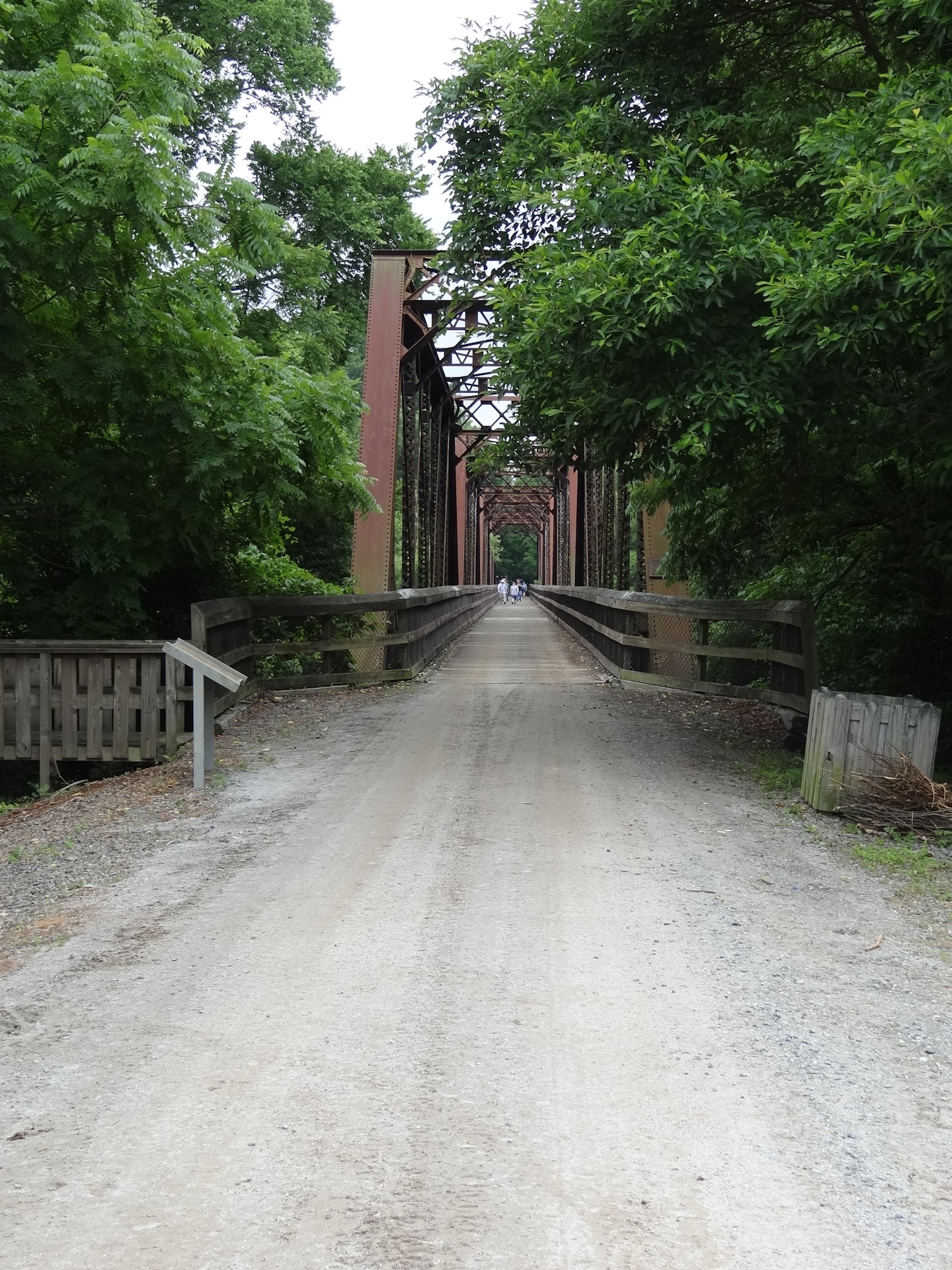
This park is a 300-acre Civil War historic site where a ragtag group of 700 Confederate old men and young boys beat the odds and held off an assault by 5,000 Union cavalry on a bridge of strategic importance to Gen. Lee's army, then under siege in Petersburg. Visit the Confederate earthworks and walk the historic bridge trail. Two visitor centers feature 2,300 square feet of exhibits on the area's rich Civil War heritage, Native American archaeological investigations,and wildlife and ecology of the park. The park includes a 1.2-mile self-guided trail through the battlefield and a .75-mile nature trail with two wildlife observation towers overlooking wetlands.
Anglers can enjoy fishing in the Staunton River, known for its abundant catfish and bass populations. The park also offers boat rentals for those who prefer deep water angling. Other species found here include crappie, bluegill, and carp. A valid Virginia freshwater fishing license is required to fish within the park boundaries.
Staunton River Battlefield State Park is located near South Boston
One shelter can be rented from 9 a.m. to dusk all day. The only restroom available is located inside the Visitor Center, which is open daily from 10 a.m.-4 p.m. This large shelter accommodates up to 90 people and may be rented daily from April 1 to Nov. 1.
Hiking, bicycle trails and self-guided historical and nature trails available.
Birding enthusiasts can spot various species like the Prothonotary Warbler, Bald Eagle and Red-headed Woodpecker. The park's diverse habitats attract migratory birds in spring and fall. Birdwatchers may also see waterfowl during winter months along the riverbanks.
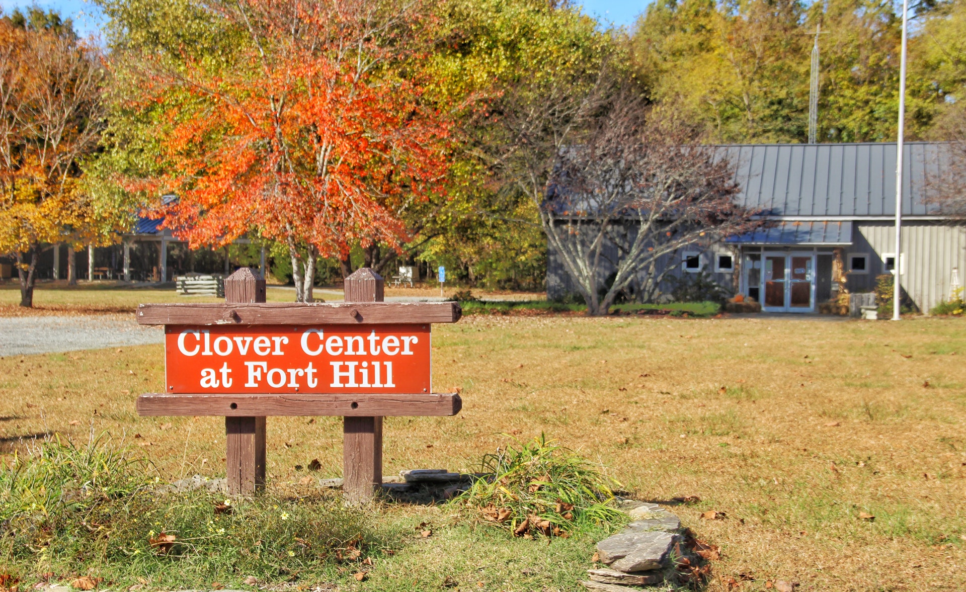
The Clover Visitor Center is at 1035 Fort Hill Trail, Randolph, VA 23962. The Roanoke Station Visitor Center is at 6000 Roanoke Station Road, Randolph, VA 23962, but it's closed for renovation.
From west Take state Route 92 east to Clover. After 5 miles, turn left on Route 600. Go 3 miles and turn right on Route 855.
From east Take Route 716 for about 1 mile then turn right onto VA 92 east. After 5 miles, turn left on Route 600. Go 3 miles and turn right on Route 855.
From north Take state Route 47 south and turn right onto Germantown Road. After about 4 miles, turn right onto Route 40. Continue 1.5 miles then turn left onto Scuffleton Road on which youll drive for 14 miles. Then turn left onto Route 600, go about 2 miles and turn left into Route 855.


 Share Your Staunton River Battlefield State Park Photos (click here)
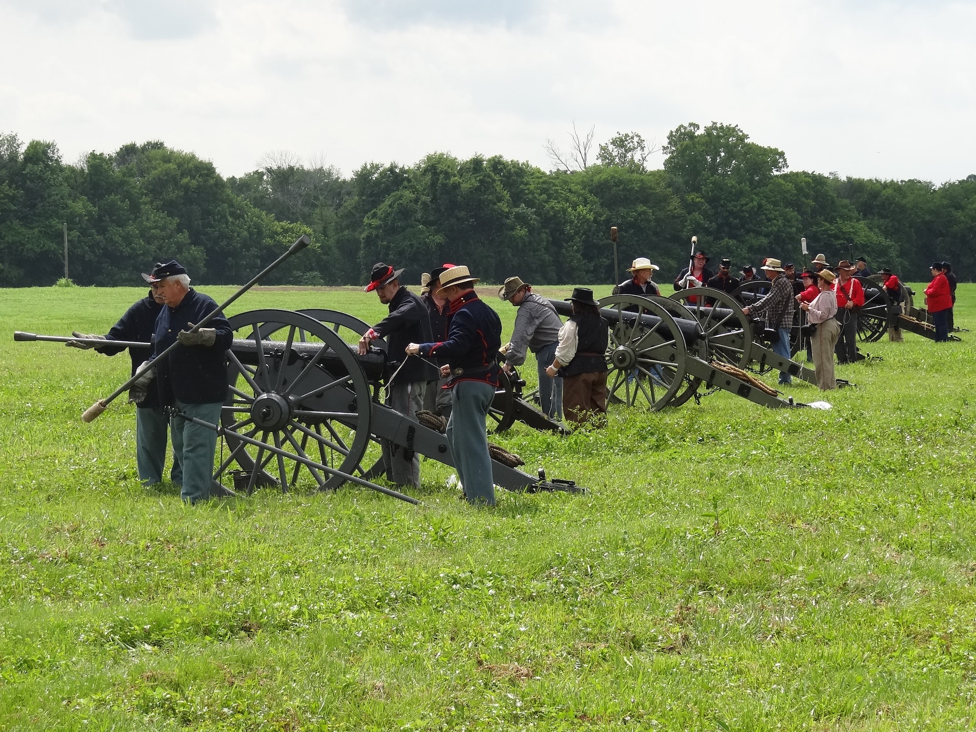