Save
You must be signed in to save park lists.
Your Park Lists
add New List
Add Photo
You must be signed in to add photos.
state route ranger badge
Illinois
52

Illinois State Parks

responsive menu icon
USA Parks
Illinois
Northern Region
Matthiessen State Park
start slideshow
Matthiessen State Park Old Bridge © Chris McCormick
Bridge over Cascade Falls
Matthiessen State Park Winter Thaw © Chris McCormick
View of Cascade Falls in early Spring.
Matthiessen State Park Waterfall Glory © Jerald Cale
Taken of my wife with our labradoodle dog at Matthiessen State Park near Utica, IL
Matthiessen State Park Lake View. © Roxanna Keyes
Looking out over the lake on a summer day.
Matthiessen State Park Creek Exploration. © Roxanna Keyes
Hiking along, and in, the creek.
Matthiessen State Park Enjoying Cascade Falls. © Roxanna Keyes
Visitors splash around in the pool beneath the Cascade Falls.
Matthiessen State Park © Michelle Gehringer
Matthiessen State Park Giants Bathtub © Jacek Fortuna
Matthiessen State Park © Karthik Gopalakrishnan
Matthiessen State Park © Sara Armstrong
Matthiessen State Park © Karthik Gopalakrishnan
Matthiessen State Park Canyon Bayu © David Kacynski
Matthiessen State Park © Karthik Gopalakrishnan
Matthiessen State Park © Steven D.J. Baumann
Matthiessen State Park © Sara Armstrong
Matthiessen State Park Lower Dells © Karthik Gopalakrishnan
Matthiessen State Park © Karthik Gopalakrishnan
Matthiessen State Park Layered rocks © Karthik Gopalakrishnan
Matthiessen State Park Lower Dells © Karthik Gopalakrishnan
Matthiessen State Park watch out forem © Karthik Gopalakrishnan
Matthiessen State Park © Stephen Longmire
Matthiessen State Park Lower Dells © Karthik Gopalakrishnan
Matthiessen State Park © Stephen Longmire
Matthiessen State Park Caves © Karthik Gopalakrishnan
Matthiessen State Park © Corey Wallace
Matthiessen State Park Above Waterfall © Corey Wallace
Matthiessen State Park © John Zignich
Matthiessen State Park Walking Bridge © Corey Wallace
Matthiessen State Park © John Zignich
Matthiessen State Park © Joe Thill
Matthiessen State Park Lake Falls © Cary Cohen
www.carycohenphotos.com all rights reserved
Matthiessen State Park © Joe Thill
Matthiessen State Park Frozen Lake Falls © Joe Thill
Matthiessen State Park Lake Falls © Jacek Fortuna
Matthiessen State Park © Joe Thill
Matthiessen State Park Ice Hole © Joe Thill
Matthiessen State Park © Joe Thill
Matthiessen State Park © Tracy Barnett
Matthiessen State Park Layered rocks © Karthik Gopalakrishnan
Matthiessen State Park © John Zignich
Matthiessen State Park © Bing Wang
Matthiessen State Park © John Zignich
Matthiessen State Park © Tim Sheets
Matthiessen State Park © John Zignich
Matthiessen State Park © Tara Payne
Matthiessen State Park © John Zignich
Search
Availability
Calendars
Availability Search
MATTHIESSEN STATE PARK
2500 Illinois 178
Oglesby, Illinois   61348
(lat:41.296 lon:-89.0244) map location

Phone: 815-667-4868
Email: park email button icon
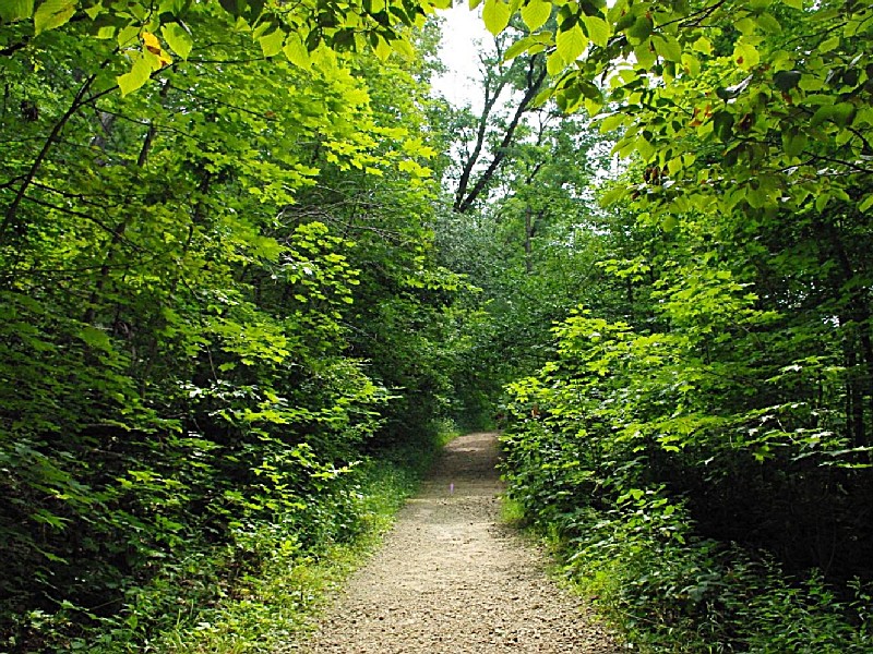
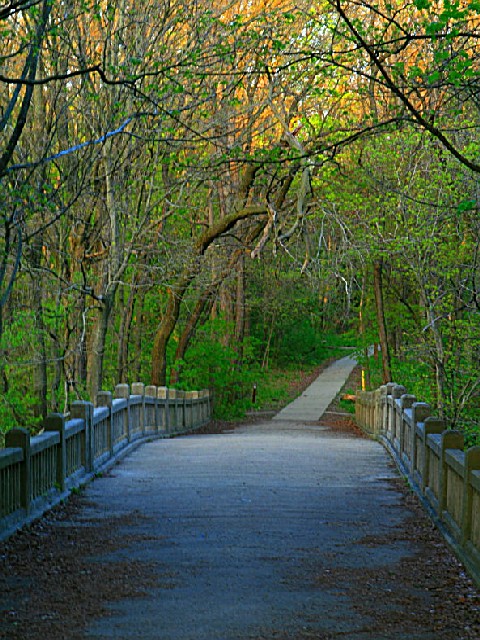
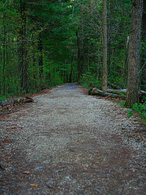
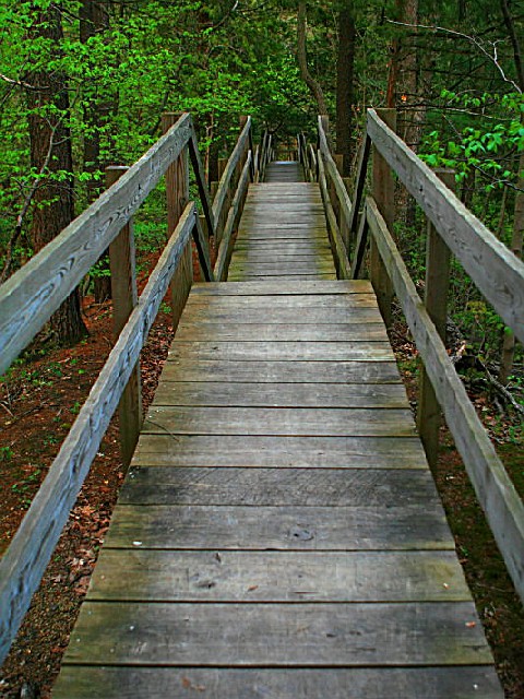
Canyons, streams, prairie and forest combine to delight visitors at Matthiessen State Park. Located in central LaSalle County, approximately four miles south of Utica and three miles east of Oglesby, Matthiessen is a paradise for those interested in geology as well as recreation. Visitors can expect to see beautiful rock formations in addition to unusual and abundant vegetation and wildlife. All of this, along with park and picnic facilities, make Matthiessen State Park a popular choice for a special outing.
Nature of the Area
Geological Features:

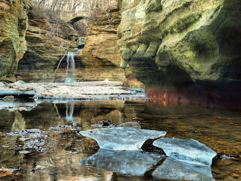
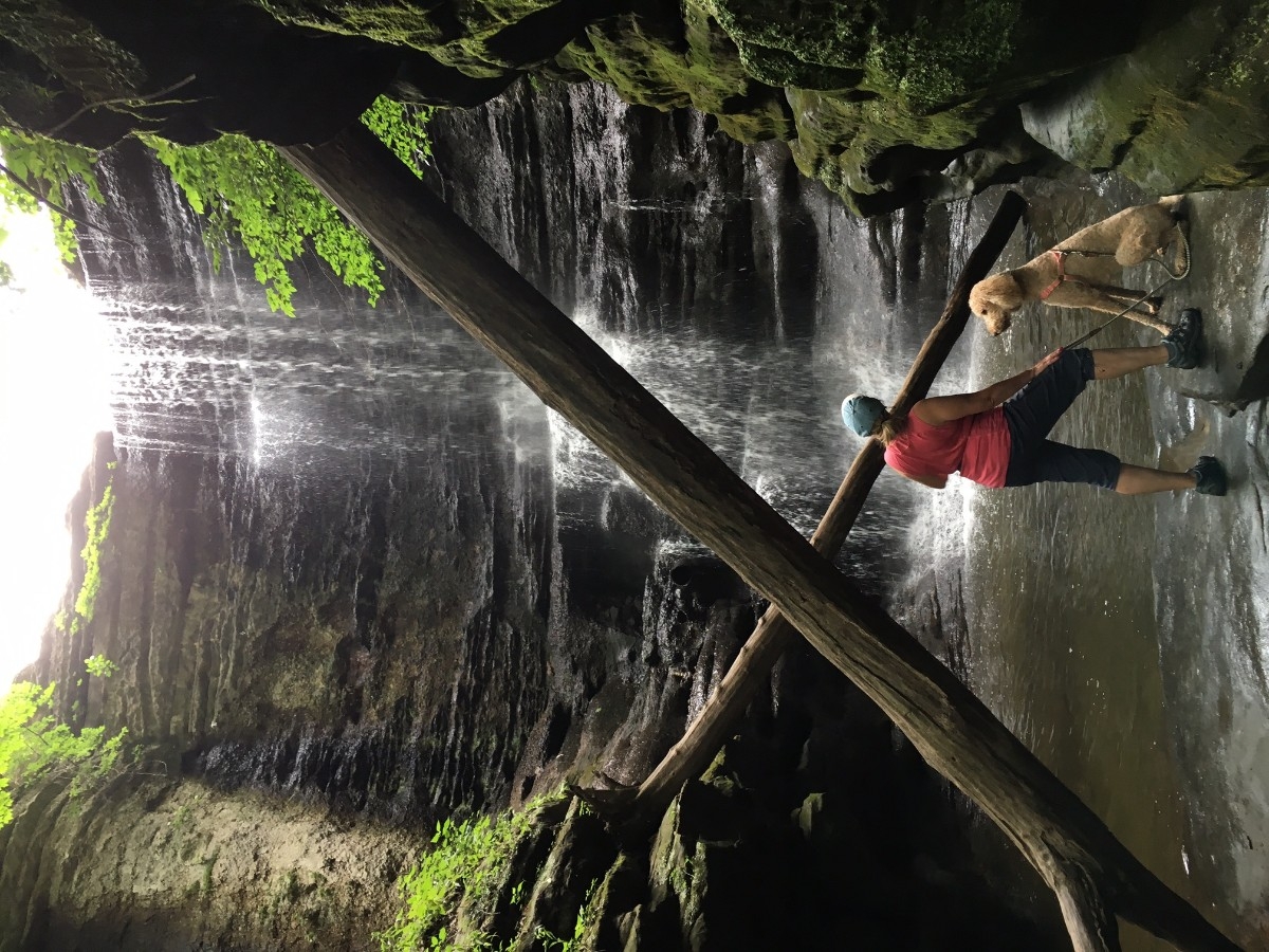
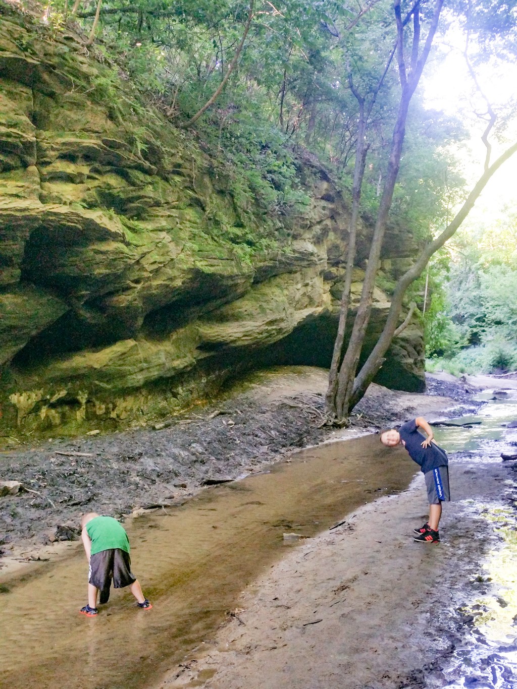
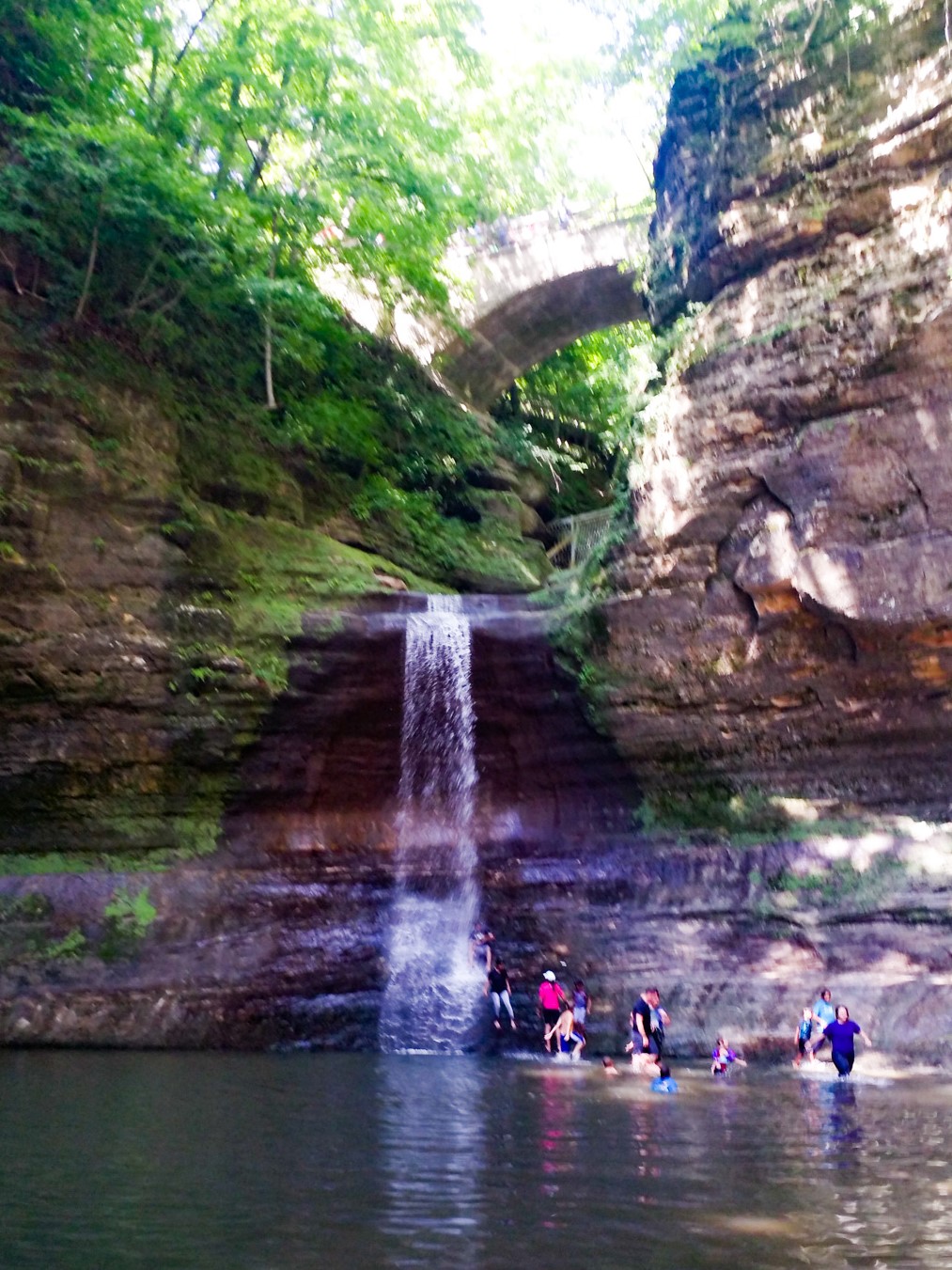
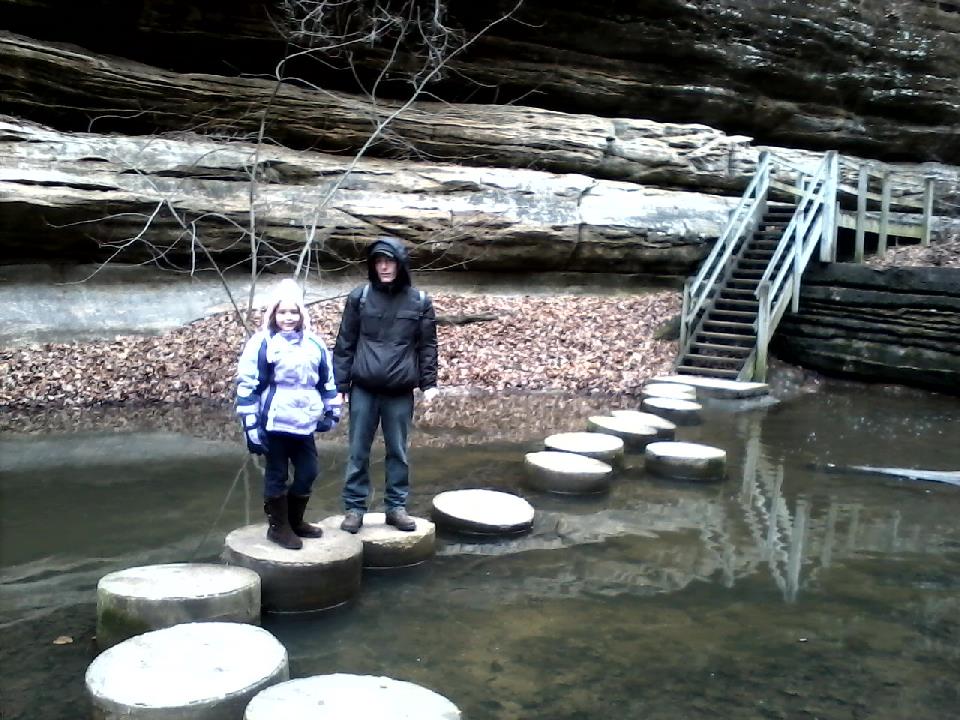
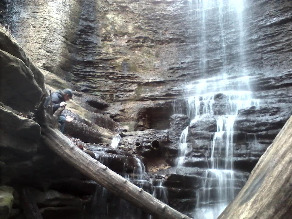
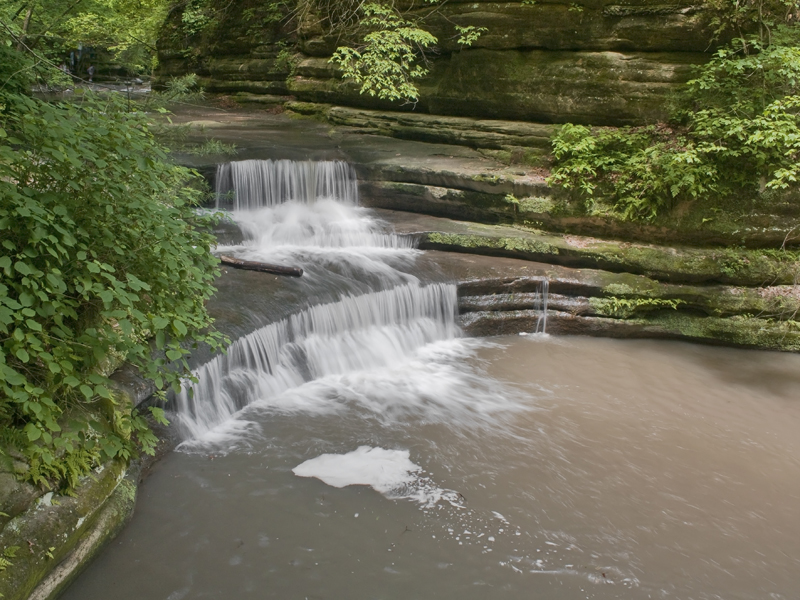
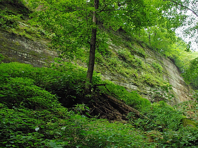
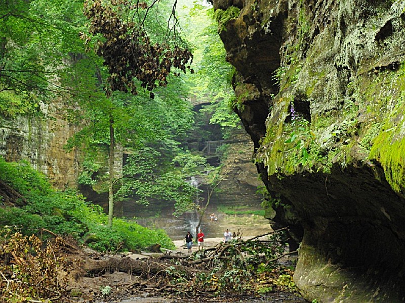
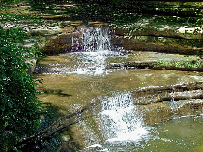
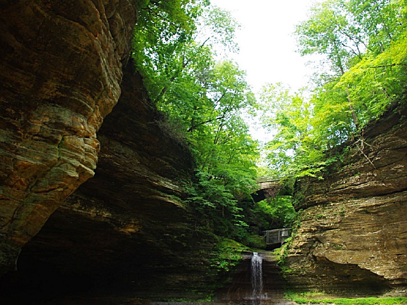
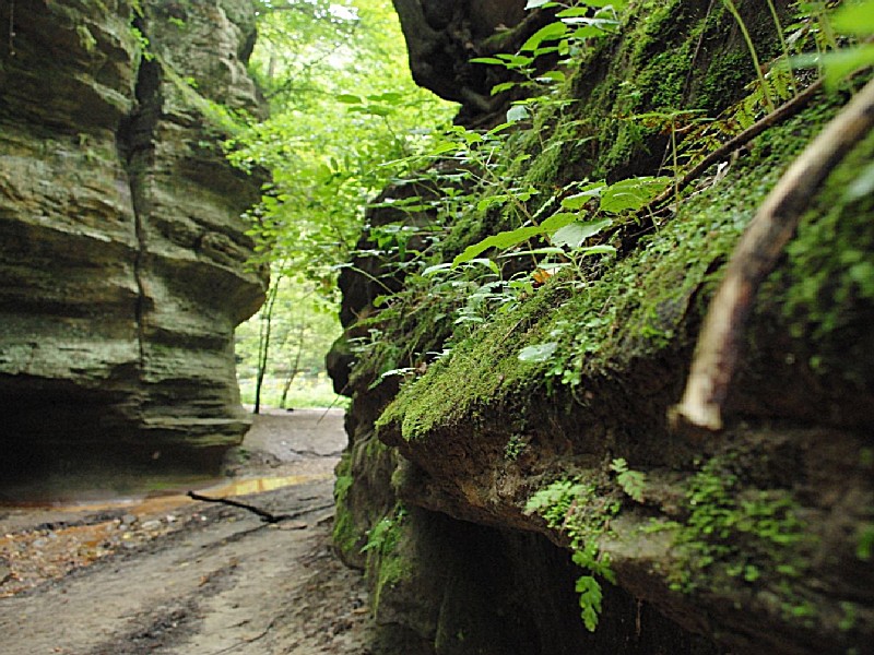
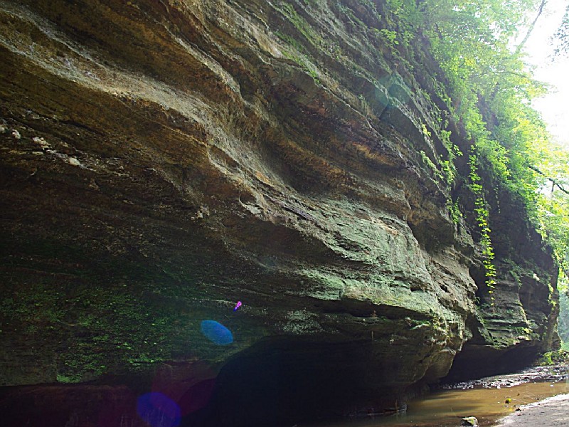
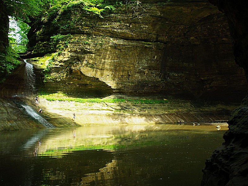
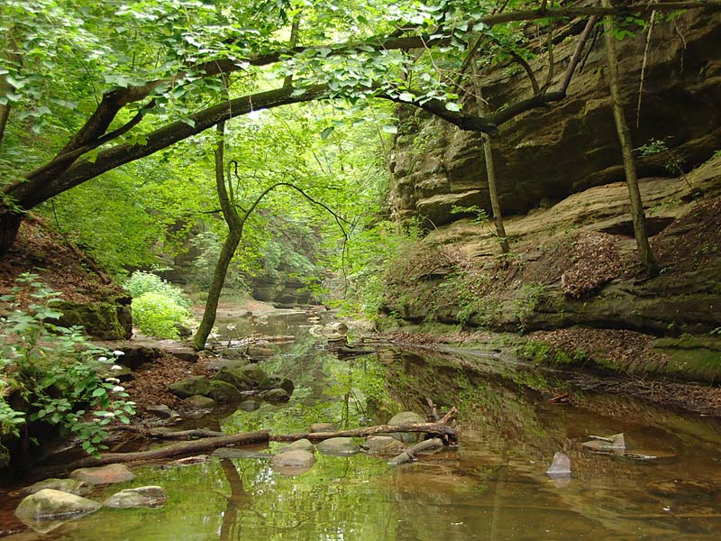
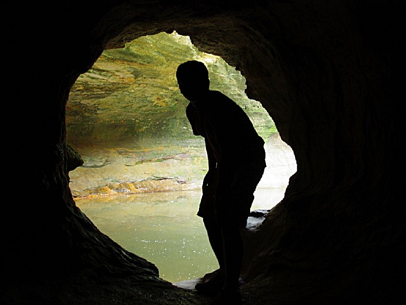
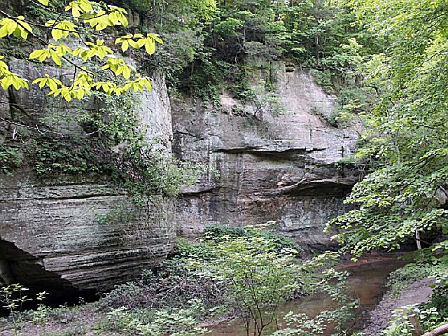
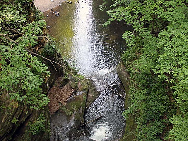
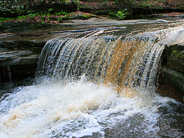
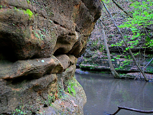
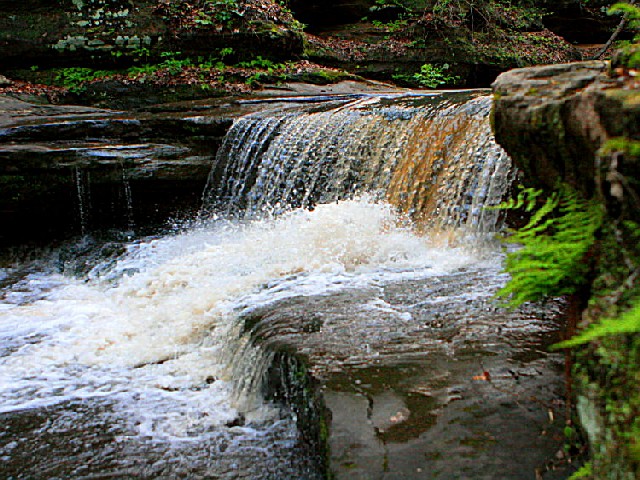
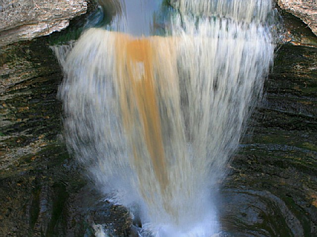
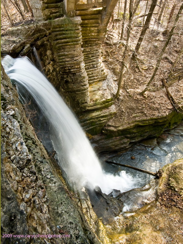
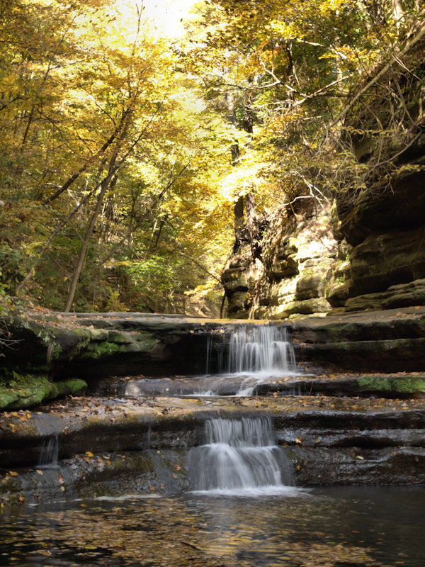
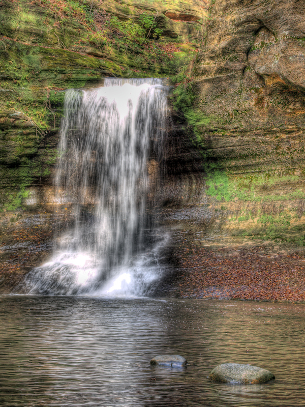
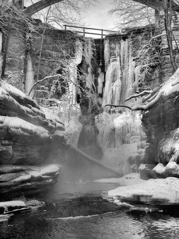
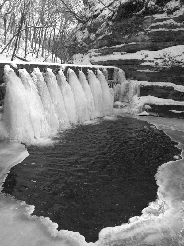
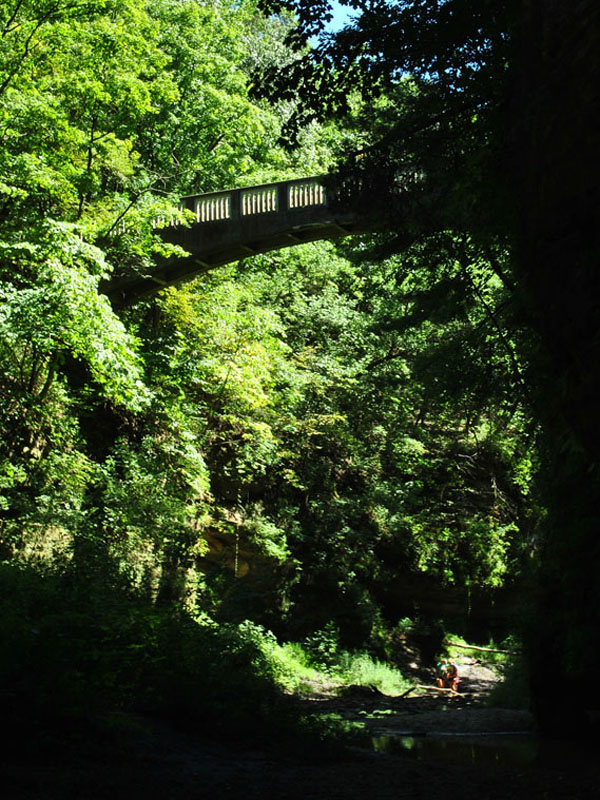
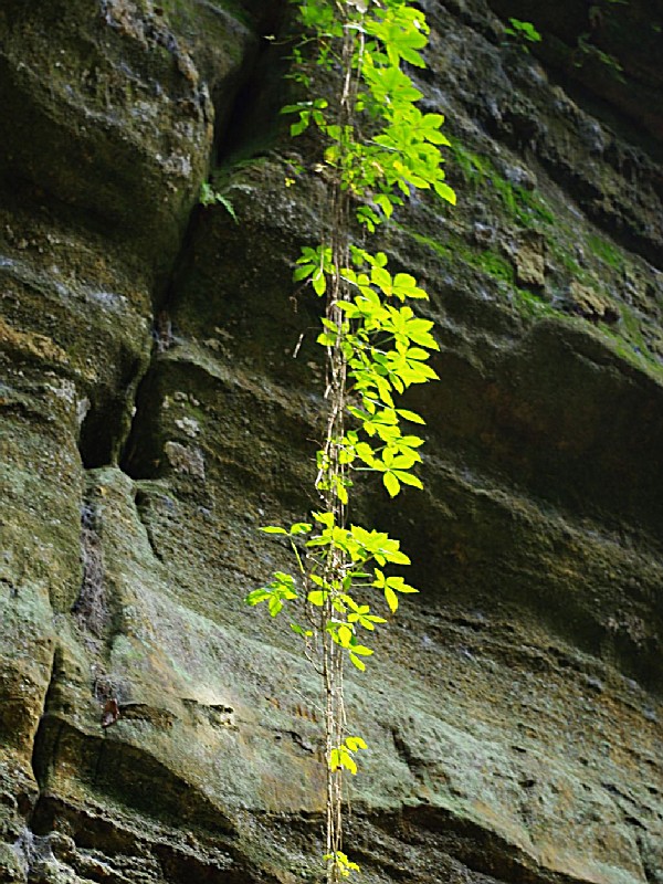
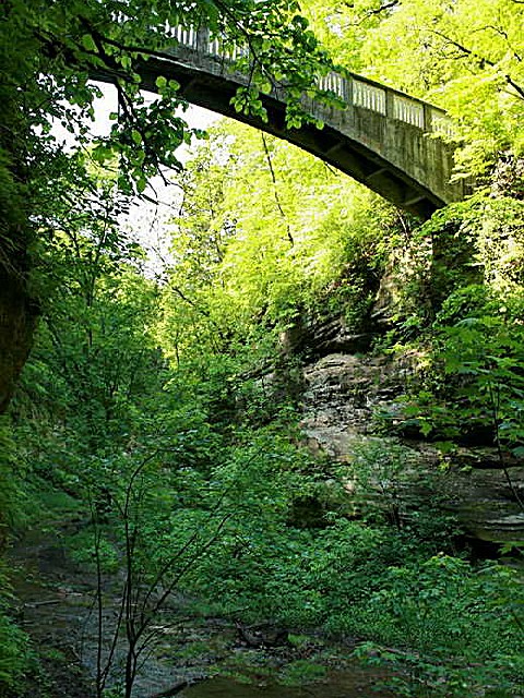
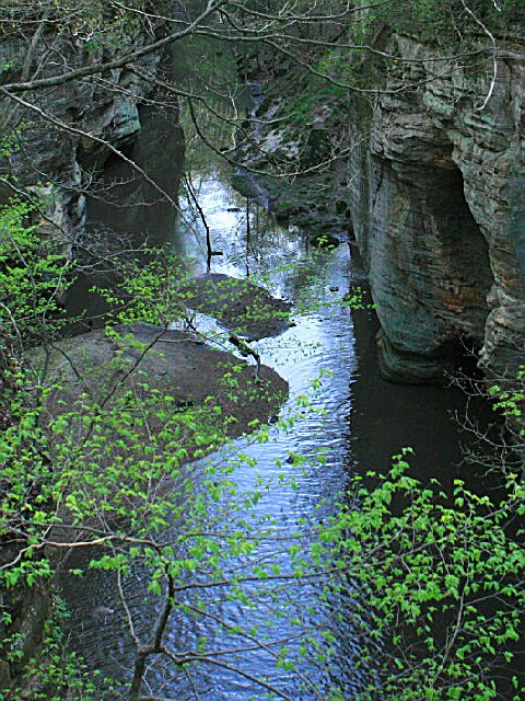
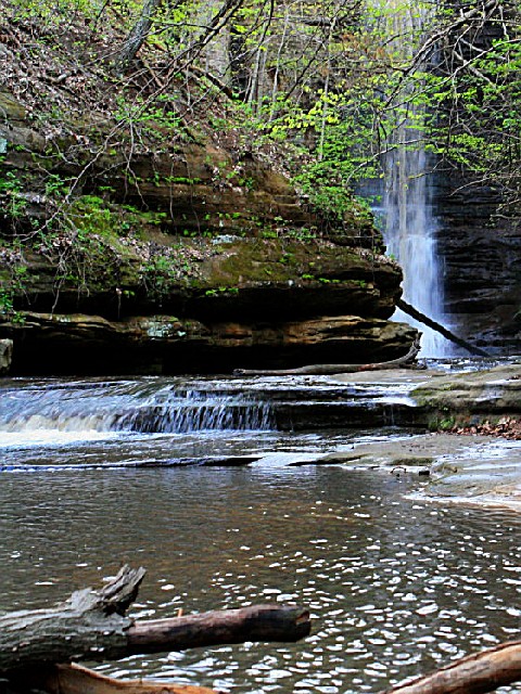
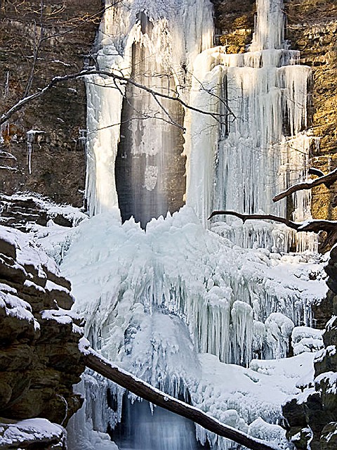
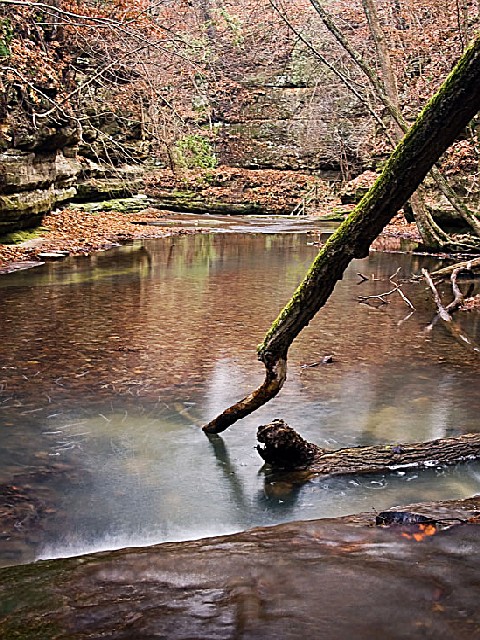
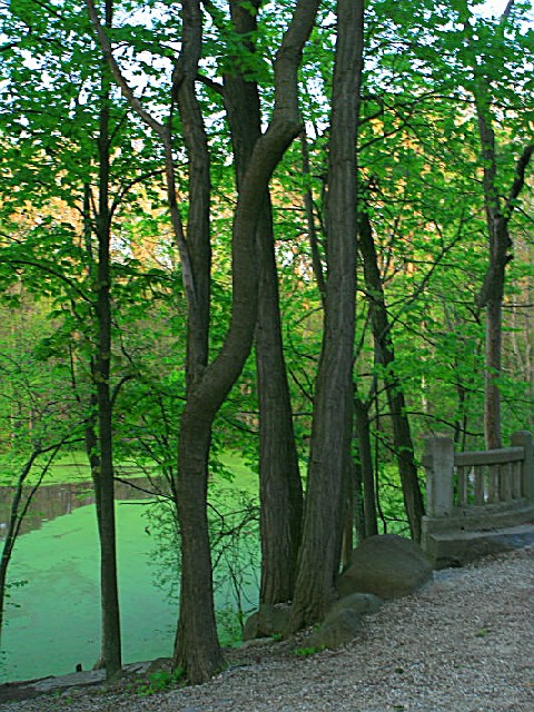
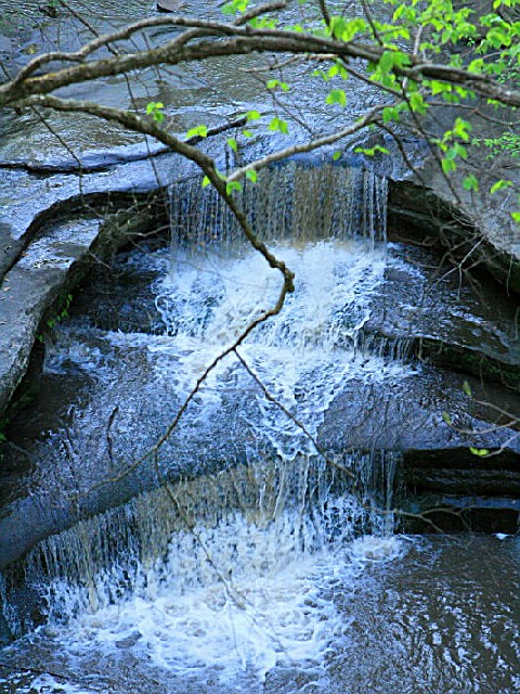
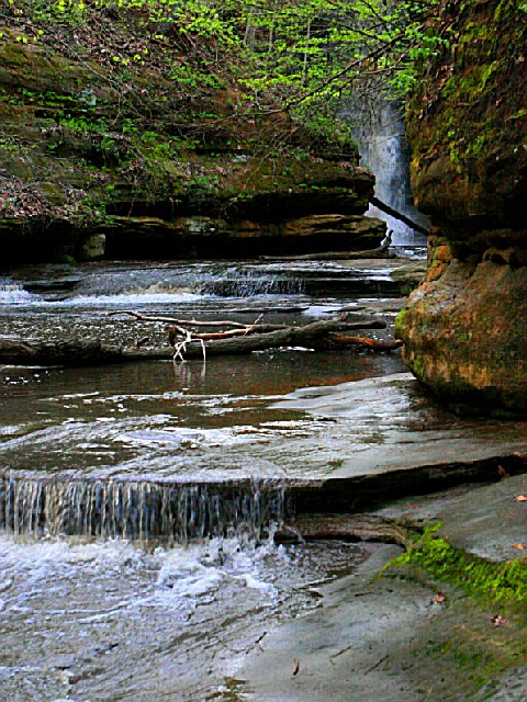
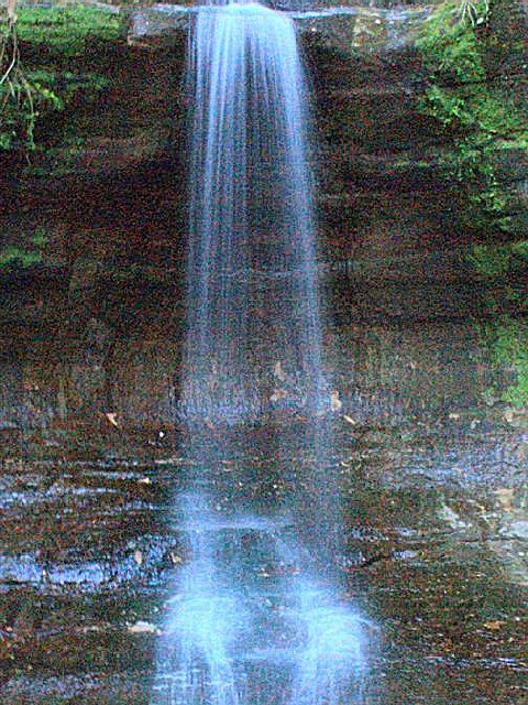
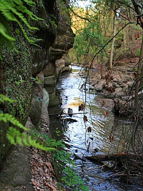
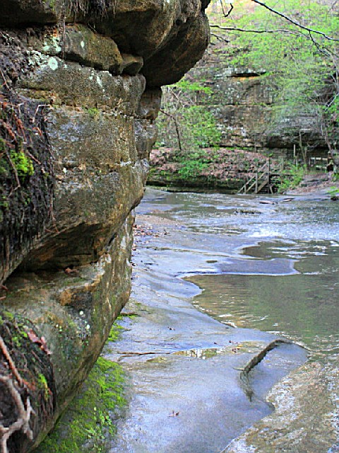
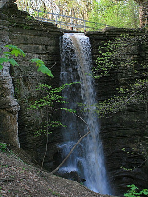
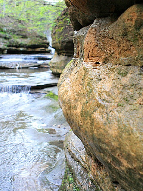
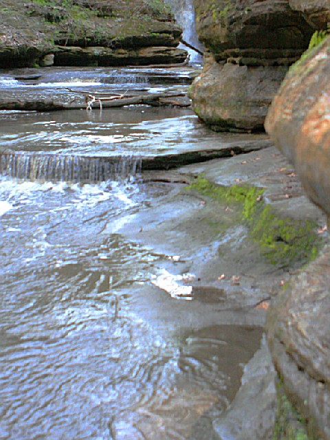
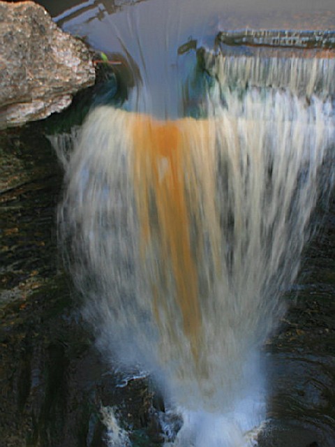
The many unusual and beautiful rock formations make a trip to Matthiessen State Park an educational as well as a fun experience. Exposed sandstone can be seen throughout. The main canyon, consisting of the Upper and Lower Dells, provides an unusual and interesting walking tour. The Upper Dell begins at Deer Park Lake and continues to Cascade Falls, where the canyon drops 45 feet and the Lower Dell begins. The canyon, formed by water erosion, is approximately one mile long, from Deer Park Lake to the Vermilion River. Visitors may observe ground water seeping out along the sandstone of the canyon walls. As the ground water evaporates along the canyon walls, the minerals that are carried in solution in the water contribute to the beautiful coloring of the rocks.

The park has several mineral springs, and each was a popular spot for the large deer population that used it as a salt lick.

Flora and Fauna:

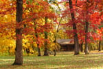
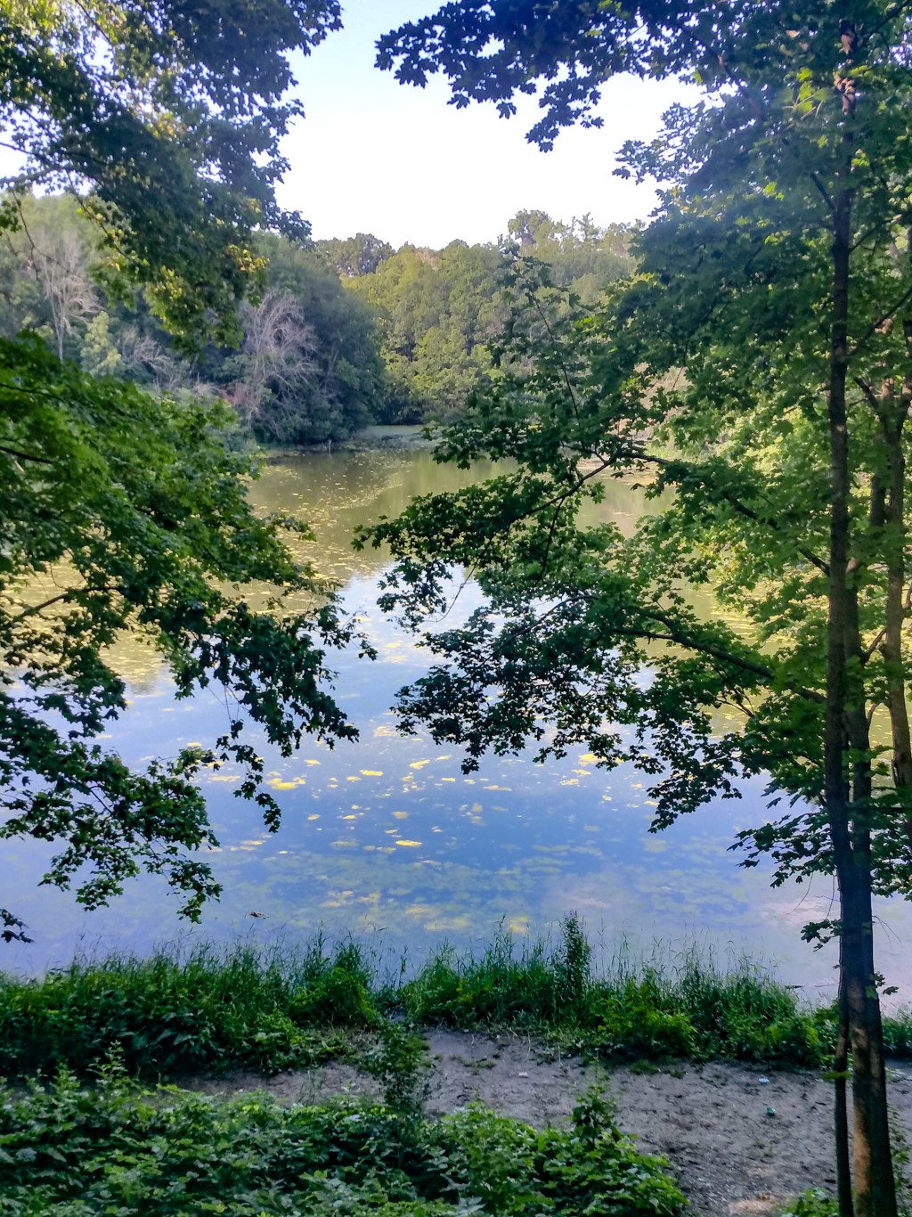
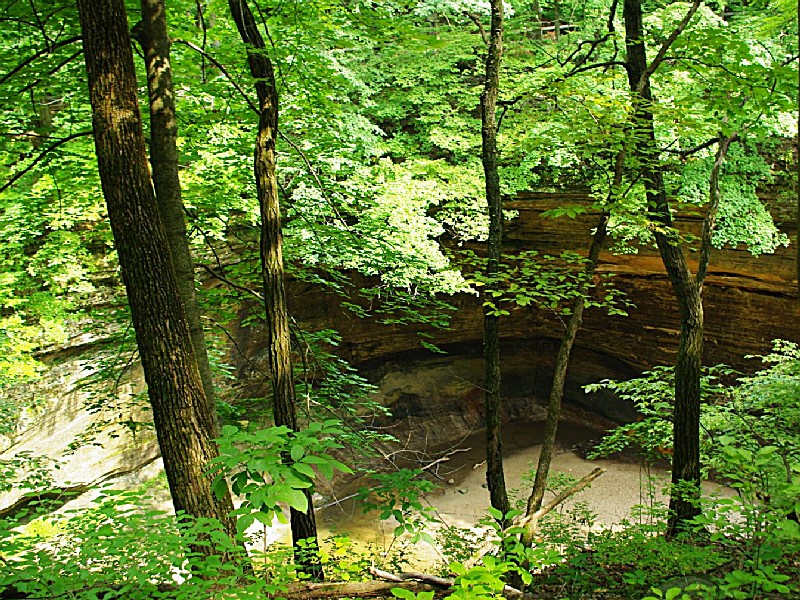
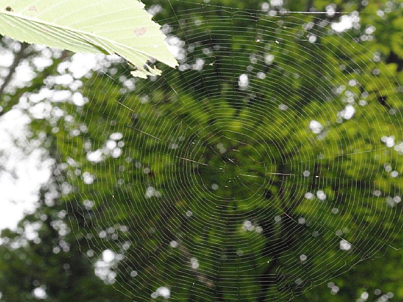
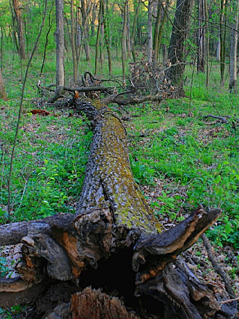
Visitors will delight at the abundance of plant and animal life. The park is alive with common and uncommon species of flora and fauna. The canyon provides a perfect habitat for many mosses and liverworts which thrive on the damp shady walls. Ferns also grow in the rich soil. Other vegetation in the canyon interior is limited to the simpler or lower orders of plant life, because most plants cannot take root on the steep rock walls. Cliff swallows and rock doves may be seen perching on the canyon walls, while frogs, toads and salamanders seek out the cool, moist canyon floors.

Along the dry, sandy bluff tops near the canyon edge, black oak, red cedar and white oak grow in abundance. White pines and white cedar are also found here, carried south by the glaciers of long ago. Shrubs common to this area include serviceberry and northern honeysuckle. Scarlet tanagers and cedar waxwings can be seen feeding on the berries of these shrubs. Holes made by yellow-bellied sapsuckers can be found on the cedar trees, as these birds feed on the sap and small insects located there. In the spring, beautiful magenta-colored blossoms erupt on the shooting star plants and the bright orange of the columbine delights the eye. By summertime, a rainbow of color emerges with the yellow partridge pea, the violet spiked lead plants and purple square-stemmed mint plants.

Farther back from the bluffs, bur oak and hickory grow. At the foot of these trees grow American witch hazel, black huckleberry and bracken fern. Nuthatches and chickadees can be seen feeding on the nuts, seeds and insects here.

Jack-in-the-pulpits, pastel-colored hepatica and delicate pink spring beauties blossom in the shaded forest soil during the spring. In the area where the sun breaks through the trees, black-eyed Susans and pink, spiked tick-trefoils bloom through the summer. Raccoons and flying squirrels spend hours among the trees searching for and gathering berries and nuts.

Along the forest edges, bright blue indigo buntings fly among the wild crabapple and plum trees. Cottontail rabbits scamper through the bluestem and Indian grasses. Red-tailed hawks soar overhead searching for field mice. Three-leaved poison ivy plants are found in all areas of the park, growing both as a vine and as an individual woody plant. Its greenish-white berries are a prime source of food for the many birds residing here.
History of the Area
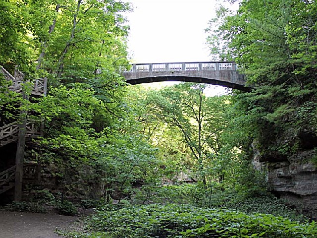
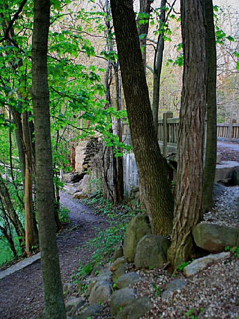
Matthiessen State Park was named for Frederick William Matthiessen, a prominent industrialist and philanthropist from LaSalle. He originally purchased the land near the end of the 19th Century and developed it as a privately owned park for many years. Mr. Matthiessen employed about 50 people to construct trails, bridges, stairways and check dams. The area was originally referred to as ?Deer Park,? in reference to the large deer population. The original 176-acre park consisted primarily of a long narrow canyon with a small stream flowing through it. At that time these formations were called ?dells,? a name that has stayed with the park. After Matthiessen?s death, the park was donated to the State of Illinois, which opened it as a public park. In 1943, the state renamed the park in honor of Matthiessen. Since then, the park has grown to 1,938 acres and includes much of the significant natural areas along the main dell, some former prairie land, and some forest land south of the original park.
Camping
An equestrian campground for horseback riders and their horses is located west of Route 178 between Route 71 and the Dells Area entrance.

The equestrian campground is for horseback riders only please. Sites are first come first serve and reservations cannot be made through the park or online. Campers will complete a registration envelope at the campground and drop the information and fee for the night in the box provided at the campground.
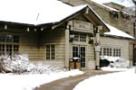
Nearby Accommodations
businesss listing main photo
Cottages and Cabins
Within a 10 minute drive from Starved Rock and even closer to Matthiessen State Parks you will find a gorgeous, tranquil property with spacious cabins on 50 wooded acres. All with full kitchens and outdoor fire pits. 3 dog friendly.
6.1 miles from park*
businesss listing main photo
Hotels/Motels
Relax in the rustic beauty and comfort of Starved Rock Lodge, Cabins and Starved Rock Inn. The historic Lodge has 69 guest rooms, which include three bay-window rooms, plus cabins nestled in the woods. Fireplaces can be found in four of the eight sunset cabins near the pool area...
2.2 miles from park*


Picnicking
The Dells Area of the park provides a perfect setting for picnics and an afternoon of relaxation. This area has picnic tables, water fountains and playground equipment, as well as a large parking lot and toilet facilities. An added attraction is the restored fort representative of the fortifications the French built in the Midwest during the 1600s and early 1700s. The main trail to the Cascade Falls area originates in this area.

To the south, at the Vermilion River Area, additional picnic shelters, picnic tables, grills and drinking fountains provide convenient picnic facilities.

Alcohol is prohibited Jan. 1 through May 31 in the picnic area.
Bicycling
Biking is not permitted on the trails within this natural area. However, nearby I&M Canal State Trail allows cycling.

Please note that biking can disturb wildlife and erode trail surfaces in sensitive areas.

Remember to respect all signage indicating where bikes are allowed or prohibited for safety reasons.

For those seeking a more leisurely ride, consider exploring local roads surrounding the park's perimeter instead of off-road paths.

Always wear appropriate protective gear when bicycling near any outdoor recreational site; helmets are essential!

Consider bringing along water and snacks as there may be limited facilities available during your bike journey around these scenic landscapes.
Trails
The park has five miles of well-marked, well-surfaced hiking trails for a relaxing walk or a vigorous hike. Large trail maps are located at all major trail intersections so visitors can choose a variety of routes. The upper area and bluff tops are easy hiking paths for the novice, but the trails into the interiors of the two dells may be difficult to negotiate, particularly during spring and early summer. Hikers must stay on marked trails, as steep cliffs and deep canyons can be dangerous. Hikers will marvel at the plant and animal life along the trails, and have an unparalleled view of geological wonders as they travel through the park. Alcohol is prohibited on all trails.

On the north side of the Dells Area entrance is a parking lot with a hitching post, which marks the access to nine miles of horseback riding trails. Horse rental is located on Route 71 a half mile west of Route 178. It is open weekends in April and November and Wednesday through Sunday from May through October. There are also six miles of cross-country ski trails with ski rental available weekends from December through March.

PLEASE NOTE! It is a state offense to remove any archaeological or Native American material from any Illinois state park.
Birding
The park offers birding enthusiasts a variety of species, including hawks, owls and songbirds. Birdwatchers can explore five miles of trails through forests and around lakes. The Dells Area is particularly popular for spotting waterfowl during migration seasons. Visitors are advised to bring binoculars for the best viewing experience.
Area Attractions
A field archery range with a sight-in area and four separate targets is located in the northwestern portion of Matthiessen State Park near Deer Park Country Club just off Illinois Route 71.

A radio-controlled model airplane field is located at the Vermilion River Area. Hobbyists and visitors will enjoy flying or watching as these crafts are maneuvered around this open field area.

Horseback Riding/Camping:

An equestrian campground for horseback riders and their horses is located west of Route 178 between Route 71 and the Dells Area entrance. The horseback riders campground and horseback trails are open as weather permits. Call the park office to check conditions and status before coming to use these facilities.

Visitor Comments, Memories and Reviews
January 16 A Peaceful Getaway
park review stars; one to five This park is lke paradise on earth. I could stay for weeks at a time and never get tired of exploring it.
December 20 A geologic laboratory!
park review stars; one to five This park is on the largest anticline in the state! A great place for geologists, fisherman, and peace of mind.
November 11 A Place to remember by Melissa
park review stars; one to five My fiance proposed to me in a cave next to the waterfall. Even though the water fall was not active it was still beautiful and PERFECT. This park is very clean and the hiking is fun, some challenging parts but exciting and beautiful. Great to take the kids there too!
write a review read more reviews
Share On

Area Campgrounds
Nature's Way RV Park
756 North 3150th Road
North Utica, IL
815-667-4988
Pleasant Creek Campground
926 North 2150th Road
Oglesby, IL
815-431-0936
Hickory Hollow Campground
757 North 3029 Road
Utica, IL
815-667-4996
LaSalle KOA
756 North 3150th Road
Utica, IL
KAYAK STARVED ROCK CAMPGROUND
1170 North 27th Road
Ottawa, IL
630-567-4653
Area Accommodations (over 20 miles away)
businesss listing main photo
Hotels/Motels
You will feel right at home when you reach Carroll County, our corner of beautiful Northwest Illinois. The magnificent Mississippi River and outdoor spaces will refresh your spirit and touch our soul.
82.7 miles from park*
Nearby Hotels
Booking.com

state route ranger badge
Illinois
52

Illinois State Parks

X